

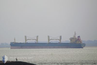
STRATEGIC EXPLORER
Cargo

Current Trip
| Time Travelled | 14 days |
|---|---|
| Remaining Time | --- |
| Distance Travelled | 2203.12 nm |
| Remaining Distance | --- |
| AVG Speed | 12.2 Knop |
| MAX Speed | 15.4 Knop |
| AVG Wind | 7.3 knots |
| MAX Wind | 22 knots |
| MIN Temp | 20.8°C / 69.44°F |
| MAX Temp | 28.7°C / 83.66°F |
| Djupgående | 9.7 m |
| Position mottagen | 2025-01-30 06:23 |
Current Position
| Longitud | --- |
|---|---|
| Latitude | --- |
| Status | Under way using engine |
| Fart | 12.5 Knop |
| Kurs | 128° |
| Område | North Pacific Ocean |
| Station | T-AIS |
| Position mottagen | 2025-01-30 06:23 |
Information
The current position of STRATEGIC EXPLORER is in North Pacific Ocean with coordinates 18.72694° / -104.84104° as reported on 2025-01-30 06:23 by AIS to our vessel tracker app. The vessel's current speed is 12.5 Knop
The vessel STRATEGIC EXPLORER (IMO: 9723708, MMSI: 565607000) is a Cargo It's sailing under the flag of [SG] Singapore.
In this page you can find informations about the vessels current position, last detected port calls, and current voyage information. If the vessels is not in coverage by AIS you will find the latest position.
The current position of STRATEGIC EXPLORER is detected by our AIS receivers and we are not responsible for the reliability of the data. The last position was recorded while the vessel was in Coverage by the Ais receivers of our vessel tracking app.
The current draught of STRATEGIC EXPLORER as reported by AIS is 9.7 meters
Weather
| Temperature | 23.9°C / 75.02°F |
|---|---|
| Wind Speed | 11 knots |
| Direction | 151° SSE |
| Pressure | 1012.1 hPa |
| Humidity | 85.8 % |
| Cloud Coverage | 80 % |


Featured Company
Last Port Calls
| Port | Arrival | Departure | Time In Port |
|---|---|---|---|
| 2025-02-13 06:14 | 2025-02-20 18:38 | 7 d | |
| 2025-01-26 00:05 | 2025-01-26 11:16 | 11 h | |
| 2025-01-02 20:49 |
Most Visited Ports (Last year)
| Port | Arrivals | |
|---|---|---|
| 3 | ||
| 3 | ||
| 2 | ||
| 1 | ||
| 1 | ||
| 1 |
Last Trips
| Origin | Departure | Destination | Arrival | Distance | |
|---|---|---|---|---|---|
| 2025-01-26 03:16 | 2025-02-13 00:14 | 2149.57 nm | |||
| 2025-01-03 04:49 | 2025-01-25 16:05 | 6308.34 nm |
Events
| Tid | Event | Detaljer | Position / Dest | Information |
|---|---|---|---|---|
| 2025-03-05 16:18 | STARTAR förflyttning |
-13.77453 / -76.29997
SV AQJ
|
Fart: 5.9 kn Kurs: 301° |
|
| 2025-03-05 04:05 | STOPPAR förflyttning |
-13.78041 / -76.29135
SV AQJ
|
Fart: 0.3 kn Kurs: 314° |
|
| 2025-03-05 03:42 | STARTAR förflyttning |
-13.79541 / -76.28386
SV AQJ
|
Fart: 3.4 kn Kurs: 17° |
|
| 2025-03-03 17:30 | STOPPAR förflyttning |
-13.80221 / -76.29012
SV AQJ
|
Fart: 0.1 kn Kurs: 193° |
|
| 2025-03-03 16:38 | STARTAR förflyttning |
-13.77364 / -76.27923
SV AQJ
|
Fart: 3.1 kn Kurs: 192° |
|
| 2025-02-26 22:55 | STOPPAR förflyttning |
-13.77809 / -76.30103
SV AQJ
|
Fart: 0.1 kn Kurs: 251° |
|
| 2025-02-26 22:12 | STARTAR förflyttning |
-13.78510 / -76.28705
SV AQJ
|
Fart: 4.5 kn Kurs: 305° |
|
| 2025-02-26 19:57 | STOPPAR förflyttning |
-13.79683 / -76.27016
SV AQJ
|
Fart: 0.3 kn Kurs: 257° |