
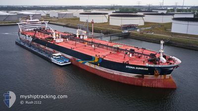
STENA SUNRISE
Crude Oil Tanker
Current Trip
| Time Travelled | 2 days |
|---|---|
| Remaining Time | --- |
| Distance Travelled | 846.68 nm |
| Remaining Distance | --- |
| AVG Speed | 12.9 Knop |
| MAX Speed | 14 Knop |
| AVG Wind | 9.1 knots |
| MAX Wind | 19.7 knots |
| MIN Temp | 14.8°C / 58.64°F |
| MAX Temp | 20.8°C / 69.44°F |
| Djupgående | 15 m |
| Position mottagen | 14 h, 54 m sen |
Current Position
| Longitud | 23.37640° |
|---|---|
| Latitude | 34.34425° |
| Status | Under way using engine |
| Fart | 13 Knop |
| Kurs | 279.3° |
| Område | Mediterranean Sea - Eastern Basin |
| Station | T-AIS |
| Position mottagen | 14 h, 54 m sen |
Info
Information
The current position of STENA SUNRISE is in Mediterranean Sea - Eastern Basin with coordinates 34.34425° / 23.37640° as reported on 2024-05-08 18:33 by AIS to our vessel tracker app. The vessel's current speed is 13 Knop and is heading at the port of BALIKPAPAN. The estimated time of arrival as calculated by MyShipTracking vessel tracking app is 2024-06-21 00:01 LT
The vessel STENA SUNRISE (IMO: 9592214, MMSI: 310654000) is a Crude Oil Tanker that was built in 2013 ( 11 År gammal ). It's sailing under the flag of [BM] Bermuda.
In this page you can find informations about the vessels current position, last detected port calls, and current voyage information. If the vessels is not in coverage by AIS you will find the latest position.
The current position of STENA SUNRISE is detected by our AIS receivers and we are not responsible for the reliability of the data. The last position was recorded while the vessel was in Coverage by the Ais receivers of our vessel tracking app.
The current draught of STENA SUNRISE as reported by AIS is 15 meters
Weather
| Temperature | 18.3°C / 64.94°F |
|---|---|
| Wind Speed | 9 knots |
| Direction | 249° WSW |
| Pressure | 1010 hPa |
| Humidity | 74.9 % |
| Cloud Coverage | 100 % |
Featured Company
Events
| Tid | Event | Detaljer | Position / Dest | Information |
|---|---|---|---|---|
| 2024-05-08 18:37 | Status ändrad | Default Under way using engine |
34.34618 / 23.36198
IDBPN
|
Fart: 13 kn Kurs: 279.3° |
| 2024-05-08 18:33 | Status ändrad | Under way using engine Default |
34.34425 / 23.37640
IDBPN
|
Fart: 13.1 kn Kurs: 279° |
| 2024-05-08 18:33 | UTANFÖR täckningsområde |
34.34425 / 23.37640
Mediterranean Sea - Eastern Basin
|
Fart: 13 kn Kurs: 279.3° |
|
| 2024-05-08 18:19 | Status ändrad | Default Under way using engine |
34.33500 / 23.43667
IDBPN
|
Fart: 13 kn Kurs: 278.1° |
| 2024-05-08 17:16 | Status ändrad | Under way using engine Default |
34.30138 / 23.71069
IDBPN
|
Fart: 13 kn Kurs: 279° |
| 2024-05-08 17:10 | Status ändrad | Default Under way using engine |
34.29666 / 23.73500
IDBPN
|
Fart: 13.1 kn Kurs: 278.8° |
| 2024-05-08 16:27 | Status ändrad | Under way using engine Default |
34.27315 / 23.92479
IDBPN
|
Fart: 13.3 kn Kurs: 278° |
| 2024-05-08 16:22 | Status ändrad | Default Under way using engine |
34.27077 / 23.94613
IDBPN
|
Fart: 13.4 kn Kurs: 277.8° |
| 2024-05-08 15:59 | Status ändrad | Under way using engine Default |
34.25991 / 24.05297
IDBPN
|
Fart: 13 kn Kurs: 277° |
| 2024-05-08 15:49 | Status ändrad | Default Under way using engine |
34.25500 / 24.09667
IDBPN
|
Fart: 13.8 kn Kurs: 276.9° |