
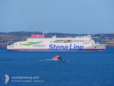
STENA ESTRID
Passenger A
Current Trip
| Trip Time | 3 h, 9 mins |
|---|---|
| Trip Distance | 56.71 nm |
| AVG Speed | 14.4 Knop |
| MAX Speed | 14.4 Knop |
| Djupgående | 6.1 m |
| AVG Wind | 16.6 knots |
| MAX Wind | 19.9 knots |
| MIN Temp | 12.2°C / 53.96°F |
| MAX Temp | 13.6°C / 56.48°F |
| Position mottagen | Nu |
Current Position
| Longitud | --- |
|---|---|
| Latitude | --- |
| Status | Under way using engine |
| Fart | 2.5 Knop |
| Kurs | 150° |
| Område | Irish Sea and St. George's Channel |
| Station | T-AIS |
| Position mottagen | Nu |
Information
The current position of STENA ESTRID is in Irish Sea and St. George's Channel with coordinates 53.32060° / -4.61530° as reported on 2025-06-03 18:53 by AIS to our vessel tracker app. The vessel's current speed is 2.5 Knop and is currently inside the port of HOLYHEAD.
The vessel STENA ESTRID (IMO: 9807293, MMSI: 209878000) is a Passenger A It's sailing under the flag of [CY] Cyprus.
In this page you can find informations about the vessels current position, last detected port calls, and current voyage information. If the vessels is not in coverage by AIS you will find the latest position.
The current position of STENA ESTRID is detected by our AIS receivers and we are not responsible for the reliability of the data. The last position was recorded while the vessel was in Coverage by the Ais receivers of our vessel tracking app.
The current draught of STENA ESTRID as reported by AIS is 6.1 meters
Weather
| Temperature | 12.7°C / 54.86°F |
|---|---|
| Wind Speed | 13 knots |
| Direction | 278° W |
| Pressure | 1002.1 hPa |
| Humidity | 69.2 % |
| Cloud Coverage | 83 % |
Featured Company
Last Port Calls
| Port | Arrival | Departure | Time In Port |
|---|---|---|---|
| 2025-06-03 18:51 | |||
| 2025-06-03 11:44 | 2025-06-03 15:42 | 3 h | |
| 2025-06-03 06:10 | 2025-06-03 08:34 | 2 h | |
| 2025-06-03 00:29 | 2025-06-03 03:06 | 2 h | |
| 2025-06-02 18:41 | 2025-06-02 21:07 | 2 h | |
| 2025-06-02 11:43 | 2025-06-02 15:43 | 4 h | |
| 2025-06-02 06:09 | 2025-06-02 08:34 | 2 h | |
| 2025-06-02 00:17 | 2025-06-02 03:09 | 2 h | |
| 2025-06-01 18:38 | 2025-06-01 21:05 | 2 h | |
| 2025-06-01 11:44 | 2025-06-01 15:30 | 3 h |
Most Visited Ports (Last year)
| Port | Arrivals | |
|---|---|---|
| 586 | ||
| 570 | ||
| 31 | ||
| 31 | ||
| 1 |
Last Trips
| Origin | Departure | Destination | Arrival | Distance | |
|---|---|---|---|---|---|
| 2025-06-03 16:42 | 2025-06-03 19:51 | 56.71 nm | |||
| 2025-06-03 09:34 | 2025-06-03 12:44 | 57.42 nm | |||
| 2025-06-03 04:06 | 2025-06-03 07:10 | 55.88 nm | |||
| 2025-06-02 22:07 | 2025-06-03 01:29 | 57.47 nm | |||
| 2025-06-02 16:43 | 2025-06-02 19:41 | 56.01 nm | |||
| 2025-06-02 09:34 | 2025-06-02 12:43 | 57.72 nm | |||
| 2025-06-02 04:09 | 2025-06-02 07:09 | 56.32 nm | |||
| 2025-06-01 22:05 | 2025-06-02 01:17 | 57.92 nm | |||
| 2025-06-01 16:30 | 2025-06-01 19:38 | 57.46 nm | |||
| 2025-06-01 09:38 | 2025-06-01 12:44 | 57.60 nm |
Events
| Tid | Event | Detaljer | Position / Dest | Information |
|---|---|---|---|---|
| 2025-06-03 18:51 | ANLÄNDER HAMN |
|
53.32293 / -4.61583
[GB] HOLYHEAD
|
Fart: 6 kn Kurs: 192.2° |
| 2025-06-03 18:01 | Status ändrad | Under way using engine Default |
53.33978 / -4.93007
GBHLY<>IEDUB
|
Fart: 21.1 kn Kurs: 87° |
| 2025-06-03 17:57 | Status ändrad | Default Under way using engine |
53.33960 / -4.97733
GBHLY<>IEDUB
|
Fart: 21.6 kn Kurs: 95.3° |
| 2025-06-03 17:43 | Status ändrad | Under way using engine Default |
53.34407 / -5.11695
GBHLY<>IEDUB
|
Fart: 21.7 kn Kurs: 96° |
| 2025-06-03 17:41 | Status ändrad | Default Under way using engine |
53.34557 / -5.13717
GBHLY<>IEDUB
|
Fart: 21.7 kn Kurs: 97.4° |
| 2025-06-03 17:40 | Status ändrad | Under way using engine Default |
53.34595 / -5.14202
GBHLY<>IEDUB
|
Fart: 21.9 kn Kurs: 99° |
| 2025-06-03 17:37 | Status ändrad | Default Under way using engine |
53.34927 / -5.17728
GBHLY<>IEDUB
|
Fart: 21.9 kn Kurs: 99.5° |
| 2025-06-03 17:25 | Byter havsområde | United Kingdom part of the Irish Sea and St. George's Channel Irish part of the Irish Sea and St. George's Channel |
53.36032 / -5.28982
Irish Sea and St. George's Channel
GBHLY<>IEDUB
|
Fart: 21.7 kn Kurs: 98.1° |
| 2025-06-03 17:18 | Status ändrad | Under way using engine Default |
53.36087 / -5.36642
GBHLY<>IEDUB
|
Fart: 21.6 kn Kurs: 89° |
| 2025-06-03 17:17 | Status ändrad | Default Under way using engine |
53.36068 / -5.37967
GBHLY<>IEDUB
|
Fart: 21.6 kn Kurs: 88.4° |