
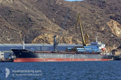
STAR II
Bulk Carrier
Current Trip
| Trip Time | 3 days |
|---|---|
| Trip Distance | 572.58 nm |
| AVG Speed | 8.5 Knop |
| MAX Speed | 11.8 Knop |
| Djupgående | 5.2 m |
| AVG Wind | 6 knots |
| MAX Wind | 14 knots |
| MIN Temp | 16.7°C / 62.06°F |
| MAX Temp | 25.4°C / 77.72°F |
| Position mottagen | 17 h, 11 m sen |
Current Position
| Longitud | 27.24459° |
|---|---|
| Latitude | 40.53750° |
| Status | Under way using engine |
| Fart | 9.3 Knop |
| Kurs | 215.1° |
| Område | Sea of Marmara |
| Station | T-AIS |
| Position mottagen | 17 h, 11 m sen |
Info
Information
The current position of STAR II is in Sea of Marmara with coordinates 40.53750° / 27.24459° as reported on 2024-05-31 21:43 by AIS to our vessel tracker app. The vessel's current speed is 9.3 Knop and is currently inside the port of ICDAS.
The vessel STAR II (IMO: 9476068, MMSI: 636021503) is a Bulk Carrier that was built in 2007 ( 17 År gammal ). It's sailing under the flag of [LR] Liberia.
In this page you can find informations about the vessels current position, last detected port calls, and current voyage information. If the vessels is not in coverage by AIS you will find the latest position.
The current position of STAR II is detected by our AIS receivers and we are not responsible for the reliability of the data. The last position was recorded while the vessel was in Coverage by the Ais receivers of our vessel tracking app.
The current draught of STAR II as reported by AIS is 5.2 meters
Weather
| Temperature | 25.4°C / 77.72°F |
|---|---|
| Wind Speed | 7 knots |
| Direction | 296° WNW |
| Pressure | 1017.1 hPa |
| Humidity | 57.9 % |
| Cloud Coverage | 3 % |
Featured Company
Last Port Calls
| Port | Arrival | Departure | Time In Port |
|---|---|---|---|
| 2024-05-31 22:40 | |||
| 2024-05-26 09:41 | 2024-05-28 14:07 | 2 d | |
| 2024-05-17 17:34 | 2024-05-20 00:42 | 2 d | |
| 2024-05-09 20:35 | 2024-05-13 11:21 | 3 d | |
| 2024-04-20 12:31 | 2024-04-24 03:52 | 3 d | |
| 2024-04-12 11:29 | 2024-04-13 12:29 | 1 d | |
| 2024-04-08 03:15 | 2024-04-08 20:29 | 17 h | |
| 2024-04-01 20:04 | 2024-04-03 13:56 | 1 d |
Last Trips
| Origin | Departure | Destination | Arrival | Distance | |
|---|---|---|---|---|---|
| 2024-05-28 17:07 | 2024-06-01 01:40 | 572.58 nm | |||
| 2024-05-20 03:42 | 2024-05-26 12:41 | 700.43 nm | |||
| 2024-05-13 14:21 | 2024-05-17 20:34 | 575.49 nm | |||
| 2024-04-24 06:52 | 2024-05-09 23:35 | 1098.21 nm | |||
| 2024-04-13 15:29 | 2024-04-20 15:31 | 501.78 nm | |||
| 2024-04-08 23:29 | 2024-04-12 14:29 | 40.26 nm | |||
| 2024-04-03 16:56 | 2024-04-08 06:15 | 414.77 nm |
Events
| Tid | Event | Detaljer | Position / Dest | Information |
|---|---|---|---|---|
| 2024-05-31 22:51 | STOPPAR förflyttning |
40.45260 / 27.14126
[TR] ICDAS
|
Fart: 0.2 kn Kurs: 166° |
|
| 2024-05-31 22:40 | ANLÄNDER HAMN |
|
40.45509 / 27.13880
[TR] ICDAS
|
Fart: 3.4 kn Kurs: 198° |
| 2024-05-31 21:59 | Status ändrad | Default Under way using engine |
40.50667 / 27.20833
TR IDS
|
Fart: 9.3 kn Kurs: 215.1° |
| 2024-05-31 21:43 | UTANFÖR täckningsområde |
40.53750 / 27.24459
Sea of Marmara
TR IDS
|
Fart: 9.3 kn Kurs: 215.1° |
|
| 2024-05-31 20:52 | Status ändrad | Under way using engine Default |
40.64833 / 27.32178
TR IDS
|
Fart: 8 kn Kurs: 239° |
| 2024-05-31 20:25 | Status ändrad | Default Under way using engine |
40.67808 / 27.39369
TR IDS
|
Fart: 8.2 kn Kurs: 245.7° |
| 2024-05-31 20:16 | Status ändrad | Under way using engine Default |
40.68691 / 27.41869
TR IDS
|
Fart: 8.1 kn Kurs: 245° |
| 2024-05-31 19:42 | Status ändrad | Default Under way using engine |
40.72383 / 27.51105
TR IDS
|
Fart: 8.5 kn Kurs: 242.8° |
| 2024-05-31 17:10 | Status ändrad | Under way using engine Default |
40.80833 / 27.98361
TR IDS
|
Fart: 8.7 kn Kurs: 262° |
| 2024-05-31 16:36 | Status ändrad | Default Under way using engine |
40.82118 / 28.08903
TR IDS
|
Fart: 8.5 kn Kurs: 260.6° |