
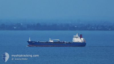
SRIWANGI
Oil/Chemical Tanker
Current Trip
| Trip Time | 1 day |
|---|---|
| Trip Distance | 396.22 nm |
| AVG Speed | 9.3 Knop |
| MAX Speed | 10.8 Knop |
| Djupgående | 8 m |
| AVG Wind | 5 knots |
| MAX Wind | 8.4 knots |
| MIN Temp | 26.9°C / 80.42°F |
| MAX Temp | 30.6°C / 87.08°F |
| Position mottagen | 3 d sen |
Current Position
| Longitud | 103.50665° |
|---|---|
| Latitude | 1.21934° |
| Status | Under way using engine |
| Fart | 9.5 Knop |
| Kurs | 284.2° |
| Område | Singapore Strait |
| Station | T-AIS |
| Position mottagen | 3 d sen |
Info
Information
The current position of SRIWANGI is in Singapore Strait with coordinates 1.21934° / 103.50665° as reported on 2024-05-16 11:40 by AIS to our vessel tracker app. The vessel's current speed is 9.5 Knop and is currently inside the port of PENANG.
The vessel SRIWANGI (IMO: 9313101, MMSI: 563167200) is a Oil/Chemical Tanker that was built in 2006 ( 18 År gammal ). It's sailing under the flag of [SG] Singapore.
In this page you can find informations about the vessels current position, last detected port calls, and current voyage information. If the vessels is not in coverage by AIS you will find the latest position.
The current position of SRIWANGI is detected by our AIS receivers and we are not responsible for the reliability of the data. The last position was recorded while the vessel was in Coverage by the Ais receivers of our vessel tracking app.
The current draught of SRIWANGI as reported by AIS is 8 meters
Weather
| Temperature | 25.9°C / 78.62°F |
|---|---|
| Wind Speed | 7 knots |
| Direction | 106° ESE |
| Pressure | 1009.1 hPa |
| Humidity | 88.5 % |
| Cloud Coverage | 100 % |
Featured Company
Last Port Calls
| Port | Arrival | Departure | Time In Port |
|---|---|---|---|
| 2024-05-18 11:20 | |||
| 2024-05-15 05:20 | 2024-05-16 17:42 | 1 d | |
| 2024-05-10 15:03 | 2024-05-11 21:31 | 1 d | |
| 2024-05-07 14:11 | 2024-05-08 20:15 | 1 d | |
| 2024-05-02 22:31 | 2024-05-04 17:39 | 1 d | |
| 2024-04-27 15:25 | 2024-04-29 23:04 | 2 d | |
| 2024-04-25 00:08 | 2024-04-26 11:36 | 1 d | |
| 2024-04-22 14:36 | 2024-04-23 20:32 | 1 d | |
| 2024-04-19 16:57 | 2024-04-20 16:02 | 23 h | |
| 2024-04-16 06:35 | 2024-04-17 21:01 | 1 d |
Most Visited Ports (Last year)
| Port | Arrivals | |
|---|---|---|
| 22 | ||
| 10 | ||
| 6 | ||
| 4 | ||
| 3 | ||
| 3 |
Last Trips
| Origin | Departure | Destination | Arrival | Distance | |
|---|---|---|---|---|---|
| 2024-05-16 17:42 | 2024-05-18 11:20 | 396.22 nm | |||
| 2024-05-11 21:31 | 2024-05-15 05:20 | 774.49 nm | |||
| 2024-05-08 20:15 | 2024-05-10 15:03 | 395.03 nm | |||
| 2024-05-04 17:39 | 2024-05-07 14:11 | 574.41 nm | |||
| 2024-04-29 23:04 | 2024-05-02 22:31 | 407.84 nm | |||
| 2024-04-26 11:36 | 2024-04-27 15:25 | 255.90 nm | |||
| 2024-04-23 20:32 | 2024-04-25 00:08 | 260.09 nm | |||
| 2024-04-20 16:02 | 2024-04-22 14:36 | 398.09 nm | |||
| 2024-04-17 21:01 | 2024-04-19 16:57 | 398.32 nm | |||
| 2024-04-14 11:22 | 2024-04-16 06:35 | 396.93 nm |
Events
| Tid | Event | Detaljer | Position / Dest | Information |
|---|---|---|---|---|
| 2024-05-19 02:05 | STOPPAR förflyttning |
5.39824 / 100.36256
[MY] PENANG
|
Fart: Kurs: 355° |
|
| 2024-05-19 01:21 | STARTAR förflyttning |
5.43095 / 100.35661
[MY] PENANG
|
Fart: 4.8 kn Kurs: 175° |
|
| 2024-05-18 03:36 | STOPPAR förflyttning |
5.43333 / 100.35500
[MY] PENANG
|
Fart: Kurs: -1° |
|
| 2024-05-18 03:20 | ANLÄNDER HAMN |
|
5.44315 / 100.35166
[MY] PENANG
|
Fart: 4.3 kn Kurs: 163° |
| 2024-05-16 11:44 | Status ändrad | Default Under way using engine |
1.22216 / 103.49518
MY_PEN
|
Fart: 9.5 kn Kurs: 284.2° |
| 2024-05-16 11:40 | UTANFÖR täckningsområde |
1.21934 / 103.50665
Singapore Strait
MY_PEN
|
Fart: 9.5 kn Kurs: 284.2° |
|
| 2024-05-16 11:07 | Byter havsområde | Malaysian part of the Singapore Strait Indonesian part of the Singapore Strait |
1.20131 / 103.59122
Singapore Strait
MY_PEN
|
Fart: 9.6 kn Kurs: 277° |
| 2024-05-16 10:49 | Byter havsområde | Indonesian part of the Singapore Strait Singaporean part of the Singapore Strait |
1.19802 / 103.63847
Singapore Strait
MY_PEN
|
Fart: 9.1 kn Kurs: 261° |
| 2024-05-16 09:44 | STARTAR förflyttning | 2.71 nm, North of BUKOM ISLAND |
1.28007 / 103.74037
MY_PEN
|
Fart: 3.1 kn Kurs: 132° |
| 2024-05-16 09:42 | AVGÅTT HAMN |
|
1.28103 / 103.73904
MY_PEN
|
Fart: 1.6 kn Kurs: 115° |