
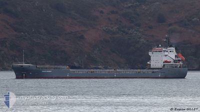
SPANACO PROGRESS
General Cargo
Current Trip
| Time Travelled | 11 days |
|---|---|
| Remaining Time | 2 days |
| Distance Travelled | 2099.24 nm |
| Remaining Distance | 411.83 nm |
| AVG Speed | 7.7 Knop |
| MAX Speed | 10.6 Knop |
| AVG Wind | 13.8 knots |
| MAX Wind | 33 knots |
| MIN Temp | 2.6°C / 36.68°F |
| MAX Temp | 18.1°C / 64.58°F |
| Djupgående | 6.1 m |
| Position mottagen | 6 h, 3 m sen |
Current Position
| Longitud | --- |
|---|---|
| Latitude | --- |
| Status | Under way using engine |
| Fart | 7.6 Knop |
| Kurs | 273.9° |
| Område | North Atlantic Ocean |
| Station | T-AIS |
| Position mottagen | 6 h, 3 m sen |
Info
Information
The current position of SPANACO PROGRESS is in North Atlantic Ocean with coordinates 35.96963° / -6.17716° as reported on 2026-01-07 22:54 by AIS to our vessel tracker app. The vessel's current speed is 7.6 Knop and is heading at the port of AVEIRO. The estimated time of arrival as calculated by MyShipTracking vessel tracking app is 2026-01-10 09:46 LT
The vessel SPANACO PROGRESS (IMO: 9306433, MMSI: 255806135) is a General Cargo that was built in 2007 ( 19 År gammal ). It's sailing under the flag of [PT] Portugal.
In this page you can find informations about the vessels current position, last detected port calls, and current voyage information. If the vessels is not in coverage by AIS you will find the latest position.
The current position of SPANACO PROGRESS is detected by our AIS receivers and we are not responsible for the reliability of the data. The last position was recorded while the vessel was in Coverage by the Ais receivers of our vessel tracking app.
The current draught of SPANACO PROGRESS as reported by AIS is 6.1 meters
Weather
| Temperature | 13°C / 55.4°F |
|---|---|
| Wind Speed | 9 knots |
| Direction | 9° N |
| Pressure | 1031.1 hPa |
| Humidity | 75.4 % |
| Cloud Coverage | 97 % |
Featured Company
Last Port Calls
| Port | Arrival | Departure | Time In Port |
|---|---|---|---|
| 2025-12-22 21:10 | 2025-12-27 18:56 | 4 d | |
| 2025-11-22 06:48 | 2025-12-17 19:58 | 25 d | |
| 2025-11-10 06:32 | 2025-11-10 22:24 | 15 h | |
| 2025-11-09 07:35 |
Last Trips
| Origin | Departure | Destination | Arrival | Distance | |
|---|---|---|---|---|---|
| 2025-12-17 20:58 | 2025-12-22 23:10 | 1138.27 nm | |||
| 2025-11-10 22:24 | 2025-11-22 07:48 | 1826.86 nm | |||
| 2025-11-09 07:35 | 2025-11-10 06:32 | 195.47 nm |
Events
| Tid | Event | Detaljer | Position / Dest | Information |
|---|---|---|---|---|
| 2026-01-07 22:59 | Status ändrad | Default Under way using engine |
35.97030 / -6.19015
PTAVE
|
Fart: 7.6 kn Kurs: 273.9° |
| 2026-01-07 22:54 | Status ändrad | Under way using engine Default |
35.96963 / -6.17716
PTAVE
|
Fart: 7 kn Kurs: 273° |
| 2026-01-07 22:54 | UTANFÖR täckningsområde |
35.96963 / -6.17716
North Atlantic Ocean
PTAVE
|
Fart: 7.6 kn Kurs: 273.9° |
|
| 2026-01-07 22:23 | Status ändrad | Default Under way using engine |
35.96667 / -6.09667
PTAVE
|
Fart: 7.3 kn Kurs: 267.7° |
| 2026-01-07 22:19 | Status ändrad | Under way using engine Default |
35.96719 / -6.08798
PTAVE
|
Fart: 7 kn Kurs: 268° |
| 2026-01-07 22:08 | Status ändrad | Default Under way using engine |
35.96667 / -6.06000
PTAVE
|
Fart: 7.6 kn Kurs: 270.9° |
| 2026-01-07 21:59 | Status ändrad | Under way using engine Default |
35.96724 / -6.03687
PTAVE
|
Fart: 7.7 kn Kurs: 272° |
| 2026-01-07 21:58 | Status ändrad | Default Under way using engine |
35.96712 / -6.03247
PTAVE
|
Fart: 7.6 kn Kurs: 271.4° |
| 2026-01-07 21:51 | Status ändrad | Under way using engine Default |
35.96654 / -6.01586
PTAVE
|
Fart: 7.5 kn Kurs: 271° |
| 2026-01-07 21:48 | Status ändrad | Default Under way using engine |
35.96630 / -6.00707
PTAVE
|
Fart: 7.5 kn Kurs: 271.5° |