
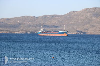
SKY FEYZ
General Cargo
Current Trip
| Time Travelled | 3 days |
|---|---|
| Remaining Time | --- |
| Distance Travelled | 31.08 nm |
| Remaining Distance | --- |
| AVG Speed | 5.9 Knop |
| MAX Speed | 7.4 Knop |
| AVG Wind | 11.5 knots |
| MAX Wind | 22 knots |
| MIN Temp | 8.1°C / 46.58°F |
| MAX Temp | 11.9°C / 53.42°F |
| Djupgående | 3 m |
| Position mottagen | 18 m sen |
Current Position
| Longitud | --- |
|---|---|
| Latitude | --- |
| Status | Under way using engine |
| Fart | 7.2 Knop |
| Kurs | 56.3° |
| Område | Black Sea |
| Station | T-AIS |
| Position mottagen | 18 m sen |
Information
The current position of SKY FEYZ is in Black Sea with coordinates 44.08089° / 29.00594° as reported on 2025-03-27 17:30 by AIS to our vessel tracker app. The vessel's current speed is 7.2 Knop
The vessel SKY FEYZ (IMO: 9116034, MMSI: 355997000) is a General Cargo that was built in 1995 ( 30 År gammal ). It's sailing under the flag of [PA] Panama.
In this page you can find informations about the vessels current position, last detected port calls, and current voyage information. If the vessels is not in coverage by AIS you will find the latest position.
The current position of SKY FEYZ is detected by our AIS receivers and we are not responsible for the reliability of the data. The last position was recorded while the vessel was in Coverage by the Ais receivers of our vessel tracking app.
The current draught of SKY FEYZ as reported by AIS is 3 meters
Weather
| Temperature | 9.1°C / 48.38°F |
|---|---|
| Wind Speed | 13 knots |
| Direction | 77° ENE |
| Pressure | 1012.8 hPa |
| Humidity | 92.2 % |
| Cloud Coverage | 100 % |
Featured Company
Last Port Calls
| Port | Arrival | Departure | Time In Port |
|---|---|---|---|
| 2025-03-20 11:15 | 2025-03-23 20:06 | 3 d | |
| 2025-02-21 05:46 | 2025-02-22 13:46 | 1 d | |
| 2025-02-17 07:13 | 2025-02-19 17:05 | 2 d | |
| 2025-02-02 06:07 | 2025-02-03 19:29 | 1 d | |
| 2025-01-27 07:04 | 2025-01-27 10:49 | 3 h | |
| 2025-01-21 15:11 | 2025-01-24 05:36 | 2 d | |
| 2025-01-03 11:32 | 2025-01-20 05:23 | 16 d |
Most Visited Ports (Last year)
| Port | Arrivals | |
|---|---|---|
| 3 | ||
| 3 | ||
| 3 | ||
| 2 | ||
| 2 | ||
| 1 |
Last Trips
| Origin | Departure | Destination | Arrival | Distance | |
|---|---|---|---|---|---|
| 2025-02-22 14:46 | 2025-03-20 13:15 | 1424.40 nm | |||
| 2025-02-19 18:05 | 2025-02-21 06:46 | 157.65 nm | |||
| 2025-02-03 21:29 | 2025-02-17 08:13 | 1414.12 nm | |||
| 2025-01-27 12:49 | 2025-02-02 08:07 | 64.74 nm | |||
| 2025-01-24 08:36 | 2025-01-27 09:04 | 399.07 nm | |||
| 2025-01-20 07:23 | 2025-01-21 18:11 | 288.59 nm | |||
| 2024-12-31 15:17 | 2025-01-03 13:32 | 566.92 nm |
Events
| Tid | Event | Detaljer | Position / Dest | Information |
|---|---|---|---|---|
| 2025-03-27 17:43 | Status ändrad | Default Under way using engine |
44.09561 / 29.03654
MDGIU
|
Fart: 7.2 kn Kurs: 56.3° |
| 2025-03-27 17:15 | Destination ändrad | MDGIU ORDER |
44.06187 / 28.96877
MDGIU
|
Fart: 7.4 kn Kurs: 53.8° |
| 2025-03-27 17:15 | ETA ändrat | 2025/03/29 07:00 2025/03/25 12:00 |
44.06187 / 28.96877
MDGIU
|
Fart: 7.4 kn Kurs: 53.8° |
| 2025-03-27 17:07 | Status ändrad | Under way using engine Default |
44.05252 / 28.95133
ORDER
|
Fart: 7.6 kn Kurs: 53° |
| 2025-03-27 17:06 | Status ändrad | Default Under way using engine |
44.05170 / 28.94980
ORDER
|
Fart: 7.6 kn Kurs: 53.2° |
| 2025-03-27 16:52 | Status ändrad | Under way using engine Default |
44.03212 / 28.92031
ORDER
|
Fart: 7.5 kn Kurs: 5° |
| 2025-03-27 16:42 | Status ändrad | Default Under way using engine |
44.01178 / 28.91754
ORDER
|
Fart: 7.3 kn Kurs: 5.9° |
| 2025-03-27 16:32 | Status ändrad | Under way using engine Default |
43.99095 / 28.91485
ORDER
|
Fart: 7.1 kn Kurs: 357° |
| 2025-03-27 16:30 | Status ändrad | Default Under way using engine |
43.98669 / 28.91508
ORDER
|
Fart: 6.6 kn Kurs: 356.1° |
| 2025-03-27 16:25 | Status ändrad | Under way using engine Default |
43.97791 / 28.91574
ORDER
|
Fart: 6.7 kn Kurs: 351° |