
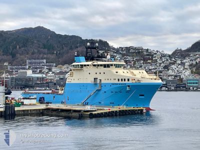
SKANDI MINDER
Tug
Current Trip
| Time Travelled | 12 h, 41 mins |
|---|---|
| Remaining Time | 2 h, 17 mins |
| Distance Travelled | 119.49 nm |
| Remaining Distance | 28.60 nm |
| AVG Speed | 9.6 Knop |
| MAX Speed | 10.6 Knop |
| AVG Wind | 6.5 knots |
| MAX Wind | 12 knots |
| MIN Temp | -6.2°C / 20.84°F |
| MAX Temp | -0.2°C / 31.64°F |
| Djupgående | 7.3 m |
| Position mottagen | 3 m sen |
Current Position
| Longitud | --- |
|---|---|
| Latitude | --- |
| Status | Under way using engine |
| Fart | 10 Knop |
| Kurs | 119.3° |
| Område | Norwegian Sea |
| Station | T-AIS |
| Position mottagen | 3 m sen |
Info
Information
The current position of SKANDI MINDER is in Norwegian Sea with coordinates 62.18835° / 5.55980° as reported on 2026-01-08 09:00 by AIS to our vessel tracker app. The vessel's current speed is 10 Knop and is heading at the port of HAREID. The estimated time of arrival as calculated by MyShipTracking vessel tracking app is 2026-01-08 12:20 LT
The vessel SKANDI MINDER (IMO: 9765469, MMSI: 257803000) is a Tug It's sailing under the flag of [NO] Norway.
In this page you can find informations about the vessels current position, last detected port calls, and current voyage information. If the vessels is not in coverage by AIS you will find the latest position.
The current position of SKANDI MINDER is detected by our AIS receivers and we are not responsible for the reliability of the data. The last position was recorded while the vessel was in Coverage by the Ais receivers of our vessel tracking app.
The current draught of SKANDI MINDER as reported by AIS is 7.3 meters
Weather
| Temperature | -6.2°C / 20.84°F |
|---|---|
| Wind Speed | 6 knots |
| Direction | 144° SE |
| Pressure | 1005 hPa |
| Humidity | 65.5 % |
| Cloud Coverage | --- |
Featured Company
Last Port Calls
| Port | Arrival | Departure | Time In Port |
|---|---|---|---|
| 2026-01-07 18:09 | 2026-01-07 21:22 | 3 h | |
| 2026-01-06 17:00 | 2026-01-07 14:53 | 21 h | |
| 2025-12-29 11:38 | 2025-12-29 16:53 | 5 h | |
| 2025-12-14 10:36 | 2025-12-27 16:43 | 13 d | |
| 2025-12-10 06:24 | 2025-12-10 16:20 | 9 h | |
| 2025-12-01 19:04 | 2025-12-02 03:48 | 8 h | |
| 2025-11-28 07:59 | 2025-12-01 06:08 | 2 d |
Most Visited Ports (Last year)
| Port | Arrivals | |
|---|---|---|
| 28 | ||
| 22 | ||
| 6 | ||
| 5 | ||
| 4 | ||
| 3 |
Last Trips
| Origin | Departure | Destination | Arrival | Distance | |
|---|---|---|---|---|---|
| 2026-01-07 14:53 | 2026-01-07 18:09 | 36.61 nm | |||
| 2025-12-29 16:53 | 2026-01-06 17:00 | 2189.21 nm | |||
| 2025-12-27 16:43 | 2025-12-29 11:38 | 151.16 nm | |||
| 2025-12-10 16:20 | 2025-12-14 10:36 | 961.54 nm | |||
| 2025-12-02 03:48 | 2025-12-10 06:24 | 914.40 nm | |||
| 2025-12-01 06:08 | 2025-12-01 19:04 | 6.88 nm | |||
| 2025-10-15 23:00 | 2025-11-28 07:59 | 1787.26 nm |
Events
| Tid | Event | Detaljer | Position / Dest | Information |
|---|---|---|---|---|
| 2026-01-07 22:58 | ETA ändrat | 2026/01/08 12:00 2026/01/08 13:00 |
61.01857 / 4.40644
HAREID
|
Fart: 10.3 kn Kurs: 358.9° |
| 2026-01-07 22:55 | ETA ändrat | 2026/01/08 13:00 2026/02/08 13:00 |
61.00721 / 4.40677
HAREID
|
Fart: 10.2 kn Kurs: 357° |
| 2026-01-07 22:52 | Byter havsområde | Norwegian part of the Norwegian Sea Norwegian part of the North Sea |
61.00120 / 4.40734
Norwegian Sea
|
Fart: 10.1 kn Kurs: 357.4° |
| 2026-01-07 20:27 | Destination ändrad | HAREID SLOVAAG |
60.83851 / 5.03892
HAREID
|
Fart: 9.3 kn Kurs: 235.5° |
| 2026-01-07 20:27 | ETA ändrat | 2026/02/08 13:00 2026/01/07 18:00 |
60.83851 / 5.03892
HAREID
|
Fart: 9.3 kn Kurs: 235.5° |
| 2026-01-07 20:22 | AVGÅTT HAMN |
|
60.84436 / 5.05609
SLOVAAG
|
Fart: 3.7 kn Kurs: 235° |
| 2026-01-07 20:20 | STARTAR förflyttning |
60.84602 / 5.06122
[NO] SLOVAG
|
Fart: 3.7 kn Kurs: 235° |
|
| 2026-01-07 17:17 | STOPPAR förflyttning |
60.84665 / 5.06531
[NO] SLOVAG
|
Fart: 0.3 kn Kurs: 276° |
|
| 2026-01-07 17:09 | ANLÄNDER HAMN |
|
60.84681 / 5.06233
[NO] SLOVAG
|
Fart: 6 kn Kurs: 48.1° |
| 2026-01-07 13:57 | Destination ändrad | SLOVAAG AAGOTNES |
60.42691 / 5.03320
SLOVAAG
|
Fart: 11.4 kn Kurs: 1.6° |