
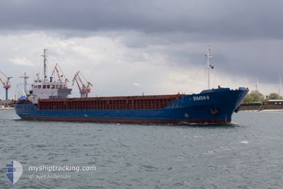
SIMON B
General Cargo
Current Trip
| Time Travelled | 19 h, 36 mins |
|---|---|
| Remaining Time | --- |
| Distance Travelled | 165.03 nm |
| Remaining Distance | --- |
| AVG Speed | 9.3 Knop |
| MAX Speed | 9.8 Knop |
| AVG Wind | 6.6 knots |
| MAX Wind | 12 knots |
| MIN Temp | 5.6°C / 42.08°F |
| MAX Temp | 9.9°C / 49.82°F |
| Djupgående | 2.9 m |
| Position mottagen | 5 h, 32 m sen |
Current Position
| Longitud | 23.56488° |
|---|---|
| Latitude | 58.20382° |
| Status | Under way using engine |
| Fart | 9.3 Knop |
| Kurs | 171.8° |
| Område | Gulf of Riga |
| Station | T-AIS |
| Position mottagen | 5 h, 32 m sen |
Info
Information
The current position of SIMON B is in Gulf of Riga with coordinates 58.20382° / 23.56488° as reported on 2024-05-02 06:38 by AIS to our vessel tracker app. The vessel's current speed is 9.3 Knop
The vessel SIMON B (IMO: 8511029, MMSI: 218801000) is a General Cargo that was built in 1986 ( 38 År gammal ). It's sailing under the flag of [DE] Germany.
In this page you can find informations about the vessels current position, last detected port calls, and current voyage information. If the vessels is not in coverage by AIS you will find the latest position.
The current position of SIMON B is detected by our AIS receivers and we are not responsible for the reliability of the data. The last position was recorded while the vessel was in Coverage by the Ais receivers of our vessel tracking app.
The current draught of SIMON B as reported by AIS is 2.9 meters
Weather
| Temperature | 8.1°C / 46.58°F |
|---|---|
| Wind Speed | 9 knots |
| Direction | 60° ENE |
| Pressure | 1022.7 hPa |
| Humidity | 72.9 % |
| Cloud Coverage | 71 % |
Featured Company
Last Port Calls
| Port | Arrival | Departure | Time In Port |
|---|---|---|---|
| 2024-04-30 18:24 | 2024-05-01 16:35 | 22 h | |
| 2024-04-29 10:40 | 2024-04-29 18:56 | 8 h | |
| 2024-04-23 17:24 | 2024-04-26 13:21 | 2 d | |
| 2024-04-23 10:55 | 2024-04-23 16:06 | 5 h | |
| 2024-04-16 15:54 | 2024-04-18 15:10 | 1 d | |
| 2024-04-09 13:22 | 2024-04-15 14:09 | 6 d | |
| 2024-04-07 10:13 | 2024-04-08 14:17 | 1 d | |
| 2024-04-05 17:54 | 2024-04-06 11:44 | 17 h | |
| 2024-04-05 09:30 | 2024-04-05 16:31 | 7 h | |
| 2024-03-30 16:52 | 2024-04-04 10:54 | 4 d |
Last Trips
| Origin | Departure | Destination | Arrival | Distance | |
|---|---|---|---|---|---|
| 2024-04-29 21:56 | 2024-04-30 21:24 | 209.02 nm | |||
| 2024-04-26 15:21 | 2024-04-29 13:40 | 538.84 nm | |||
| 2024-04-23 18:06 | 2024-04-23 19:24 | 9.75 nm | |||
| 2024-04-18 17:10 | 2024-04-23 12:55 | 388.45 nm | |||
| 2024-04-15 16:09 | 2024-04-16 17:54 | 232.18 nm | |||
| 2024-04-08 16:17 | 2024-04-09 15:22 | 104.10 nm | |||
| 2024-04-06 13:44 | 2024-04-07 12:13 | 164.18 nm | |||
| 2024-04-05 18:31 | 2024-04-05 19:54 | 9.85 nm | |||
| 2024-04-04 12:54 | 2024-04-05 11:30 | 102.55 nm | |||
| 2024-03-28 17:41 | 2024-03-30 17:52 | 398.09 nm |
Events
| Tid | Event | Detaljer | Position / Dest | Information |
|---|---|---|---|---|
| 2024-05-02 06:38 | UTANFÖR täckningsområde |
58.20382 / 23.56488
Gulf of Riga
LVRIX
|
Fart: 9.3 kn Kurs: 171.8° |
|
| 2024-05-02 05:59 | Byter havsområde | Estonian part of the Gulf of Riga Estonian part of the Baltic Sea |
58.30497 / 23.53567
Gulf of Riga
LVRIX
|
Fart: 9.3 kn Kurs: 170° |
| 2024-05-02 05:59 | I täckningsområde |
58.30497 / 23.53567
Gulf of Riga
LVRIX
|
Fart: 9.3 kn Kurs: 170° |
|
| 2024-05-01 22:46 | Status ändrad | Default Under way using engine |
59.31451 / 23.33289
LVRIX
|
Fart: 9.5 kn Kurs: 239.7° |
| 2024-05-01 22:43 | Upptäckt i hav | Estonian part of the Baltic Sea |
59.31925 / 23.34538
Baltic Sea
LVRIX
|
Fart: 9.5 kn Kurs: 239.7° |
| 2024-05-01 22:43 | UTANFÖR täckningsområde |
59.31925 / 23.34538
Baltic Sea
LVRIX
|
Fart: 9.5 kn Kurs: 239.7° |
|
| 2024-05-01 21:27 | Status ändrad | Under way using engine Default |
59.41983 / 23.69441
LVRIX
|
Fart: 9 kn Kurs: 241° |
| 2024-05-01 21:17 | Status ändrad | Default Under way using engine |
59.43167 / 23.74167
LVRIX
|
Fart: 9.7 kn Kurs: 241.2° |
| 2024-05-01 21:05 | Status ändrad | Under way using engine Default |
59.44716 / 23.79487
LVRIX
|
Fart: 9.5 kn Kurs: 237° |
| 2024-05-01 20:05 | UTANFÖR täckningsområde |
59.52831 / 24.06829
Gulf of Finland
LVRIX
|
Fart: 9.5 kn Kurs: 241.1° |