

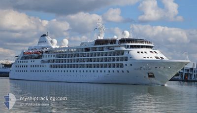
SILVER WIND
Passengers Ship

Current Trip
MELCHIOR HARBOUR
| Time Travelled | 5 days |
|---|---|
| Remaining Time | --- |
| Distance Travelled | 1305.83 nm |
| Remaining Distance | --- |
| AVG Speed | 13.1 Knop |
| MAX Speed | 17.6 Knop |
| AVG Wind | 18.9 knots |
| MAX Wind | 38.7 knots |
| MIN Temp | 2.2°C / 35.96°F |
| MAX Temp | 11.8°C / 53.24°F |
| Djupgående | 5.7 m |
| Position mottagen | 7 d sen |
Current Position
| Longitud | --- |
|---|---|
| Latitude | --- |
| Status | Under way using engine |
| Fart | 13.6 Knop |
| Kurs | 8.8° |
| Område | Southern Ocean |
| Station | T-AIS |
| Position mottagen | 7 d sen |
Information
The current position of SILVER WIND is in Southern Ocean with coordinates -64.23053° / -63.07256° as reported on 2025-02-20 09:35 by AIS to our vessel tracker app. The vessel's current speed is 13.6 Knop
The vessel SILVER WIND (IMO: 8903935, MMSI: 308814000) is a Passengers Ship that was built in 1995 ( 30 År gammal ). It's sailing under the flag of [BS] Bahamas.
In this page you can find informations about the vessels current position, last detected port calls, and current voyage information. If the vessels is not in coverage by AIS you will find the latest position.
The current position of SILVER WIND is detected by our AIS receivers and we are not responsible for the reliability of the data. The last position was recorded while the vessel was in Coverage by the Ais receivers of our vessel tracking app.
The current draught of SILVER WIND as reported by AIS is 5.7 meters
Weather
| Temperature | 3.6°C / 38.48°F |
|---|---|
| Wind Speed | 17 knots |
| Direction | 289° WNW |
| Pressure | 999.4 hPa |
| Humidity | 95.8 % |
| Cloud Coverage | 100 % |


Featured Company
Last Port Calls
| Port | Arrival | Departure | Time In Port |
|---|---|---|---|
| 2025-02-22 08:24 | 2025-02-23 00:50 | 16 h | |
| 2025-02-11 18:56 | 2025-02-13 00:25 | 1 d | |
| 2025-01-24 22:29 | 2025-01-26 01:17 | 1 d | |
| 2025-01-14 19:20 | 2025-01-16 06:55 | 1 d | |
| 2025-01-04 22:29 | 2025-01-05 23:03 | 1 d | |
| 2024-12-17 15:16 | 2024-12-19 00:29 | 1 d | |
| 2024-12-07 20:33 | 2024-12-08 23:23 | 1 d |
Most Visited Ports (Last year)
| Port | Arrivals | |
|---|---|---|
| 8 | ||
| 4 | ||
| 2 | ||
| 2 | ||
| 2 | ||
| 1 |
Last Trips
| Origin | Departure | Destination | Arrival | Distance | |
|---|---|---|---|---|---|
| 2025-02-12 21:25 | 2025-02-22 05:24 | 1869.10 nm | |||
| 2025-01-25 22:17 | 2025-02-11 15:56 | 3699.25 nm | |||
| 2025-01-16 03:55 | 2025-01-24 19:29 | 1796.18 nm | |||
| 2025-01-05 20:03 | 2025-01-14 16:20 | 1935.81 nm | |||
| 2024-12-18 21:29 | 2025-01-04 19:29 | 3716.79 nm | |||
| 2024-12-08 20:23 | 2024-12-17 12:16 | 1752.65 nm | |||
| 2024-11-28 18:04 | 2024-12-07 17:33 | 1871.42 nm |
Events
| Tid | Event | Detaljer | Position / Dest | Information |
|---|---|---|---|---|
| 2025-02-27 21:44 | STOPPAR förflyttning |
-54.05376 / -37.31961
MELCHIOR HARBOUR
|
Fart: 0.3 kn Kurs: 273° |
|
| 2025-02-25 17:25 | STARTAR förflyttning |
-51.67012 / -57.82529
MELCHIOR HARBOUR
|
Fart: 8.3 kn Kurs: 78° |
|
| 2025-02-25 09:48 | STOPPAR förflyttning |
-51.67516 / -57.83582
MELCHIOR HARBOUR
|
Fart: Kurs: 210° |
|
| 2025-02-24 16:50 | STOPPAR förflyttning |
-51.34621 / -60.66983
MELCHIOR HARBOUR
|
Fart: 0.2 kn Kurs: 248° |
|
| 2025-02-24 14:05 | STARTAR förflyttning |
-51.73311 / -61.27536
MELCHIOR HARBOUR
|
Fart: 5.4 kn Kurs: 100° |
|
| 2025-02-24 09:41 | STOPPAR förflyttning |
-51.73339 / -61.28482
MELCHIOR HARBOUR
|
Fart: 0.1 kn Kurs: 312° |
|
| 2025-02-23 00:50 | AVGÅTT HAMN |
|
-54.92361 / -67.58753
MELCHIOR HARBOUR
|
Fart: 4.1 kn Kurs: 64° |
| 2025-02-23 00:45 | STARTAR förflyttning |
-54.93010 / -67.60457
[CL] CABO DE HORNOS
|
Fart: 4.1 kn Kurs: 64° |
|
| 2025-02-22 08:29 | STOPPAR förflyttning |
-54.93236 / -67.60899
[CL] CABO DE HORNOS
|
Fart: 0.3 kn Kurs: 260° |
|
| 2025-02-22 08:24 | ANLÄNDER HAMN |
|
-54.93205 / -67.60843
[CL] CABO DE HORNOS
|
Fart: 1.7 kn Kurs: 237° |