
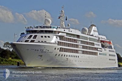
SILVER CLOUD
Passengers Ship
Current Trip
MIKKELSEN HBR
| Time Travelled | 2 days |
|---|---|
| Remaining Time | --- |
| Distance Travelled | 687.98 nm |
| Remaining Distance | --- |
| AVG Speed | 12.3 Knop |
| MAX Speed | 17.5 Knop |
| AVG Wind | 18.1 knots |
| MAX Wind | 30 knots |
| MIN Temp | -6.1°C / 21.02°F |
| MAX Temp | 7°C / 44.6°F |
| Djupgående | 5.7 m |
| Position mottagen | 2 d sen |
Current Position
| Longitud | --- |
|---|---|
| Latitude | --- |
| Status | Under way using engine |
| Fart | 14.6 Knop |
| Kurs | 156.2° |
| Område | South Atlantic Ocean |
| Station | T-AIS |
| Position mottagen | 2 d sen |
Info
Information
The current position of SILVER CLOUD is in South Atlantic Ocean with coordinates -55.55988° / -65.98712° as reported on 2025-02-28 03:37 by AIS to our vessel tracker app. The vessel's current speed is 14.6 Knop
The vessel SILVER CLOUD (IMO: 8903923, MMSI: 309027000) is a Passengers Ship that was built in 1994 ( 31 År gammal ). It's sailing under the flag of [BS] Bahamas.
In this page you can find informations about the vessels current position, last detected port calls, and current voyage information. If the vessels is not in coverage by AIS you will find the latest position.
The current position of SILVER CLOUD is detected by our AIS receivers and we are not responsible for the reliability of the data. The last position was recorded while the vessel was in Coverage by the Ais receivers of our vessel tracking app.
The current draught of SILVER CLOUD as reported by AIS is 5.7 meters
Weather
| Temperature | -6.1°C / 21.02°F |
|---|---|
| Wind Speed | 6 knots |
| Direction | 211° SSW |
| Pressure | 997.3 hPa |
| Humidity | 84 % |
| Cloud Coverage | 19 % |
Featured Company
Last Port Calls
| Port | Arrival | Departure | Time In Port |
|---|---|---|---|
| 2025-02-27 00:37 | 2025-02-27 22:42 | 22 h | |
| 2025-02-16 16:05 | 2025-02-18 00:38 | 1 d | |
| 2025-02-06 15:46 | 2025-02-08 00:52 | 1 d | |
| 2025-01-23 19:29 | 2025-01-23 23:05 | 3 h | |
| 2025-01-22 15:18 | 2025-01-23 15:07 | 23 h | |
| 2025-01-12 15:22 | 2025-01-13 21:23 | 1 d |
Most Visited Ports (Last year)
| Port | Arrivals | |
|---|---|---|
| 11 | ||
| 9 | ||
| 6 | ||
| 2 | ||
| 2 | ||
| 2 |
Last Trips
| Origin | Departure | Destination | Arrival | Distance | |
|---|---|---|---|---|---|
| 2025-02-17 21:38 | 2025-02-26 21:37 | 1856.77 nm | |||
| 2025-02-07 21:52 | 2025-02-16 13:05 | 1721.17 nm | |||
| 2025-01-23 20:05 | 2025-02-06 12:46 | 3279.23 nm | |||
| 2025-01-23 12:07 | 2025-01-23 16:29 | 0.97 nm | |||
| 2025-01-13 18:23 | 2025-01-22 12:18 | 1825.21 nm | |||
| 2024-12-29 18:56 | 2025-01-12 12:22 | 3443.45 nm |
Events
| Tid | Event | Detaljer | Position / Dest | Information |
|---|---|---|---|---|
| 2025-02-28 03:46 | Status ändrad | Default Under way using engine |
-55.59122 / -65.95883
MIKKELSEN HBR
|
Fart: 14.6 kn Kurs: 156.2° |
| 2025-02-28 03:37 | UTANFÖR täckningsområde |
-55.55988 / -65.98712
South Atlantic Ocean
MIKKELSEN HBR
|
Fart: 14.6 kn Kurs: 156.2° |
|
| 2025-02-28 03:33 | Status ändrad | Under way using engine Default |
-55.54518 / -65.99925
MIKKELSEN HBR
|
Fart: 14.5 kn Kurs: 153° |
| 2025-02-28 02:52 | Status ändrad | Default Under way using engine |
-55.40250 / -66.12728
MIKKELSEN HBR
|
Fart: 14.2 kn Kurs: 157.3° |
| 2025-02-28 02:07 | Destination ändrad | MIKKELSEN HBR CUVERVILLE IS. |
-55.24538 / -66.26777
MIKKELSEN HBR
|
Fart: 14 kn Kurs: 151.6° |
| 2025-02-28 02:07 | ETA ändrat | 2025/03/02 09:15 2025/02/23 09:00 |
-55.24538 / -66.26777
MIKKELSEN HBR
|
Fart: 14 kn Kurs: 151.6° |
| 2025-02-28 02:05 | Byter havsområde | Chilean (disputed - Chilean point of view) part of the South Atlantic Ocean Chilean (disputed - Chilean point of view) part of the South Pacific Ocean |
-55.23667 / -66.27522
South Atlantic Ocean
|
Fart: 14 kn Kurs: 153° |
| 2025-02-28 01:55 | Byter havsområde | Chilean (disputed - Chilean point of view) part of the South Pacific Ocean Chilean (disputed - Chilean point of view) part of the South Atlantic Ocean |
-55.20392 / -66.30492
South Pacific Ocean
|
Fart: 14.2 kn Kurs: 154.8° |
| 2025-02-28 01:55 | Status ändrad | Under way using engine Default |
-55.20243 / -66.30627
CUVERVILLE IS.
|
Fart: 14 kn Kurs: 155° |
| 2025-02-28 01:50 | I täckningsområde |
-55.20392 / -66.30492
South Pacific Ocean
|
Fart: 14.2 kn Kurs: 154.8° |