
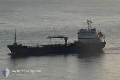
SIKINOS
Oil Products Tanker
Current Trip
| Time Travelled | 2 days |
|---|---|
| Remaining Time | --- |
| Distance Travelled | 45.49 nm |
| Remaining Distance | --- |
| AVG Speed | 6.7 Knop |
| MAX Speed | 11.5 Knop |
| AVG Wind | 12.6 knots |
| MAX Wind | 25 knots |
| MIN Temp | 8.9°C / 48.02°F |
| MAX Temp | 26.1°C / 78.98°F |
| Djupgående | 6.2 m |
| Position mottagen | 4 m sen |
Current Position
| Longitud | -5.36061° |
|---|---|
| Latitude | 36.11392° |
| Status | Moored |
| Fart | |
| Kurs | 254° |
| Område | Strait of Gibraltar |
| Station | T-AIS |
| Position mottagen | 4 m sen |
Info
Information
The current position of SIKINOS is in Strait of Gibraltar with coordinates 36.11392° / -5.36061° as reported on 2024-05-15 19:21 by AIS to our vessel tracker app. The vessel's current speed is 0 Knop
The vessel SIKINOS (IMO: 9460851, MMSI: 256462000) is a Oil Products Tanker that was built in 2011 ( 13 År gammal ). It's sailing under the flag of [MT] Malta.
In this page you can find informations about the vessels current position, last detected port calls, and current voyage information. If the vessels is not in coverage by AIS you will find the latest position.
The current position of SIKINOS is detected by our AIS receivers and we are not responsible for the reliability of the data. The last position was recorded while the vessel was in Coverage by the Ais receivers of our vessel tracking app.
The current draught of SIKINOS as reported by AIS is 6.2 meters
Weather
| Temperature | 16.7°C / 62.06°F |
|---|---|
| Wind Speed | 21 knots |
| Direction | 269° W |
| Pressure | 1011.8 hPa |
| Humidity | 70.4 % |
| Cloud Coverage | --- |
Featured Company
Last Port Calls
| Port | Arrival | Departure | Time In Port |
|---|---|---|---|
| 2024-05-13 00:26 | 2024-05-13 10:07 | 9 h | |
| 2024-05-11 19:36 | 2024-05-12 06:36 | 11 h | |
| 2024-05-10 00:30 | 2024-05-10 09:02 | 8 h | |
| 2024-05-07 09:22 | 2024-05-07 17:23 | 8 h | |
| 2024-05-03 21:21 | 2024-05-04 11:05 | 13 h | |
| 2024-05-01 19:44 | 2024-05-01 23:13 | 3 h | |
| 2024-04-30 07:27 | 2024-05-01 13:28 | 1 d | |
| 2024-04-29 07:53 | 2024-04-29 16:11 | 8 h | |
| 2024-04-28 07:34 | 2024-04-28 11:00 | 3 h | |
| 2024-04-28 07:10 | 2024-04-28 07:17 | 7 m |
Most Visited Ports (Last year)
| Port | Arrivals | |
|---|---|---|
| 134 | ||
| 93 | ||
| 13 |
Last Trips
| Origin | Departure | Destination | Arrival | Distance | |
|---|---|---|---|---|---|
| 2024-05-12 07:36 | 2024-05-13 01:26 | 16.73 nm | |||
| 2024-05-10 10:02 | 2024-05-11 20:36 | 47.70 nm | |||
| 2024-05-07 18:23 | 2024-05-10 01:30 | 54.76 nm | |||
| 2024-05-04 12:05 | 2024-05-07 10:22 | 66.66 nm | |||
| 2024-05-02 01:13 | 2024-05-03 22:21 | 44.11 nm | |||
| 2024-05-01 15:28 | 2024-05-01 21:44 | 4.45 nm | |||
| 2024-04-29 17:11 | 2024-04-30 09:27 | 31.85 nm | |||
| 2024-04-28 13:00 | 2024-04-29 08:53 | 22.73 nm | |||
| 2024-04-28 09:17 | 2024-04-28 09:34 | 0.74 nm | |||
| 2024-04-27 09:23 | 2024-04-28 09:10 | 16.34 nm |
Events
| Tid | Event | Detaljer | Position / Dest | Information |
|---|---|---|---|---|
| 2024-05-15 12:48 | Status ändrad | Moored Under way using engine |
36.11039 / -5.36222
GI GIB
|
Fart: 0.1 kn Kurs: 337° |
| 2024-05-15 12:43 | STOPPAR förflyttning | 2.22 nm, South of GIBRALTAR |
36.11053 / -5.36183
GI GIB
|
Fart: 0.3 kn Kurs: 322° |
| 2024-05-15 12:07 | Byter havsområde | Gibraltarian part of the Strait of Gibraltar Spanish part of the Strait of Gibraltar |
36.15023 / -5.38009
Strait of Gibraltar
|
Fart: 6.1 kn Kurs: 201.7° |
| 2024-05-15 12:05 | STARTAR förflyttning | 0.83 nm, North West of GIBRALTAR |
36.15297 / -5.37845
GI GIB
|
Fart: 4.2 kn Kurs: 214° |
| 2024-05-15 11:57 | Status ändrad | Under way using engine At anchor |
36.15396 / -5.37702
GI GIB
|
Fart: 0.3 kn Kurs: 294° |
| 2024-05-14 20:26 | STOPPAR förflyttning | 0.8 nm, North West of GIBRALTAR |
36.15440 / -5.37673
GI GIB
|
Fart: 0.2 kn Kurs: 262° |
| 2024-05-14 20:17 | Status ändrad | At anchor Under way using engine |
36.15378 / -5.37770
GI GIB
|
Fart: 0.8 kn Kurs: 329° |
| 2024-05-14 20:14 | Byter havsområde | Spanish part of the Strait of Gibraltar Gibraltarian part of the Strait of Gibraltar |
36.15223 / -5.37851
Strait of Gibraltar
|
Fart: 2.8 kn Kurs: 25.6° |
| 2024-05-14 19:50 | STARTAR förflyttning | 1.27 nm, South of GIBRALTAR |
36.12640 / -5.36550
GI GIB
|
Fart: 4.7 kn Kurs: 304° |
| 2024-05-14 19:40 | Status ändrad | Under way using engine Moored |
36.12503 / -5.36299
GI GIB
|
Fart: 0.1 kn Kurs: 284° |