

SHIRA-E
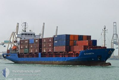
Container Ship

Current Trip
EGAAC
| Time Travelled | 8 h, 14 mins |
|---|---|
| Remaining Time | --- |
| Distance Travelled | 45.61 nm |
| Remaining Distance | --- |
| AVG Speed | 6.7 Knop |
| MAX Speed | 7.3 Knop |
| AVG Wind | 7.4 knots |
| MAX Wind | 9 knots |
| MIN Temp | 17.8°C / 64.04°F |
| MAX Temp | 18°C / 64.4°F |
| Djupgående | 4.2 m |
| Position mottagen | 19 h, 19 m sen |
Current Position
| Longitud | --- |
|---|---|
| Latitude | --- |
| Status | Moored |
| Fart | |
| Kurs | 199° |
| Område | Mediterranean Sea - Eastern Basin |
| Station | T-AIS |
| Position mottagen | 19 h, 19 m sen |
Information
The current position of SHIRA-E is in Mediterranean Sea - Eastern Basin with coordinates 31.15300° / 33.82944° as reported on 2025-03-25 10:39 by AIS to our vessel tracker app. The vessel's current speed is 0 Knop
The vessel SHIRA-E (IMO: 9083897, MMSI: 341258000) is a Container Ship that was built in 1993 ( 32 År gammal ). It's sailing under the flag of [KN] St Kitts Nevis.
In this page you can find informations about the vessels current position, last detected port calls, and current voyage information. If the vessels is not in coverage by AIS you will find the latest position.
The current position of SHIRA-E is detected by our AIS receivers and we are not responsible for the reliability of the data. The last position was recorded while the vessel was in Coverage by the Ais receivers of our vessel tracking app.
The current draught of SHIRA-E as reported by AIS is 4.2 meters
Weather
| Temperature | 17.9°C / 64.22°F |
|---|---|
| Wind Speed | 6 knots |
| Direction | 56° NE |
| Pressure | 1017.1 hPa |
| Humidity | 84.1 % |
| Cloud Coverage | 7 % |


Featured Company
Last Port Calls
| Port | Arrival | Departure | Time In Port |
|---|---|---|---|
| 2025-03-24 14:46 | 2025-03-25 23:44 | 1 d | |
| 2025-03-12 03:32 | 2025-03-17 23:34 | 5 d | |
| 2025-03-09 23:27 | 2025-03-11 12:14 | 1 d | |
| 2025-03-02 08:51 | 2025-03-05 23:16 | 3 d | |
| 2025-02-27 14:11 | 2025-03-01 14:33 | 2 d | |
| 2025-02-18 23:56 | 2025-02-23 16:36 | 4 d | |
| 2025-02-18 09:40 | |||
| 2025-02-08 22:13 | 2025-02-11 21:02 | 2 d | |
| 2025-02-02 23:40 | 2025-02-05 21:07 | 2 d | |
| 2025-01-27 03:04 | 2025-01-31 04:42 | 4 d |
Last Trips
| Origin | Departure | Destination | Arrival | Distance | |
|---|---|---|---|---|---|
| 2025-03-17 23:34 | 2025-03-24 14:46 | 76.56 nm | |||
| 2025-03-11 12:14 | 2025-03-12 03:32 | 83.89 nm | |||
| 2025-03-05 23:16 | 2025-03-09 23:27 | 71.46 nm | |||
| 2025-03-01 14:33 | 2025-03-02 08:51 | 80.18 nm | |||
| 2025-02-23 16:36 | 2025-02-27 14:11 | 75.91 nm | |||
| 2025-02-18 09:40 | 2025-02-18 23:56 | 90.17 nm | |||
| 2025-02-05 21:07 | 2025-02-08 22:13 | 87.01 nm | |||
| 2025-01-31 04:42 | 2025-02-02 23:40 | 74.39 nm | |||
| 2025-01-26 14:26 | 2025-01-27 03:04 | 41.32 nm | |||
| 2025-01-19 21:34 | 2025-01-20 09:29 | 75.53 nm |
Events
| Tid | Event | Detaljer | Position / Dest | Information |
|---|---|---|---|---|
| 2025-03-25 21:44 | AVGÅTT HAMN |
|
31.16285 / 33.84252
EGAAC
|
Fart: 4 kn Kurs: 46° |
| 2025-03-25 21:37 | STARTAR förflyttning |
31.15450 / 33.83224
[EG] AL ARISH
|
Fart: 4 kn Kurs: 46° |
|
| 2025-03-25 10:57 | Status ändrad | Default Moored |
31.15300 / 33.82944
[EG] AL ARISH
|
Fart: Kurs: 199° |
| 2025-03-25 10:39 | UTANFÖR täckningsområde |
31.15300 / 33.82944
Mediterranean Sea - Eastern Basin
[EG] AL ARISH
|
Fart: Kurs: 33.3° |
|
| 2025-03-25 10:33 | Status ändrad | Moored Default |
31.15300 / 33.82946
[EG] AL ARISH
|
Fart: Kurs: 199° |
| 2025-03-25 10:15 | I täckningsområde |
31.15300 / 33.82946
Mediterranean Sea - Eastern Basin
[EG] AL ARISH
|
Fart: Kurs: 33.3° |
|
| 2025-03-25 05:09 | Status ändrad | Default Moored |
31.15298 / 33.82946
[EG] AL ARISH
|
Fart: Kurs: 199° |
| 2025-03-25 05:03 | UTANFÖR täckningsområde |
31.15299 / 33.82946
Mediterranean Sea - Eastern Basin
[EG] AL ARISH
|
Fart: Kurs: 33.3° |
|
| 2025-03-25 04:12 | Status ändrad | Moored Default |
31.15299 / 33.82948
[EG] AL ARISH
|
Fart: Kurs: 199° |
| 2025-03-25 03:36 | Status ändrad | Default Moored |
31.15299 / 33.82951
[EG] AL ARISH
|
Fart: Kurs: 199° |