
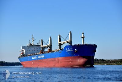
SHENG MAO HAI
Cargo
Current Trip
| Time Travelled | 11 days |
|---|---|
| Remaining Time | --- |
| Distance Travelled | 1714.78 nm |
| Remaining Distance | 511.69 nm |
| AVG Speed | 12.1 Knop |
| MAX Speed | 13.7 Knop |
| AVG Wind | 10.4 knots |
| MAX Wind | 19 knots |
| MIN Temp | 10.3°C / 50.54°F |
| MAX Temp | 29°C / 84.2°F |
| Djupgående | 6.5 m |
| Position mottagen | 11 d sen |
Current Position
| Longitud | -77.15024° |
|---|---|
| Latitude | 3.83304° |
| Status | Under way using engine |
| Fart | 11.5 Knop |
| Kurs | 247.2° |
| Område | North Pacific Ocean |
| Station | T-AIS |
| Position mottagen | 11 d sen |
Info
Information
The current position of SHENG MAO HAI is in North Pacific Ocean with coordinates 3.83304° / -77.15024° as reported on 2024-05-28 20:28 by AIS to our vessel tracker app. The vessel's current speed is 11.5 Knop and is heading at the port of CALLAO. The estimated time of arrival as calculated by MyShipTracking vessel tracking app is 2024-06-01 17:05 LT
The vessel SHENG MAO HAI (IMO: 9533086, MMSI: 414009000) is a Cargo It's sailing under the flag of [CN] China.
In this page you can find informations about the vessels current position, last detected port calls, and current voyage information. If the vessels is not in coverage by AIS you will find the latest position.
The current position of SHENG MAO HAI is detected by our AIS receivers and we are not responsible for the reliability of the data. The last position was recorded while the vessel was in Coverage by the Ais receivers of our vessel tracking app.
The current draught of SHENG MAO HAI as reported by AIS is 6.5 meters
Weather
| Temperature | 12.4°C / 54.32°F |
|---|---|
| Wind Speed | 4 knots |
| Direction | 24° NNE |
| Pressure | 1015.6 hPa |
| Humidity | 86.1 % |
| Cloud Coverage | 85 % |
Featured Company
Last Port Calls
| Port | Arrival | Departure | Time In Port |
|---|---|---|---|
| 2024-05-13 12:23 | 2024-05-28 19:58 | 15 d | |
| 2024-05-02 02:14 | 2024-05-02 06:38 | 4 h | |
| 2024-04-26 12:29 | 2024-04-29 10:02 | 2 d | |
| 2024-04-19 02:30 | 2024-04-22 17:54 | 3 d |
Most Visited Ports (Last year)
| Port | Arrivals | |
|---|---|---|
| 2 | ||
| 2 | ||
| 2 | ||
| 2 | ||
| 1 | ||
| 1 |
Last Trips
| Origin | Departure | Destination | Arrival | Distance | |
|---|---|---|---|---|---|
| 2024-05-02 01:38 | 2024-05-13 07:23 | 1885.94 nm | |||
| 2024-04-29 05:02 | 2024-05-01 21:14 | 79.83 nm | |||
| 2024-04-22 12:54 | 2024-04-26 07:29 | 576.87 nm | |||
| 2024-02-08 06:38 | 2024-04-18 21:30 | 12182.30 nm |
Events
| Tid | Event | Detaljer | Position / Dest | Information |
|---|---|---|---|---|
| 2024-06-08 19:35 | STOPPAR förflyttning | 1.85 nm, North of ILO |
-17.62167 / -71.36667
CALLAO
|
Fart: Kurs: -1° |
| 2024-06-08 16:50 | STARTAR förflyttning | 11.99 nm, South East of ILO |
-17.79035 / -71.20506
CALLAO
|
Fart: 6.3 kn Kurs: 276° |
| 2024-06-07 15:53 | STOPPAR förflyttning | 12.05 nm, South East of ILO |
-17.78500 / -71.19833
CALLAO
|
Fart: Kurs: -1° |
| 2024-06-07 12:47 | STARTAR förflyttning | 2.23 nm, North of ILO |
-17.61500 / -71.36667
CALLAO
|
Fart: 6 kn Kurs: 202° |
| 2024-06-03 18:38 | STOPPAR förflyttning | 2.64 nm, North of ILO |
-17.60833 / -71.36833
CALLAO
|
Fart: Kurs: -1° |
| 2024-06-02 02:07 | STARTAR förflyttning | 4.23 nm, North West of CALLAO |
-12.02462 / -77.21999
CALLAO
|
Fart: 5.6 kn Kurs: 192° |
| 2024-06-01 16:59 | STOPPAR förflyttning | 4.49 nm, North West of CALLAO |
-12.02234 / -77.22371
CALLAO
|
Fart: 0.2 kn Kurs: 86° |