

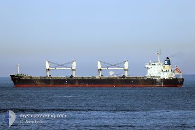
SERENE THEODORA
Bulk Carrier

Current Trip
| Time Travelled | 1 day |
|---|---|
| Remaining Time | --- |
| Distance Travelled | 346.73 nm |
| Remaining Distance | --- |
| AVG Speed | 10.5 Knop |
| MAX Speed | 12.6 Knop |
| AVG Wind | 10.7 knots |
| MAX Wind | 23.3 knots |
| MIN Temp | 13.3°C / 55.94°F |
| MAX Temp | 18.5°C / 65.3°F |
| Djupgående | 10 m |
| Position mottagen | 6 m sen |
Current Position
| Longitud | --- |
|---|---|
| Latitude | --- |
| Status | At anchor |
| Fart | 0.1 Knop |
| Kurs | 352° |
| Område | North Atlantic Ocean |
| Station | T-AIS |
| Position mottagen | 6 m sen |
Information
The current position of SERENE THEODORA is in North Atlantic Ocean with coordinates 28.10750° / -15.40083° as reported on 2025-02-28 09:10 by AIS to our vessel tracker app. The vessel's current speed is 0.1 Knop
The vessel SERENE THEODORA (IMO: 9567946, MMSI: 248999000) is a Bulk Carrier that was built in 2010 ( 15 År gammal ). It's sailing under the flag of [MT] Malta.
In this page you can find informations about the vessels current position, last detected port calls, and current voyage information. If the vessels is not in coverage by AIS you will find the latest position.
The current position of SERENE THEODORA is detected by our AIS receivers and we are not responsible for the reliability of the data. The last position was recorded while the vessel was in Coverage by the Ais receivers of our vessel tracking app.
The current draught of SERENE THEODORA as reported by AIS is 10 meters
Weather
| Temperature | 14.3°C / 57.74°F |
|---|---|
| Wind Speed | 13 knots |
| Direction | 321° NW |
| Pressure | 1020.5 hPa |
| Humidity | 70.4 % |
| Cloud Coverage | 48 % |


Featured Company
Last Port Calls
| Port | Arrival | Departure | Time In Port |
|---|---|---|---|
| 2025-02-23 09:50 | 2025-02-26 18:50 | 3 d | |
| 2025-02-14 15:40 | 2025-02-17 23:52 | 3 d | |
| 2025-02-04 17:58 | 2025-02-07 04:29 | 2 d | |
| 2025-01-24 01:39 | 2025-01-24 21:00 | 19 h | |
| 2024-12-19 10:10 | 2024-12-24 01:40 | 4 d |
Most Visited Ports (Last year)
| Port | Arrivals | |
|---|---|---|
| 8 | ||
| 2 | ||
| 1 | ||
| 1 | ||
| 1 | ||
| 1 |
Last Trips
| Origin | Departure | Destination | Arrival | Distance | |
|---|---|---|---|---|---|
| 2025-02-17 23:52 | 2025-02-23 09:50 | 302.59 nm | |||
| 2025-02-07 04:29 | 2025-02-14 15:40 | 24.58 nm | |||
| 2025-01-24 21:00 | 2025-02-04 17:58 | 637.49 nm | |||
| 2024-12-24 01:40 | 2025-01-24 01:39 | 4767.85 nm | |||
| 2024-11-05 11:08 | 2024-12-19 10:10 | 548.81 nm |
Events
| Tid | Event | Detaljer | Position / Dest | Information |
|---|---|---|---|---|
| 2025-02-28 09:13 | Status ändrad | Default At anchor |
28.10750 / -15.40083
ESLPA
|
Fart: 0.1 kn Kurs: 352° |
| 2025-02-28 08:52 | Status ändrad | At anchor Default |
28.10750 / -15.40067
ESLPA
|
Fart: 0.1 kn Kurs: 353° |
| 2025-02-28 08:43 | Status ändrad | Default At anchor |
28.10750 / -15.40050
ESLPA
|
Fart: 0.1 kn Kurs: 344° |
| 2025-02-28 08:37 | Status ändrad | At anchor Default |
28.10767 / -15.40050
ESLPA
|
Fart: 0.1 kn Kurs: 346° |
| 2025-02-28 08:31 | Status ändrad | Default At anchor |
28.10750 / -15.40050
ESLPA
|
Fart: 0.2 kn Kurs: 345° |
| 2025-02-28 08:25 | Status ändrad | At anchor Default |
28.10750 / -15.40050
ESLPA
|
Fart: 0.2 kn Kurs: 353° |
| 2025-02-28 08:13 | Status ändrad | Default At anchor |
28.10750 / -15.40067
ESLPA
|
Fart: 0.2 kn Kurs: 337° |
| 2025-02-28 08:07 | Status ändrad | At anchor Default |
28.10767 / -15.40033
ESLPA
|
Fart: 0.2 kn Kurs: 342° |
| 2025-02-28 07:58 | Status ändrad | Default At anchor |
28.10750 / -15.40050
ESLPA
|
Fart: 0.1 kn Kurs: 359° |
| 2025-02-28 07:52 | Status ändrad | At anchor Default |
28.10767 / -15.40100
ESLPA
|
Fart: 0.1 kn Kurs: 357° |