
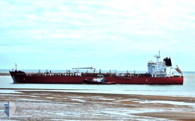
SEAWAYS CAPE MAY
Tanker
Current Trip
| Time Travelled | 16 days |
|---|---|
| Remaining Time | --- |
| Distance Travelled | 3055.40 nm |
| Remaining Distance | --- |
| AVG Speed | 9.6 Knop |
| MAX Speed | 12.3 Knop |
| AVG Wind | 11.4 knots |
| MAX Wind | 21 knots |
| MIN Temp | 18.6°C / 65.48°F |
| MAX Temp | 29.5°C / 85.1°F |
| Djupgående | 11.8 m |
| Position mottagen | 5 d sen |
Current Position
| Longitud | -79.45894° |
|---|---|
| Latitude | 8.54489° |
| Status | Under way using engine |
| Fart | 10 Knop |
| Kurs | 174° |
| Område | North Pacific Ocean |
| Station | T-AIS |
| Position mottagen | 5 d sen |
Info
Information
The current position of SEAWAYS CAPE MAY is in North Pacific Ocean with coordinates 8.54489° / -79.45894° as reported on 2024-07-02 18:38 by AIS to our vessel tracker app. The vessel's current speed is 10 Knop and is heading at the port of QUINTERO. The estimated time of arrival as calculated by MyShipTracking vessel tracking app is 2024-07-12 12:00 LT
The vessel SEAWAYS CAPE MAY (IMO: 9717785, MMSI: 538005536) is a Tanker It's sailing under the flag of [MH] Marshall Is.
In this page you can find informations about the vessels current position, last detected port calls, and current voyage information. If the vessels is not in coverage by AIS you will find the latest position.
The current position of SEAWAYS CAPE MAY is detected by our AIS receivers and we are not responsible for the reliability of the data. The last position was recorded while the vessel was in Coverage by the Ais receivers of our vessel tracking app.
The current draught of SEAWAYS CAPE MAY as reported by AIS is 11.8 meters
Weather
| Temperature | 18.7°C / 65.66°F |
|---|---|
| Wind Speed | 17 knots |
| Direction | 142° SE |
| Pressure | 1012.7 hPa |
| Humidity | 78.6 % |
| Cloud Coverage | 100 % |
Featured Company
Last Port Calls
| Port | Arrival | Departure | Time In Port |
|---|---|---|---|
| 2024-06-16 03:32 | 2024-06-21 00:06 | 4 d | |
| 2024-06-13 13:07 | 2024-06-15 00:15 | 1 d | |
| 2024-05-24 20:00 | 2024-05-29 12:27 | 4 d | |
| 2024-05-07 03:00 | 2024-05-11 02:59 | 3 d |
Most Visited Ports (Last year)
| Port | Arrivals | |
|---|---|---|
| 5 | ||
| 2 | ||
| 2 | ||
| 2 | ||
| 2 | ||
| 2 |
Last Trips
| Origin | Departure | Destination | Arrival | Distance | |
|---|---|---|---|---|---|
| 2024-06-14 19:15 | 2024-06-15 22:32 | 220.42 nm | |||
| 2024-05-29 07:27 | 2024-06-13 08:07 | 1314.38 nm | |||
| 2024-05-10 21:59 | 2024-05-24 15:00 | 1678.43 nm | |||
| 2024-04-25 15:41 | 2024-05-06 22:00 | 2210.26 nm |
Events
| Tid | Event | Detaljer | Position / Dest | Information |
|---|---|---|---|---|
| 2024-07-02 18:39 | Status ändrad | Default Under way using engine |
8.54255 / -79.45869
QUINTERO
|
Fart: 10 kn Kurs: 174° |
| 2024-07-02 18:38 | Status ändrad | Under way using engine Default |
8.54489 / -79.45894
QUINTERO
|
Fart: 10.2 kn Kurs: 175° |
| 2024-07-02 18:38 | UTANFÖR täckningsområde |
8.54489 / -79.45894
North Pacific Ocean
QUINTERO
|
Fart: 10 kn Kurs: 174° |
|
| 2024-07-02 18:30 | Status ändrad | Default Under way using engine |
8.56787 / -79.46107
QUINTERO
|
Fart: 9 kn Kurs: 175° |
| 2024-07-02 18:18 | Status ändrad | Under way using engine Default |
8.60115 / -79.46390
QUINTERO
|
Fart: 9.3 kn Kurs: 175° |
| 2024-07-02 18:14 | Status ändrad | Default Under way using engine |
8.61277 / -79.46484
QUINTERO
|
Fart: 9 kn Kurs: 175° |
| 2024-07-02 17:45 | Status ändrad | Under way using engine Default |
8.68235 / -79.46573
QUINTERO
|
Fart: 8.6 kn Kurs: 176° |
| 2024-07-02 17:41 | Status ändrad | Default Under way using engine |
8.69323 / -79.46629
QUINTERO
|
Fart: 8 kn Kurs: 176° |
| 2024-07-02 17:06 | Status ändrad | Under way using engine Default |
8.75538 / -79.49142
QUINTERO
|
Fart: 5.5 kn Kurs: 119° |
| 2024-07-02 17:03 | Status ändrad | Default Under way using engine |
8.75805 / -79.49621
QUINTERO
|
Fart: 5 kn Kurs: 119° |