

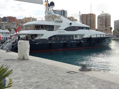
SEASCAPE V
Yacht

Current Trip
| Time Travelled | 4 days |
|---|---|
| Remaining Time | --- |
| Distance Travelled | 47.35 nm |
| Remaining Distance | --- |
| AVG Speed | 7.8 Knop |
| MAX Speed | 11.7 Knop |
| AVG Wind | 15.9 knots |
| MAX Wind | 16.3 knots |
| MIN Temp | 21.3°C / 70.34°F |
| MAX Temp | 24.4°C / 75.92°F |
| Djupgående | 2.8 m |
| Position mottagen | 3 d sen |
Current Position
| Longitud | --- |
|---|---|
| Latitude | --- |
| Status | Under way using engine |
| Fart | |
| Kurs | 105° |
| Område | North Atlantic Ocean |
| Station | T-AIS |
| Position mottagen | 3 d sen |
Information
The current position of SEASCAPE V is in North Atlantic Ocean with coordinates 26.71089° / -80.04662° as reported on 2025-03-18 18:45 by AIS to our vessel tracker app. The vessel's current speed is 0 Knop
The vessel SEASCAPE V (IMO: 1008425, MMSI: 311001375) is a Yacht that was built in 2005 ( 20 År gammal ). It's sailing under the flag of [BS] Bahamas.
In this page you can find informations about the vessels current position, last detected port calls, and current voyage information. If the vessels is not in coverage by AIS you will find the latest position.
The current position of SEASCAPE V is detected by our AIS receivers and we are not responsible for the reliability of the data. The last position was recorded while the vessel was in Coverage by the Ais receivers of our vessel tracking app.
The current draught of SEASCAPE V as reported by AIS is 2.8 meters
Weather
| Temperature | 22.3°C / 72.14°F |
|---|---|
| Wind Speed | 14 knots |
| Direction | 19° NNE |
| Pressure | 1020.7 hPa |
| Humidity | 48.4 % |
| Cloud Coverage | --- |


Featured Company
Last Port Calls
| Port | Arrival | Departure | Time In Port |
|---|---|---|---|
| 2025-03-17 06:34 |
Most Visited Ports (Last year)
| Port | Arrivals | |
|---|---|---|
| 3 | ||
| 1 | ||
| 1 | ||
| 1 |
Last Trips
| Origin | Departure | Destination | Arrival | Distance |
|---|
Events
| Tid | Event | Detaljer | Position / Dest | Information |
|---|---|---|---|---|
| 2025-03-18 18:45 | UTANFÖR täckningsområde |
26.71089 / -80.04662
North Atlantic Ocean
|
Fart: Kurs: 186° |
|
| 2025-03-18 14:03 | I täckningsområde |
26.71088 / -80.04662
North Atlantic Ocean
|
Fart: Kurs: 192° |
|
| 2025-03-17 19:37 | UTANFÖR täckningsområde |
26.71089 / -80.04663
North Atlantic Ocean
|
Fart: Kurs: 165.9° |
|
| 2025-03-17 17:45 | I täckningsområde |
26.71088 / -80.04662
North Atlantic Ocean
|
Fart: Kurs: 188.1° |
|
| 2025-03-17 15:57 | UTANFÖR täckningsområde |
26.71598 / -80.04674
North Atlantic Ocean
|
Fart: 0.1 kn Kurs: 136.1° |
|
| 2025-03-17 15:52 | STOPPAR förflyttning | 3.39 nm, South of PALM BEACH |
26.71614 / -80.04693
PALM BEACH, USA
|
Fart: 0.3 kn Kurs: 173° |
| 2025-03-17 15:48 | STARTAR förflyttning | 3.21 nm, South of PALM BEACH |
26.71902 / -80.04705
PALM BEACH, USA
|
Fart: 5.9 kn Kurs: 180.4° |
| 2025-03-17 15:25 | STOPPAR förflyttning | 3.09 nm, South of PALM BEACH |
26.72108 / -80.04680
PALM BEACH, USA
|
Fart: 0.1 kn Kurs: 177° |
| 2025-03-17 15:19 | STARTAR förflyttning | 2.73 nm, South of PALM BEACH |
26.72718 / -80.04712
PALM BEACH, USA
|
Fart: 5.6 kn Kurs: 180° |
| 2025-03-17 14:59 | STOPPAR förflyttning | 2.27 nm, South of PALM BEACH |
26.73486 / -80.04720
PALM BEACH, USA
|
Fart: 0.2 kn Kurs: 172° |