
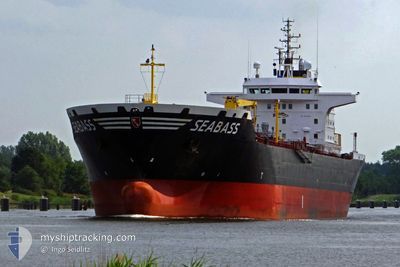
SEABAS
Oil Products Tanker
Current Trip
| Time Travelled | --- |
|---|---|
| Remaining Time | --- |
| Distance Travelled | --- |
| Remaining Distance | --- |
| AVG Speed | --- |
| MAX Speed | --- |
| AVG Wind | --- |
| MAX Wind | --- |
| MIN Temp | --- |
| MAX Temp | --- |
| Djupgående | 10 m |
| Position mottagen | 3 m sen |
Current Position
| Longitud | 55.35262° |
|---|---|
| Latitude | 25.51987° |
| Status | At anchor |
| Fart | 0.2 Knop |
| Kurs | 276° |
| Område | Persian Gulf |
| Station | T-AIS |
| Position mottagen | 3 m sen |
Info
Information
The current position of SEABAS is in Persian Gulf with coordinates 25.51987° / 55.35262° as reported on 2024-05-02 05:47 by AIS to our vessel tracker app. The vessel's current speed is 0.2 Knop
The vessel SEABAS (IMO: 9251640, MMSI: 620847000) is a Oil Products Tanker that was built in 2001 ( 23 År gammal ). It's sailing under the flag of [KM] Comoros.
In this page you can find informations about the vessels current position, last detected port calls, and current voyage information. If the vessels is not in coverage by AIS you will find the latest position.
The current position of SEABAS is detected by our AIS receivers and we are not responsible for the reliability of the data. The last position was recorded while the vessel was in Coverage by the Ais receivers of our vessel tracking app.
The current draught of SEABAS as reported by AIS is 10 meters
Weather
| Temperature | 23°C / 73.4°F |
|---|---|
| Wind Speed | 5 knots |
| Direction | 9° N |
| Pressure | 1009.7 hPa |
| Humidity | 87.8 % |
| Cloud Coverage | 100 % |
Featured Company
Last Port Calls
| Port | Arrival | Departure | Time In Port |
|---|---|---|---|
| 2024-04-17 19:45 | |||
| 2024-03-28 13:23 | 2024-03-30 11:27 | 1 d | |
| 2024-03-19 08:53 | |||
| 2024-03-01 06:43 |
Most Visited Ports (Last year)
| Port | Arrivals | |
|---|---|---|
| 9 | ||
| 2 | ||
| 1 |
Last Trips
| Origin | Departure | Destination | Arrival | Distance | |
|---|---|---|---|---|---|
| 2024-03-30 15:27 | 2024-04-17 22:45 | 555.30 nm | |||
| 2024-03-01 10:43 | 2024-03-19 11:53 | 833.61 nm |
Events
| Tid | Event | Detaljer | Position / Dest | Information |
|---|---|---|---|---|
| 2024-05-02 04:35 | Status ändrad | At anchor Default |
25.51912 / 55.35263
HAMRIYAH^2C UAE
|
Fart: 0.1 kn Kurs: 303° |
| 2024-05-02 04:26 | Status ändrad | Default At anchor |
25.51880 / 55.35260
HAMRIYAH^2C UAE
|
Fart: 0.1 kn Kurs: 305° |
| 2024-05-02 04:08 | Status ändrad | At anchor Default |
25.51897 / 55.35258
HAMRIYAH^2C UAE
|
Fart: 0.1 kn Kurs: 310° |
| 2024-05-02 03:59 | Status ändrad | Default At anchor |
25.51857 / 55.35242
HAMRIYAH^2C UAE
|
Fart: 0.2 kn Kurs: 299° |
| 2024-05-02 03:32 | Status ändrad | At anchor Default |
25.51815 / 55.35225
HAMRIYAH^2C UAE
|
Fart: Kurs: 316° |
| 2024-05-02 03:23 | Status ändrad | Default At anchor |
25.51825 / 55.35223
HAMRIYAH^2C UAE
|
Fart: 0.1 kn Kurs: 321° |
| 2024-05-02 03:16 | Status ändrad | At anchor Default |
25.51807 / 55.35220
HAMRIYAH^2C UAE
|
Fart: 0.1 kn Kurs: 317° |
| 2024-05-02 03:10 | Status ändrad | Default At anchor |
25.51807 / 55.35220
HAMRIYAH^2C UAE
|
Fart: Kurs: 316° |
| 2024-05-02 00:27 | Status ändrad | At anchor Default |
25.52418 / 55.35608
HAMRIYAH^2C UAE
|
Fart: 0.4 kn Kurs: 293° |
| 2024-05-02 00:06 | Status ändrad | Default At anchor |
25.52453 / 55.35765
HAMRIYAH^2C UAE
|
Fart: 0.5 kn Kurs: 291° |