

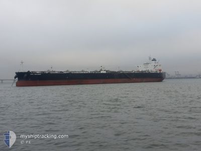
SEA VALIANT
Crude Oil Tanker

Current Trip
MYMKZ
| Time Travelled | 53 days |
|---|---|
| Remaining Time | --- |
| Distance Travelled | 9406.28 nm |
| Remaining Distance | --- |
| AVG Speed | 11.3 Knop |
| MAX Speed | 14.5 Knop |
| AVG Wind | 13.7 knots |
| MAX Wind | 34 knots |
| MIN Temp | 7.3°C / 45.14°F |
| MAX Temp | 28.8°C / 83.84°F |
| Djupgående | 12.1 m |
| Position mottagen | 2025-02-05 04:05 |
Current Position
| Longitud | --- |
|---|---|
| Latitude | --- |
| Status | Under way using engine |
| Fart | 12.1 Knop |
| Kurs | 296.5° |
| Område | Malacca Strait |
| Station | T-AIS |
| Position mottagen | 2025-02-05 04:05 |
Information
The current position of SEA VALIANT is in Malacca Strait with coordinates 3.57910° / 100.21710° as reported on 2025-02-05 04:05 by AIS to our vessel tracker app. The vessel's current speed is 12.1 Knop
The vessel SEA VALIANT (IMO: 9420629, MMSI: 538009850) is a Crude Oil Tanker that was built in 2010 ( 15 År gammal ). It's sailing under the flag of [MH] Marshall Is.
In this page you can find informations about the vessels current position, last detected port calls, and current voyage information. If the vessels is not in coverage by AIS you will find the latest position.
The current position of SEA VALIANT is detected by our AIS receivers and we are not responsible for the reliability of the data. The last position was recorded while the vessel was in Coverage by the Ais receivers of our vessel tracking app.
The current draught of SEA VALIANT as reported by AIS is 12.1 meters
Weather
| Temperature | 25°C / 77°F |
|---|---|
| Wind Speed | 11 knots |
| Direction | 6° N |
| Pressure | 1008.1 hPa |
| Humidity | 43.2 % |
| Cloud Coverage | 49 % |


Featured Company
Last Port Calls
| Port | Arrival | Departure | Time In Port |
|---|---|---|---|
| 2025-02-03 10:31 | 2025-02-05 00:07 | 1 d | |
| 2025-01-07 07:36 | 2025-01-09 18:01 | 2 d | |
| 2025-01-06 14:13 | 2025-01-07 06:58 | 16 h |
Most Visited Ports (Last year)
| Port | Arrivals | |
|---|---|---|
| 3 | ||
| 3 | ||
| 2 | ||
| 1 | ||
| 1 | ||
| 1 |
Last Trips
| Origin | Departure | Destination | Arrival | Distance | |
|---|---|---|---|---|---|
| 2025-01-09 18:01 | 2025-02-03 10:31 | 2376.14 nm | |||
| 2025-01-07 06:58 | 2025-01-07 07:36 | 0.47 nm | |||
| 2024-12-25 17:56 | 2025-01-06 14:13 | 1525.01 nm |
Events
| Tid | Event | Detaljer | Position / Dest | Information |
|---|---|---|---|---|
| 2025-03-29 11:47 | STOPPAR förflyttning | 6.71 nm, South East of PUERTO ROSALES |
-38.97892 / -61.94179
MYMKZ
|
Fart: Kurs: 281° |
| 2025-03-29 11:03 | STARTAR förflyttning | 2.09 nm, South East of PUERTO ROSALES |
-38.95219 / -62.03721
MYMKZ
|
Fart: 4 kn Kurs: 124° |
| 2025-03-27 12:39 | STOPPAR förflyttning | 1.42 nm, South East of PUERTO ROSALES |
-38.94634 / -62.05022
MYMKZ
|
Fart: 0.2 kn Kurs: 306° |
| 2025-03-27 10:03 | STARTAR förflyttning | 15.88 nm, South East of PUERTO ROSALES |
-39.08815 / -61.79906
MYMKZ
|
Fart: 3.9 kn Kurs: 295° |
| 2025-03-26 23:31 | STOPPAR förflyttning | 16.04 nm, South East of PUERTO ROSALES |
-39.08913 / -61.79575
MYMKZ
|
Fart: 0.1 kn Kurs: 349° |
| 2025-03-26 20:38 | STARTAR förflyttning |
-39.31958 / -61.47244
MYMKZ
|
Fart: 4.2 kn Kurs: 255° |