
SEA PHANAGORIA
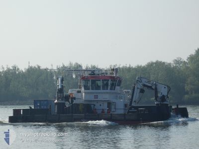
Tug
Current Trip
NISI
| Time Travelled | --- |
|---|---|
| Remaining Time | --- |
| Distance Travelled | 1035.35 nm |
| Remaining Distance | --- |
| AVG Speed | 6.6 Knop |
| MAX Speed | 6.6 Knop |
| AVG Wind | 9.9 knots |
| MAX Wind | 25 knots |
| MIN Temp | 18°C / 64.4°F |
| MAX Temp | 28.2°C / 82.76°F |
| Djupgående | 3.3 m |
| Position mottagen | 1 m sen |
Current Position
| Longitud | --- |
|---|---|
| Latitude | --- |
| Status | Under way using engine |
| Fart | |
| Kurs | 32° |
| Område | Persian Gulf |
| Station | T-AIS |
| Position mottagen | 1 m sen |
Information
The current position of SEA PHANAGORIA is in Persian Gulf with coordinates 24.69852° / 54.49574° as reported on 2025-03-04 15:36 by AIS to our vessel tracker app. The vessel's current speed is 0 Knop
The vessel SEA PHANAGORIA (IMO: 9868522, MMSI: 245916000) is a Tug It's sailing under the flag of [NL] Netherlands.
In this page you can find informations about the vessels current position, last detected port calls, and current voyage information. If the vessels is not in coverage by AIS you will find the latest position.
The current position of SEA PHANAGORIA is detected by our AIS receivers and we are not responsible for the reliability of the data. The last position was recorded while the vessel was in Coverage by the Ais receivers of our vessel tracking app.
The current draught of SEA PHANAGORIA as reported by AIS is 3.3 meters
Weather
| Temperature | 21.9°C / 71.42°F |
|---|---|
| Wind Speed | 12 knots |
| Direction | 15° NNE |
| Pressure | 1014.8 hPa |
| Humidity | 72 % |
| Cloud Coverage | 100 % |
Featured Company
Most Visited Ports (Last year)
| Port | Arrivals | |
|---|---|---|
| 6 | ||
| 3 | ||
| 3 | ||
| 3 | ||
| 2 | ||
| 2 |
Events
| Tid | Event | Detaljer | Position / Dest | Information |
|---|---|---|---|---|
| 2025-03-04 04:12 | STOPPAR förflyttning | 11.42 nm, South West of KHALIFA |
24.69894 / 54.49598
NISI
|
Fart: 0.3 kn Kurs: 148° |
| 2025-03-04 04:07 | STARTAR förflyttning | 11.35 nm, South West of KHALIFA |
24.69927 / 54.49731
NISI
|
Fart: 3.6 kn Kurs: 151° |
| 2025-03-04 03:13 | STOPPAR förflyttning | 11.41 nm, South West of KHALIFA |
24.70013 / 54.49530
NISI
|
Fart: Kurs: 324° |
| 2025-03-04 02:57 | STARTAR förflyttning | 10.7 nm, South West of KHALIFA |
24.70316 / 54.50889
NISI
|
Fart: 3.9 kn Kurs: 305° |
| 2025-03-04 01:58 | STOPPAR förflyttning | 10.73 nm, South West of KHALIFA |
24.70072 / 54.51016
NISI
|
Fart: 0.1 kn Kurs: 100° |
| 2025-03-04 01:46 | STARTAR förflyttning | 10.7 nm, South West of KHALIFA |
24.69955 / 54.51174
NISI
|
Fart: 4.1 kn Kurs: 37° |
| 2025-03-04 00:47 | STOPPAR förflyttning | 10.75 nm, South West of KHALIFA |
24.70106 / 54.50937
NISI
|
Fart: 0.2 kn Kurs: 244° |
| 2025-03-04 00:22 | STARTAR förflyttning | 11.38 nm, South West of KHALIFA |
24.68492 / 54.50872
NISI
|
Fart: 3.4 kn Kurs: 25° |
| 2025-03-03 23:01 | Status ändrad | Under way using engine Default |
24.68332 / 54.50701
NISI
|
Fart: 0.2 kn Kurs: 58° |
| 2025-03-03 22:49 | Status ändrad | Default Under way using engine |
24.68337 / 54.50700
NISI
|
Fart: 0.1 kn Kurs: 45° |