
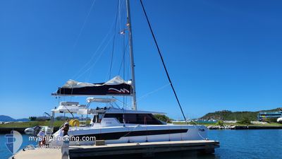
SEA GAL
Pleasure Craft
Current Trip
LAST UPDATE TIME
Unknown Port
ETA*
2024-03-05 02:15 UTC
| Time Travelled | 11 h, 34 mins |
|---|---|
| Remaining Time | --- |
| Distance Travelled | 13.83 nm |
| Remaining Distance | --- |
| AVG Speed | 6.5 Knop |
| MAX Speed | 8.6 Knop |
| AVG Wind | 16 knots |
| MAX Wind | 16.9 knots |
| MIN Temp | 25.4°C / 77.72°F |
| MAX Temp | 25.7°C / 78.26°F |
| Djupgående | 0 m |
| Position mottagen | 3 m sen |
Current Position
| Longitud | --- |
|---|---|
| Latitude | --- |
| Status | Default |
| Fart | 0.1 Knop |
| Kurs | --- |
| Område | Caribbean Sea |
| Station | T-AIS |
| Position mottagen | 3 m sen |
Info
info
Information
The current position of SEA GAL is in Caribbean Sea with coordinates 18.46050° / -64.52898° as reported on 2025-02-20 00:41 by AIS to our vessel tracker app. The vessel's current speed is 0.1 Knop
The vessel SEA GAL (MMSI: 368344070) is a Pleasure Craft It's sailing under the flag of [US] USA.
In this page you can find informations about the vessels current position, last detected port calls, and current voyage information. If the vessels is not in coverage by AIS you will find the latest position.
The current position of SEA GAL is detected by our AIS receivers and we are not responsible for the reliability of the data. The last position was recorded while the vessel was in Coverage by the Ais receivers of our vessel tracking app.
Weather
| Temperature | 25.7°C / 78.26°F |
|---|---|
| Wind Speed | 16 knots |
| Direction | 104° ESE |
| Pressure | 1017.4 hPa |
| Humidity | 76.3 % |
| Cloud Coverage | 21 % |
Featured Company
Limited time offer - Install a base station receiver to your area and list your company on MyShipTracking Free forever!
Last Port Calls
| Port | Arrival | Departure | Time In Port |
|---|---|---|---|
| 2025-02-18 20:30 | 2025-02-19 13:11 | 16 h | |
| 2025-02-17 17:24 | 2025-02-17 18:40 | 1 h | |
| 2025-02-14 19:59 | 2025-02-17 16:28 | 2 d | |
| 2025-02-13 17:18 | 2025-02-14 12:06 | 18 h | |
| 2025-02-09 18:02 | 2025-02-10 13:57 | 19 h | |
| 2025-02-05 15:18 | 2025-02-09 14:13 | 3 d | |
| 2025-02-01 20:01 | 2025-02-02 15:23 | 19 h | |
| 2025-01-31 20:35 | 2025-02-01 15:46 | 19 h | |
| 2025-01-31 16:43 | |||
| 2025-01-26 16:33 | 2025-01-28 17:38 | 2 d |
Most Visited Ports (Last year)
| Port | Arrivals | |
|---|---|---|
| 32 | ||
| 24 | ||
| 19 | ||
| 15 | ||
| 8 | ||
| 7 |
Last Trips
| Origin | Departure | Destination | Arrival | Distance | |
|---|---|---|---|---|---|
| 2025-02-17 14:40 | 2025-02-18 16:30 | 12.17 nm | |||
| 2025-02-17 12:28 | 2025-02-17 13:24 | 7.11 nm | |||
| 2025-02-14 08:06 | 2025-02-14 15:59 | 16.36 nm | |||
| 2025-02-10 09:57 | 2025-02-13 13:18 | 57.16 nm | |||
| 2025-02-09 10:13 | 2025-02-09 14:02 | 16.61 nm | |||
| 2025-02-02 11:23 | 2025-02-05 11:18 | 49.42 nm | |||
| 2025-02-01 11:46 | 2025-02-01 16:01 | 6.66 nm | |||
| 2025-01-31 12:43 | 2025-01-31 16:35 | 15.04 nm | |||
| 2025-01-24 09:13 | 2025-01-26 12:33 | 34.09 nm | |||
| 2025-01-21 10:16 | 2025-01-22 11:22 | 21.71 nm |
Events
| Tid | Event | Detaljer | Position / Dest | Information |
|---|---|---|---|---|
| 2025-02-19 19:22 | STOPPAR förflyttning | 0.89 nm, North of BEEF ISLAND |
18.46053 / -64.52896
LAST UPDATE TIME
|
Fart: Kurs: 511° |
| 2025-02-19 18:53 | STARTAR förflyttning | 2.57 nm, North West of BEEF ISLAND |
18.46470 / -64.57436
LAST UPDATE TIME
|
Fart: 6.2 kn Kurs: 152.9° |
| 2025-02-19 14:50 | STOPPAR förflyttning | 2.85 nm, North West of BEEF ISLAND |
18.47246 / -64.57542
LAST UPDATE TIME
|
Fart: 0.3 kn Kurs: 511° |
| 2025-02-19 13:11 | AVGÅTT HAMN |
|
18.43779 / -64.74872
LAST UPDATE TIME
|
Fart: 5 kn Kurs: 140.7° |
| 2025-02-19 13:11 | STARTAR förflyttning |
18.43868 / -64.74979
[VG] JOST VAN DYKE
|
Fart: 5 kn Kurs: 140.7° |
|
| 2025-02-19 11:58 | I täckningsområde |
18.44093 / -64.75213
Caribbean Sea
[VG] JOST VAN DYKE
|
Fart: 0.2 kn Kurs: 511° |
|
| 2025-02-19 02:25 | UTANFÖR täckningsområde |
18.44098 / -64.75218
Caribbean Sea
[VG] JOST VAN DYKE
|
Fart: 0.1 kn Kurs: 511° |
|
| 2025-02-18 20:32 | STOPPAR förflyttning |
18.44105 / -64.75211
[VG] JOST VAN DYKE
|
Fart: 0.1 kn Kurs: 511° |
|
| 2025-02-18 20:30 | ANLÄNDER HAMN |
|
18.43994 / -64.75214
[VG] JOST VAN DYKE
|
Fart: 4.8 kn Kurs: 29.3° |
| 2025-02-18 19:23 | STARTAR förflyttning | 2.87 nm, West of ROAD TOWN |
18.42720 / -64.66160
LAST UPDATE TIME
|
Fart: 5.7 kn Kurs: 304° |