

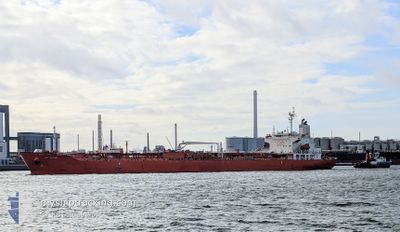
SC PETREL
Tanker

Current Trip
HAZIRA
| Time Travelled | 1 day |
|---|---|
| Remaining Time | --- |
| Distance Travelled | 279.86 nm |
| Remaining Distance | --- |
| AVG Speed | 12.3 Knop |
| MAX Speed | 14.6 Knop |
| AVG Wind | 9.6 knots |
| MAX Wind | 14.7 knots |
| MIN Temp | 23.3°C / 73.94°F |
| MAX Temp | 24°C / 75.2°F |
| Djupgående | 9.8 m |
| Position mottagen | 11 d sen |
Current Position
| Longitud | --- |
|---|---|
| Latitude | --- |
| Status | Under way using engine |
| Fart | 13.3 Knop |
| Kurs | 306.6° |
| Område | Laccadive Sea |
| Station | T-AIS |
| Position mottagen | 11 d sen |
Information
The current position of SC PETREL is in Laccadive Sea with coordinates 7.74561° / 76.65556° as reported on 2025-02-16 13:06 by AIS to our vessel tracker app. The vessel's current speed is 13.3 Knop
The vessel SC PETREL (IMO: 9746176, MMSI: 477129500) is a Tanker It's sailing under the flag of [HK] Hong Kong.
In this page you can find informations about the vessels current position, last detected port calls, and current voyage information. If the vessels is not in coverage by AIS you will find the latest position.
The current position of SC PETREL is detected by our AIS receivers and we are not responsible for the reliability of the data. The last position was recorded while the vessel was in Coverage by the Ais receivers of our vessel tracking app.
The current draught of SC PETREL as reported by AIS is 9.8 meters
Weather
| Temperature | 23.3°C / 73.94°F |
|---|---|
| Wind Speed | 12 knots |
| Direction | 252° WSW |
| Pressure | 1014 hPa |
| Humidity | 67.8 % |
| Cloud Coverage | 100 % |


Featured Company
Last Port Calls
| Port | Arrival | Departure | Time In Port |
|---|---|---|---|
| 2025-02-25 19:23 | 2025-02-26 15:11 | 19 h | |
| 2025-02-23 07:54 | 2025-02-24 09:34 | 1 d | |
| 2025-01-19 07:37 | 2025-01-21 03:38 | 1 d | |
| 2024-12-27 15:28 | 2024-12-28 12:38 | 21 h | |
| 2024-12-26 17:03 | 2024-12-27 14:06 | 21 h | |
| 2024-12-08 07:18 | 2024-12-11 19:50 | 3 d | |
| 2024-12-05 07:44 | 2024-12-06 11:25 | 1 d | |
| 2024-12-02 02:10 | 2024-12-03 16:36 | 1 d |
Last Trips
| Origin | Departure | Destination | Arrival | Distance | |
|---|---|---|---|---|---|
| 2025-02-24 15:04 | 2025-02-26 00:23 | 285.12 nm | |||
| 2025-01-21 11:38 | 2025-02-23 13:24 | 7162.89 nm | |||
| 2024-12-28 20:38 | 2025-01-19 15:37 | 3199.42 nm | |||
| 2024-12-27 22:06 | 2024-12-27 23:28 | 4.85 nm | |||
| 2024-12-11 22:50 | 2024-12-27 01:03 | 3876.27 nm | |||
| 2024-12-06 15:25 | 2024-12-08 10:18 | 383.28 nm | |||
| 2024-12-03 19:36 | 2024-12-05 11:44 | 378.03 nm | |||
| 2024-11-12 15:16 | 2024-12-02 05:10 | 1360.59 nm |
Events
| Tid | Event | Detaljer | Position / Dest | Information |
|---|---|---|---|---|
| 2025-02-26 15:11 | STARTAR förflyttning | 0.48 nm, South East of SALEHAABAD ISLAND |
24.80169 / 66.97782
HAZIRA
|
Fart: 7.1 kn Kurs: 150° |
| 2025-02-26 15:11 | AVGÅTT HAMN |
|
24.80169 / 66.97782
HAZIRA
|
Fart: 2 kn Kurs: 158° |
| 2025-02-25 19:23 | STOPPAR förflyttning |
24.80958 / 66.97572
[PK] KARACHI
|
Fart: Kurs: 341° |
|
| 2025-02-25 19:23 | ANLÄNDER HAMN |
|
24.80958 / 66.97572
[PK] KARACHI
|
Fart: 3.3 kn Kurs: 342° |
| 2025-02-25 17:52 | STARTAR förflyttning | 6.39 nm, South West of SALEHAABAD ISLAND |
24.71551 / 66.90575
HAZIRA
|
Fart: 3.5 kn Kurs: 65° |
| 2025-02-25 16:47 | STOPPAR förflyttning | 6.58 nm, South West of SALEHAABAD ISLAND |
24.71727 / 66.89706
HAZIRA
|
Fart: 0.2 kn Kurs: 55° |
| 2025-02-25 16:34 | STARTAR förflyttning | 6.88 nm, South West of SALEHAABAD ISLAND |
24.72002 / 66.88493
HAZIRA
|
Fart: 3.2 kn Kurs: 104° |
| 2025-02-25 11:43 | STOPPAR förflyttning | 6.74 nm, South West of SALEHAABAD ISLAND |
24.72473 / 66.88305
HAZIRA
|
Fart: 0.3 kn Kurs: 191° |
| 2025-02-25 11:06 | STARTAR förflyttning | 5.93 nm, South West of SALEHAABAD ISLAND |
24.72147 / 66.91116
HAZIRA
|
Fart: 8.2 kn Kurs: 275° |
| 2025-02-25 09:29 | STOPPAR förflyttning | 6.11 nm, South West of SALEHAABAD ISLAND |
24.71349 / 66.92012
HAZIRA
|
Fart: 0.3 kn Kurs: 186° |