
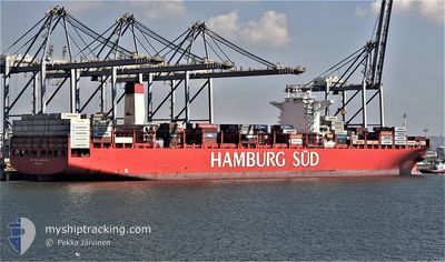
SAN AUGUSTIN MAERSK
Container Ship
Current Trip
| Trip Time | 25 days |
|---|---|
| Trip Distance | 10484.97 nm |
| AVG Speed | 17.2 Knop |
| MAX Speed | 21.8 Knop |
| Djupgående | 13.2 m |
| AVG Wind | 15.6 knots |
| MAX Wind | 31.3 knots |
| MIN Temp | 15.8°C / 60.44°F |
| MAX Temp | 28.8°C / 83.84°F |
| Position mottagen | 21 d sen |
Current Position
| Longitud | --- |
|---|---|
| Latitude | --- |
| Status | Under way using engine |
| Fart | 16.3 Knop |
| Kurs | 261.6° |
| Område | Java Sea |
| Station | T-AIS |
| Position mottagen | 21 d sen |
Info
Information
The current position of SAN AUGUSTIN MAERSK is in Java Sea with coordinates -6.31253° / 105.28891° as reported on 2025-12-15 07:39 by AIS to our vessel tracker app. The vessel's current speed is 16.3 Knop and is currently inside the port of SANTOS.
The vessel SAN AUGUSTIN MAERSK (IMO: 9622239, MMSI: 219100000) is a Container Ship that was built in 2013 ( 13 År gammal ). It's sailing under the flag of [DK] Denmark.
In this page you can find informations about the vessels current position, last detected port calls, and current voyage information. If the vessels is not in coverage by AIS you will find the latest position.
The current position of SAN AUGUSTIN MAERSK is detected by our AIS receivers and we are not responsible for the reliability of the data. The last position was recorded while the vessel was in Coverage by the Ais receivers of our vessel tracking app.
The current draught of SAN AUGUSTIN MAERSK as reported by AIS is 13.2 meters
Weather
| Temperature | 22°C / 71.6°F |
|---|---|
| Wind Speed | 11 knots |
| Direction | 70° ENE |
| Pressure | 1017 hPa |
| Humidity | 80.4 % |
| Cloud Coverage | 74 % |
Featured Company
Last Port Calls
| Port | Arrival | Departure | Time In Port |
|---|---|---|---|
| 2026-01-05 14:05 | |||
| 2025-12-10 11:04 | 2025-12-11 08:30 | 21 h | |
| 2025-12-08 13:44 | 2025-12-09 07:53 | 18 h | |
| 2025-11-30 05:53 | 2025-12-01 06:36 | 1 d | |
| 2025-11-21 01:21 | 2025-11-22 05:03 | 1 d | |
| 2025-11-14 19:59 | 2025-11-16 10:25 | 1 d |
Most Visited Ports (Last year)
| Port | Arrivals | |
|---|---|---|
| 9 | ||
| 6 | ||
| 4 | ||
| 4 | ||
| 4 | ||
| 4 |
Last Trips
| Origin | Departure | Destination | Arrival | Distance | |
|---|---|---|---|---|---|
| 2025-12-11 08:30 | 2026-01-05 14:05 | 10484.97 nm | |||
| 2025-12-09 07:53 | 2025-12-10 11:04 | 63.92 nm | |||
| 2025-12-01 06:36 | 2025-12-08 13:44 | 918.05 nm | |||
| 2025-11-22 05:03 | 2025-11-30 05:53 | 1142.89 nm | |||
| 2025-11-16 10:25 | 2025-11-21 01:21 | 1499.08 nm | |||
| 2025-10-18 21:21 | 2025-11-14 19:59 | 9026.24 nm |
Events
| Tid | Event | Detaljer | Position / Dest | Information |
|---|---|---|---|---|
| 2026-01-05 18:10 | STOPPAR förflyttning |
-23.92602 / -46.32156
[BR] SANTOS
|
Fart: 0.1 kn Kurs: 276° |
|
| 2026-01-05 17:05 | ANLÄNDER HAMN |
|
-23.99948 / -46.33304
[BR] SANTOS
|
Fart: 7.7 kn Kurs: 23° |
| 2026-01-05 15:10 | STARTAR förflyttning | 16.55 nm, South of SANTOS |
-24.22923 / -46.42133
HKHKG>BRSSZ
|
Fart: 3.3 kn Kurs: 232° |
| 2026-01-05 13:54 | STOPPAR förflyttning | 16.97 nm, South of SANTOS |
-24.23721 / -46.41943
HKHKG>BRSSZ
|
Fart: 0.3 kn Kurs: 174° |
| 2026-01-05 10:45 | STARTAR förflyttning | 16.49 nm, South of SANTOS |
-24.22639 / -46.42648
HKHKG>BRSSZ
|
Fart: 3.4 kn Kurs: 197° |
| 2026-01-05 09:10 | STOPPAR förflyttning | 17.51 nm, South of SANTOS |
-24.24573 / -46.42275
HKHKG>BRSSZ
|
Fart: 0.2 kn Kurs: 172° |
| 2026-01-05 08:30 | STARTAR förflyttning | 16.34 nm, South of SANTOS |
-24.22194 / -46.43176
HKHKG>BRSSZ
|
Fart: 3.2 kn Kurs: 175° |
| 2026-01-05 07:02 | STOPPAR förflyttning | 17.37 nm, South of SANTOS |
-24.24232 / -46.42594
HKHKG>BRSSZ
|
Fart: 0.2 kn Kurs: 146° |
| 2026-01-05 06:09 | STARTAR förflyttning | 16.39 nm, South West of SANTOS |
-24.21829 / -46.44364
HKHKG>BRSSZ
|
Fart: 3.6 kn Kurs: 267° |
| 2026-01-05 05:02 | STOPPAR förflyttning | 17.15 nm, South of SANTOS |
-24.23649 / -46.43177
HKHKG>BRSSZ
|
Fart: 0.3 kn Kurs: 151° |