
RUMBO SOHAIL
Fishing
Current Trip
Unknown
| Time Travelled | 26 days |
|---|---|
| Remaining Time | --- |
| Distance Travelled | 395.13 nm |
| Remaining Distance | --- |
| AVG Speed | 7.5 Knop |
| MAX Speed | 11.6 Knop |
| AVG Wind | 5.7 knots |
| MAX Wind | 13 knots |
| MIN Temp | 8.2°C / 46.76°F |
| MAX Temp | 17.1°C / 62.78°F |
| Djupgående | 3.2 m |
| Position mottagen | 3 d sen |
Current Position
| Longitud | --- |
|---|---|
| Latitude | --- |
| Status | Restricted manoeuverability |
| Fart | 4.1 Knop |
| Kurs | 3.1° |
| Område | Alboran Sea |
| Station | T-AIS |
| Position mottagen | 3 d sen |
Info
Information
The current position of RUMBO SOHAIL is in Alboran Sea with coordinates 36.40486° / -4.58302° as reported on 2025-02-27 12:29 by AIS to our vessel tracker app. The vessel's current speed is 4.1 Knop
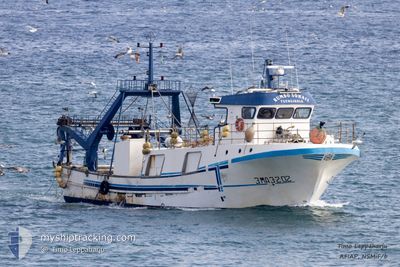
The vessel RUMBO SOHAIL (MMSI: 224068550) is a Fishing It's sailing under the flag of [ES] Spain.
In this page you can find informations about the vessels current position, last detected port calls, and current voyage information. If the vessels is not in coverage by AIS you will find the latest position.
The current position of RUMBO SOHAIL is detected by our AIS receivers and we are not responsible for the reliability of the data. The last position was recorded while the vessel was in Coverage by the Ais receivers of our vessel tracking app.
The current draught of RUMBO SOHAIL as reported by AIS is 3.2 meters
Weather
| Temperature | 14.7°C / 58.46°F |
|---|---|
| Wind Speed | 6 knots |
| Direction | 209° SSW |
| Pressure | 1020.1 hPa |
| Humidity | 74.1 % |
| Cloud Coverage | 87 % |
Featured Company
Events
| Tid | Event | Detaljer | Position / Dest | Information |
|---|---|---|---|---|
| 2025-02-27 12:29 | UTANFÖR täckningsområde |
36.40486 / -4.58302
Alboran Sea
|
Fart: 4.1 kn Kurs: 3.1° |
|
| 2025-02-27 05:01 | STARTAR förflyttning | 13.68 nm, South West of MALAGA |
36.54092 / -4.61611
|
Fart: 3.7 kn Kurs: 30.6° |
| 2025-02-27 04:04 | I täckningsområde |
36.53921 / -4.61722
Alboran Sea
|
Fart: Kurs: 0° |
|
| 2025-02-25 13:29 | UTANFÖR täckningsområde |
36.53923 / -4.61722
Alboran Sea
|
Fart: Kurs: 155.1° |
|
| 2025-02-25 13:25 | STOPPAR förflyttning | 13.78 nm, South West of MALAGA |
36.53927 / -4.61717
|
Fart: 0.1 kn Kurs: 511° |
| 2025-02-25 12:30 | STARTAR förflyttning | 18.34 nm, South of MALAGA |
36.41971 / -4.55771
|
Fart: 11 kn Kurs: 1.6° |
| 2025-02-25 12:20 | STOPPAR förflyttning | 18.71 nm, South of MALAGA |
36.41431 / -4.56186
|
Fart: 0.1 kn Kurs: 511° |
| 2025-02-25 04:59 | STARTAR förflyttning | 13.69 nm, South West of MALAGA |
36.54062 / -4.61630
|
Fart: 3.5 kn Kurs: 22° |
| 2025-02-25 04:04 | I täckningsområde |
36.53972 / -4.61836
Alboran Sea
|
Fart: Kurs: 102.1° |
|
| 2025-02-24 16:51 | UTANFÖR täckningsområde |
36.53975 / -4.61841
Alboran Sea
|
Fart: Kurs: 225.2° |