
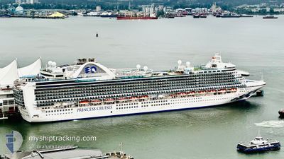
RUBY PRINCESS
Passengers Ship
Current Trip
| Time Travelled | 1 day |
|---|---|
| Remaining Time | --- |
| Distance Travelled | 569.10 nm |
| Remaining Distance | --- |
| AVG Speed | 17.4 Knop |
| MAX Speed | 19 Knop |
| AVG Wind | 8.8 knots |
| MAX Wind | 16.3 knots |
| MIN Temp | 13.6°C / 56.48°F |
| MAX Temp | 19.7°C / 67.46°F |
| Djupgående | 8.8 m |
| Position mottagen | 4 h, 51 m sen |
Current Position
| Longitud | --- |
|---|---|
| Latitude | --- |
| Status | Under way using engine |
| Fart | 12.5 Knop |
| Kurs | 139.2° |
| Område | North Pacific Ocean |
| Station | T-AIS |
| Position mottagen | 4 h, 51 m sen |
Info
Information
The current position of RUBY PRINCESS is in North Pacific Ocean with coordinates 31.08272° / -119.06248° as reported on 2026-03-09 04:17 by AIS to our vessel tracker app. The vessel's current speed is 12.5 Knop and is heading at the port of KAHULUI. The estimated time of arrival as calculated by MyShipTracking vessel tracking app is 2026-02-27 07:00 LT
The vessel RUBY PRINCESS (IMO: 9378462, MMSI: 310567000) is a Passengers Ship that was built in 2008 ( 18 År gammal ). It's sailing under the flag of [BM] Bermuda.
In this page you can find informations about the vessels current position, last detected port calls, and current voyage information. If the vessels is not in coverage by AIS you will find the latest position.
The current position of RUBY PRINCESS is detected by our AIS receivers and we are not responsible for the reliability of the data. The last position was recorded while the vessel was in Coverage by the Ais receivers of our vessel tracking app.
The current draught of RUBY PRINCESS as reported by AIS is 8.8 meters
Weather
| Temperature | 15.9°C / 60.62°F |
|---|---|
| Wind Speed | 10 knots |
| Direction | 77° ENE |
| Pressure | 1011.5 hPa |
| Humidity | 66.4 % |
| Cloud Coverage | 97 % |
Featured Company
Last Port Calls
| Port | Arrival | Departure | Time In Port |
|---|---|---|---|
| 2026-03-07 06:11 | 2026-03-07 16:35 | 10 h | |
| 2026-03-05 08:09 | 2026-03-05 17:40 | 9 h | |
| 2026-02-27 07:14 | 2026-02-27 23:15 | 16 h | |
| 2026-02-25 07:22 | 2026-02-25 17:22 | 10 h | |
| 2026-02-24 06:48 | 2026-02-24 23:16 | 16 h | |
| 2026-02-19 05:57 | 2026-02-19 16:19 | 10 h | |
| 2026-02-17 07:03 | 2026-02-17 17:31 | 10 h | |
| 2026-02-16 07:03 | 2026-02-16 22:58 | 15 h | |
| 2026-02-14 06:08 | 2026-02-14 16:23 | 10 h | |
| 2026-02-12 08:07 | 2026-02-12 17:23 | 9 h |
Last Trips
| Origin | Departure | Destination | Arrival | Distance | |
|---|---|---|---|---|---|
| 2026-03-05 17:40 | 2026-03-07 06:11 | 557.49 nm | |||
| 2026-02-27 23:15 | 2026-03-05 08:09 | 2245.89 nm | |||
| 2026-02-25 17:22 | 2026-02-27 07:14 | 373.90 nm | |||
| 2026-02-24 23:16 | 2026-02-25 07:22 | 98.07 nm | |||
| 2026-02-19 16:19 | 2026-02-24 06:48 | 2223.45 nm | |||
| 2026-02-17 17:31 | 2026-02-19 05:57 | 557.05 nm | |||
| 2026-02-16 22:58 | 2026-02-17 07:03 | 87.06 nm | |||
| 2026-02-14 16:23 | 2026-02-16 07:03 | 525.26 nm | |||
| 2026-02-12 17:23 | 2026-02-14 06:08 | 557.32 nm | |||
| 2026-02-06 19:14 | 2026-02-12 08:07 | 2245.94 nm |
Events
| Tid | Event | Detaljer | Position / Dest | Information |
|---|---|---|---|---|
| 2026-03-09 04:22 | Status ändrad | Default Under way using engine |
31.06832 / -119.04851
USOGG
|
Fart: 12.5 kn Kurs: 139.2° |
| 2026-03-09 04:17 | UTANFÖR täckningsområde |
31.08272 / -119.06248
North Pacific Ocean
|
Fart: 12.5 kn Kurs: 139.2° |
|
| 2026-03-09 03:48 | Status ändrad | Under way using engine Default |
31.16182 / -119.13962
USOGG
|
Fart: 13 kn Kurs: 140° |
| 2026-03-09 03:42 | Status ändrad | Default Under way using engine |
31.17731 / -119.15488
USOGG
|
Fart: 12.8 kn Kurs: 140° |
| 2026-03-09 02:13 | Status ändrad | Under way using engine Default |
31.48824 / -119.45864
USOGG
|
Fart: 18 kn Kurs: 139° |
| 2026-03-09 01:26 | Status ändrad | Default Under way using engine |
31.67116 / -119.63778
USOGG
|
Fart: 18.5 kn Kurs: 139.8° |
| 2026-03-09 01:16 | Status ändrad | Under way using engine Default |
31.71291 / -119.67879
USOGG
|
Fart: 19 kn Kurs: 139° |
| 2026-03-09 00:59 | Status ändrad | Default Under way using engine |
31.78060 / -119.74505
USOGG
|
Fart: 18.6 kn Kurs: 139° |
| 2026-03-09 00:51 | Status ändrad | Under way using engine Default |
31.81186 / -119.77596
USOGG
|
Fart: 18.5 kn Kurs: 140° |
| 2026-03-09 00:34 | I täckningsområde |
31.80593 / -119.77005
North Pacific Ocean
|
Fart: 18.6 kn Kurs: 139° |