
ROSS SEA
Crude Oil Tanker
Current Trip
| Time Travelled | 14 h, 32 mins |
|---|---|
| Remaining Time | 1 day |
| Distance Travelled | 181.08 nm |
| Remaining Distance | 373.79 nm |
| AVG Speed | 11.7 Knop |
| MAX Speed | 13.5 Knop |
| AVG Wind | 15.8 knots |
| MAX Wind | 22 knots |
| MIN Temp | 8.9°C / 48.02°F |
| MAX Temp | 11.4°C / 52.52°F |
| Djupgående | 8.7 m |
| Position mottagen | Nu |
Current Position
| Longitud | -4.45728° |
|---|---|
| Latitude | 49.73000° |
| Status | Under way using engine |
| Fart | 13.1 Knop |
| Kurs | 85.4° |
| Område | English Channel |
| Station | T-AIS |
| Position mottagen | Nu |
Info
Information
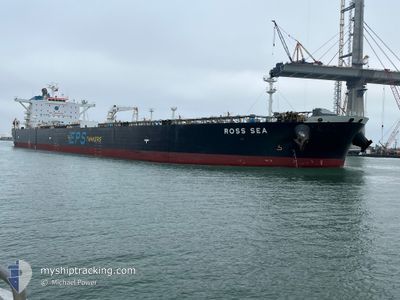
The current position of ROSS SEA is in English Channel with coordinates 49.73000° / -4.45728° as reported on 2024-05-03 03:15 by AIS to our vessel tracker app. The vessel's current speed is 13.1 Knop and is heading at the port of ROTTERDAM. The estimated time of arrival as calculated by MyShipTracking vessel tracking app is 2024-05-04 07:16 LT
The vessel ROSS SEA (IMO: 9457593, MMSI: 566071000) is a Crude Oil Tanker that was built in 2011 ( 13 År gammal ). It's sailing under the flag of [SG] Singapore.
In this page you can find informations about the vessels current position, last detected port calls, and current voyage information. If the vessels is not in coverage by AIS you will find the latest position.
The current position of ROSS SEA is detected by our AIS receivers and we are not responsible for the reliability of the data. The last position was recorded while the vessel was in Coverage by the Ais receivers of our vessel tracking app.
The current draught of ROSS SEA as reported by AIS is 8.7 meters
Weather
| Temperature | 11.3°C / 52.34°F |
|---|---|
| Wind Speed | 10 knots |
| Direction | 254° WSW |
| Pressure | 1009.8 hPa |
| Humidity | 76.5 % |
| Cloud Coverage | 100 % |
Featured Company
Last Port Calls
| Port | Arrival | Departure | Time In Port |
|---|---|---|---|
| 2024-04-30 21:57 | 2024-05-02 12:43 | 1 d | |
| 2024-04-12 11:00 | 2024-04-12 11:35 | 35 m | |
| 2024-03-15 20:16 | 2024-03-15 20:33 | 17 m | |
| 2024-03-12 18:36 | 2024-03-14 22:07 | 2 d | |
| 2024-03-01 15:27 | 2024-03-01 16:07 | 40 m |
Most Visited Ports (Last year)
| Port | Arrivals | |
|---|---|---|
| 4 | ||
| 3 | ||
| 3 | ||
| 2 | ||
| 2 | ||
| 1 |
Last Trips
| Origin | Departure | Destination | Arrival | Distance | |
|---|---|---|---|---|---|
| 2024-04-12 06:35 | 2024-04-30 22:57 | 4821.06 nm | |||
| 2024-03-15 15:33 | 2024-04-12 06:00 | 357.30 nm | |||
| 2024-03-14 17:07 | 2024-03-15 15:16 | 124.94 nm | |||
| 2024-03-01 10:07 | 2024-03-12 13:36 | 1261.58 nm | |||
| 2024-02-28 13:54 | 2024-03-01 09:27 | 6.32 nm |
Events
| Tid | Event | Detaljer | Position / Dest | Information |
|---|---|---|---|---|
| 2024-05-03 01:43 | Status ändrad | Under way using engine Default |
49.70329 / -4.97216
NLRTM
|
Fart: 13.2 kn Kurs: 83° |
| 2024-05-03 01:19 | Status ändrad | Default Under way using engine |
49.69559 / -5.10829
NLRTM
|
Fart: 13.5 kn Kurs: 85.2° |
| 2024-05-03 01:07 | Status ändrad | Under way using engine Default |
49.69215 / -5.17242
NLRTM
|
Fart: 13.5 kn Kurs: 85° |
| 2024-05-03 00:58 | Status ändrad | Default Under way using engine |
49.68947 / -5.22340
NLRTM
|
Fart: 13.4 kn Kurs: 85.1° |
| 2024-05-03 00:44 | Byter havsområde | United Kingdom part of the English Channel United Kingdom part of the Celtic Sea |
49.68473 / -5.30851
English Channel
NLRTM
|
Fart: 13.4 kn Kurs: 85.2° |
| 2024-05-03 00:44 | Status ändrad | Under way using engine Default |
49.68473 / -5.30851
NLRTM
|
Fart: 13.4 kn Kurs: 85° |
| 2024-05-03 00:35 | I täckningsområde |
49.68473 / -5.30851
English Channel
NLRTM
|
Fart: 13.4 kn Kurs: 85.2° |
|
| 2024-05-02 23:38 | Status ändrad | Default Under way using engine |
49.71679 / -5.66705
NLRTM
|
Fart: 13.2 kn Kurs: 126.1° |
| 2024-05-02 23:32 | UTANFÖR täckningsområde |
49.73160 / -5.69825
Celtic Sea
NLRTM
|
Fart: 13.2 kn Kurs: 126.1° |
|
| 2024-05-02 23:31 | Status ändrad | Under way using engine Default |
49.73194 / -5.69902
NLRTM
|
Fart: 13.2 kn Kurs: 126° |