
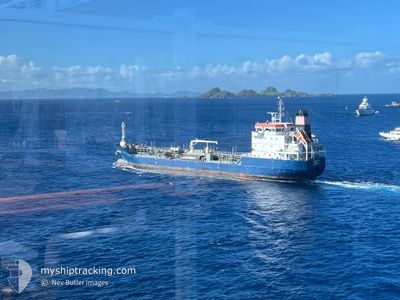
ROSE PG
Tanker
Current Trip
| Time Travelled | 5 days |
|---|---|
| Remaining Time | --- |
| Distance Travelled | 496.47 nm |
| Remaining Distance | --- |
| AVG Speed | 7.7 Knop |
| MAX Speed | 10.8 Knop |
| AVG Wind | 8.4 knots |
| MAX Wind | 14 knots |
| MIN Temp | 24.7°C / 76.46°F |
| MAX Temp | 26.4°C / 79.52°F |
| Djupgående | 6 m |
| Position mottagen | 2 m sen |
Current Position
| Longitud | --- |
|---|---|
| Latitude | --- |
| Status | Moored |
| Fart | |
| Kurs | 99° |
| Område | Caribbean Sea |
| Station | T-AIS |
| Position mottagen | 2 m sen |
Info
Information
The current position of ROSE PG is in Caribbean Sea with coordinates 18.38704° / -64.65368° as reported on 2025-03-17 13:26 by AIS to our vessel tracker app. The vessel's current speed is 0 Knop
The vessel ROSE PG (IMO: 9799032, MMSI: 232010199) is a Tanker It's sailing under the flag of [GB] United Kingdom.
In this page you can find informations about the vessels current position, last detected port calls, and current voyage information. If the vessels is not in coverage by AIS you will find the latest position.
The current position of ROSE PG is detected by our AIS receivers and we are not responsible for the reliability of the data. The last position was recorded while the vessel was in Coverage by the Ais receivers of our vessel tracking app.
The current draught of ROSE PG as reported by AIS is 6 meters
Weather
| Temperature | 25.5°C / 77.9°F |
|---|---|
| Wind Speed | 12 knots |
| Direction | 51° NE |
| Pressure | 1016.9 hPa |
| Humidity | 69.5 % |
| Cloud Coverage | 49 % |
Featured Company
Last Port Calls
| Port | Arrival | Departure | Time In Port |
|---|---|---|---|
| 2025-03-11 07:19 | 2025-03-11 15:11 | 7 h | |
| 2025-03-08 07:03 | 2025-03-09 16:31 | 1 d | |
| 2025-03-06 07:11 | 2025-03-06 16:27 | 9 h | |
| 2025-02-27 17:19 | 2025-03-01 03:51 | 1 d | |
| 2025-02-25 07:20 | 2025-02-25 15:28 | 8 h | |
| 2025-02-21 19:51 | 2025-02-23 02:03 | 1 d | |
| 2025-02-18 07:45 | 2025-02-18 14:41 | 6 h | |
| 2025-02-13 08:58 | 2025-02-13 17:07 | 8 h | |
| 2025-02-07 07:20 | 2025-02-08 14:55 | 1 d | |
| 2025-02-04 06:44 | 2025-02-04 14:45 | 8 h |
Most Visited Ports (Last year)
| Port | Arrivals | |
|---|---|---|
| 51 | ||
| 13 | ||
| 5 | ||
| 2 | ||
| 2 | ||
| 1 |
Last Trips
| Origin | Departure | Destination | Arrival | Distance | |
|---|---|---|---|---|---|
| 2025-03-09 16:31 | 2025-03-11 07:19 | 181.10 nm | |||
| 2025-03-06 16:27 | 2025-03-08 07:03 | 130.54 nm | |||
| 2025-03-01 03:51 | 2025-03-06 07:11 | 211.94 nm | |||
| 2025-02-25 15:28 | 2025-02-27 17:19 | 175.20 nm | |||
| 2025-02-23 02:03 | 2025-02-25 07:20 | 177.96 nm | |||
| 2025-02-18 14:41 | 2025-02-21 19:51 | 255.34 nm | |||
| 2025-02-13 17:07 | 2025-02-18 07:45 | 442.00 nm | |||
| 2025-02-08 14:55 | 2025-02-13 08:58 | 398.22 nm | |||
| 2025-02-04 14:45 | 2025-02-07 07:20 | 194.51 nm | |||
| 2025-02-03 20:01 | 2025-02-04 06:44 | 63.62 nm |
Events
| Tid | Event | Detaljer | Position / Dest | Information |
|---|---|---|---|---|
| 2025-03-17 11:08 | STOPPAR förflyttning | 2.89 nm, East of SOPERS HOLE |
18.38606 / -64.65346
VG TOV
|
Fart: Kurs: 67° |
| 2025-03-17 11:08 | Status ändrad | Moored Under way using engine |
18.38601 / -64.65342
VG TOV
|
Fart: 0.9 kn Kurs: 62° |
| 2025-03-17 10:41 | Byter havsområde | British Virgin Islands part of the Caribbean Sea Puerto Rican part of the Caribbean Sea |
18.36817 / -64.64328
Caribbean Sea
VG TOV
|
Fart: 5.3 kn Kurs: 338.8° |
| 2025-03-17 10:32 | Byter havsområde | Puerto Rican part of the Caribbean Sea British Virgin Islands part of the Caribbean Sea |
18.35059 / -64.64002
Caribbean Sea
VG TOV
|
Fart: 9.4 kn Kurs: 355.1° |
| 2025-03-17 10:26 | Byter havsområde | British Virgin Islands part of the Caribbean Sea Puerto Rican part of the Caribbean Sea |
18.33477 / -64.63992
Caribbean Sea
VG TOV
|
Fart: 9.4 kn Kurs: 1.5° |
| 2025-03-17 10:19 | Byter havsområde | Puerto Rican part of the Caribbean Sea British Virgin Islands part of the Caribbean Sea |
18.31846 / -64.64038
Caribbean Sea
VG TOV
|
Fart: 9.3 kn Kurs: 1.2° |
| 2025-03-17 04:31 | Upptäckt i hav | British Virgin Islands part of the Caribbean Sea |
18.06656 / -63.88589
Caribbean Sea
VG TOV
|
Fart: 7.7 kn Kurs: 287.6° |
| 2025-03-17 02:16 | Upptäckt i hav | Anguilla part of the Caribbean Sea |
17.97777 / -63.58897
Caribbean Sea
VG TOV
|
Fart: 8.2 kn Kurs: 288.7° |
| 2025-03-17 02:12 | Status ändrad | Under way using engine Default |
17.97527 / -63.58097
VG TOV
|
Fart: 8.2 kn Kurs: 289° |
| 2025-03-17 02:10 | Status ändrad | Default Under way using engine |
17.97362 / -63.57568
VG TOV
|
Fart: 8.2 kn Kurs: 288.3° |