
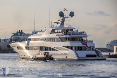
ROCK.IT
Pleasure Craft
Current Trip
| Trip Time | 7 h, 10 mins |
|---|---|
| Trip Distance | 91.02 nm |
| AVG Speed | 11 Knop |
| MAX Speed | 13.3 Knop |
| Djupgående | 3.3 m |
| AVG Wind | 5.7 knots |
| MAX Wind | 9.5 knots |
| MIN Temp | 12.7°C / 54.86°F |
| MAX Temp | 18.9°C / 66.02°F |
| Position mottagen | 1 m sen |
Current Position
| Longitud | 7.28553° |
|---|---|
| Latitude | 43.69450° |
| Status | Moored |
| Fart | |
| Kurs | 195° |
| Område | Mediterranean Sea - Western Basin |
| Station | T-AIS |
| Position mottagen | 1 m sen |
Info
Information
The current position of ROCK.IT is in Mediterranean Sea - Western Basin with coordinates 43.69450° / 7.28553° as reported on 2024-05-20 02:37 by AIS to our vessel tracker app. The vessel's current speed is 0 Knop and is currently inside the port of NICE.
The vessel ROCK.IT (IMO: 1012347, MMSI: 319072900) is a Pleasure Craft It's sailing under the flag of [KY] Cayman Is.
In this page you can find informations about the vessels current position, last detected port calls, and current voyage information. If the vessels is not in coverage by AIS you will find the latest position.
The current position of ROCK.IT is detected by our AIS receivers and we are not responsible for the reliability of the data. The last position was recorded while the vessel was in Coverage by the Ais receivers of our vessel tracking app.
The current draught of ROCK.IT as reported by AIS is 3.3 meters
Weather
| Temperature | 14.4°C / 57.92°F |
|---|---|
| Wind Speed | 5 knots |
| Direction | 343° NNW |
| Pressure | 1010.5 hPa |
| Humidity | 66.8 % |
| Cloud Coverage | 83 % |
Featured Company
Most Visited Ports (Last year)
| Port | Arrivals | |
|---|---|---|
| 5 | ||
| 2 | ||
| 2 | ||
| 2 | ||
| 2 | ||
| 1 |
Last Trips
| Origin | Departure | Destination | Arrival | Distance | |
|---|---|---|---|---|---|
| 2024-05-16 08:12 | 2024-05-16 15:22 | 91.02 nm | |||
| 2024-05-07 09:29 | 2024-05-07 11:01 | 14.65 nm | |||
| 2024-03-18 13:19 | 2024-03-21 11:47 | 866.22 nm | |||
| 2024-03-05 08:43 | 2024-03-18 06:02 | 3260.05 nm | |||
| 2024-03-02 10:09 | 2024-03-03 11:42 | 24.32 nm |
Events
| Tid | Event | Detaljer | Position / Dest | Information |
|---|---|---|---|---|
| 2024-05-16 13:54 | Status ändrad | Moored Under way using engine |
43.69450 / 7.28554
[FR] NICE
|
Fart: Kurs: 196° |
| 2024-05-16 13:30 | STOPPAR förflyttning |
43.69396 / 7.28463
[FR] NICE
|
Fart: 0.3 kn Kurs: 291° |
|
| 2024-05-16 13:22 | ANLÄNDER HAMN |
|
43.68982 / 7.28910
[FR] NICE
|
Fart: 4.1 kn Kurs: 346° |
| 2024-05-16 12:34 | Byter havsområde | French part of the Mediterranean Sea - Western Basin Mon�gasque part of the Mediterranean Sea - Western Basin |
43.66297 / 7.43413
Mediterranean Sea - Western Basin
NICE
|
Fart: 12.5 kn Kurs: 256.7° |
| 2024-05-16 12:26 | Byter havsområde | Mon�gasque part of the Mediterranean Sea - Western Basin French part of the Mediterranean Sea - Western Basin |
43.66967 / 7.47599
Mediterranean Sea - Western Basin
NICE
|
Fart: 12.7 kn Kurs: 257.6° |
| 2024-05-16 12:04 | Upptäckt i hav | French part of the Mediterranean Sea - Western Basin |
43.68519 / 7.57904
Mediterranean Sea - Western Basin
NICE
|
Fart: 13.1 kn Kurs: 258.5° |
| 2024-05-16 11:37 | Byter havsområde | Italian part of the Mediterranean Sea - Western Basin Italian part of the Ligurian Sea |
43.70553 / 7.71083
Mediterranean Sea - Western Basin
NICE
|
Fart: 12.8 kn Kurs: 259.1° |
| 2024-05-16 09:39 | I täckningsområde |
43.88260 / 8.22925
Ligurian Sea
NICE
|
Fart: 13.3 kn Kurs: 232.9° |
|
| 2024-05-16 08:30 | UTANFÖR täckningsområde |
44.05131 / 8.49610
Ligurian Sea
NICE
|
Fart: 12.8 kn Kurs: 229.5° |
|
| 2024-05-16 06:12 | AVGÅTT HAMN |
|
44.38429 / 8.94288
NICE
|
Fart: 11.2 kn Kurs: 161° |