
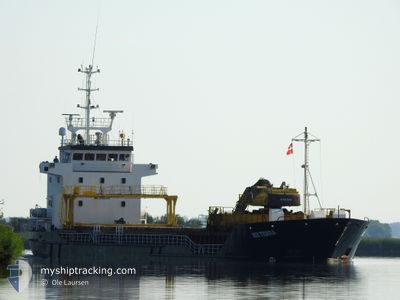
RIX TERRA
General Cargo
Current Trip
| Trip Time | 15 h, 11 mins |
|---|---|
| Trip Distance | 150.38 nm |
| AVG Speed | 9.9 Knop |
| MAX Speed | 11.8 Knop |
| Djupgående | 3.5 m |
| AVG Wind | 16.2 knots |
| MAX Wind | 18.8 knots |
| MIN Temp | 7.9°C / 46.22°F |
| MAX Temp | 10.2°C / 50.36°F |
| Position mottagen | 2 m sen |
Current Position
| Longitud | --- |
|---|---|
| Latitude | --- |
| Status | Moored |
| Fart | |
| Kurs | 341° |
| Område | Baltic Sea |
| Station | T-AIS |
| Position mottagen | 2 m sen |
Info
Information
The current position of RIX TERRA is in Baltic Sea with coordinates 54.15283° / 12.12167° as reported on 2025-12-11 04:17 by AIS to our vessel tracker app. The vessel's current speed is 0 Knop and is currently inside the port of ROSTOCK.
The vessel RIX TERRA (IMO: 9100188, MMSI: 275557000) is a General Cargo that was built in 1996 ( 29 År gammal ). It's sailing under the flag of [LV] Latvia.
In this page you can find informations about the vessels current position, last detected port calls, and current voyage information. If the vessels is not in coverage by AIS you will find the latest position.
The current position of RIX TERRA is detected by our AIS receivers and we are not responsible for the reliability of the data. The last position was recorded while the vessel was in Coverage by the Ais receivers of our vessel tracking app.
The current draught of RIX TERRA as reported by AIS is 3.5 meters
Weather
| Temperature | 9.1°C / 48.38°F |
|---|---|
| Wind Speed | 21 knots |
| Direction | 260° W |
| Pressure | 1017.6 hPa |
| Humidity | 80.6 % |
| Cloud Coverage | 39 % |
Featured Company
Last Port Calls
| Port | Arrival | Departure | Time In Port |
|---|---|---|---|
| 2025-12-10 06:30 | |||
| 2025-12-07 13:51 | 2025-12-09 15:19 | 2 d | |
| 2025-12-01 16:58 | 2025-12-02 17:29 | 1 d | |
| 2025-11-28 07:00 | 2025-11-28 19:20 | 12 h | |
| 2025-11-24 09:59 | 2025-11-25 00:12 | 14 h | |
| 2025-11-19 09:16 | 2025-11-20 23:06 | 1 d | |
| 2025-11-13 12:01 | 2025-11-14 10:46 | 22 h | |
| 2025-11-07 13:55 | 2025-11-09 15:24 | 2 d | |
| 2025-11-04 10:27 | 2025-11-05 04:29 | 18 h | |
| 2025-10-29 20:22 | 2025-11-01 02:24 | 2 d |
Most Visited Ports (Last year)
| Port | Arrivals | |
|---|---|---|
| 6 | ||
| 5 | ||
| 4 | ||
| 2 | ||
| 2 | ||
| 2 |
Last Trips
| Origin | Departure | Destination | Arrival | Distance | |
|---|---|---|---|---|---|
| 2025-12-09 16:19 | 2025-12-10 07:30 | 150.38 nm | |||
| 2025-12-02 18:29 | 2025-12-07 14:51 | 561.50 nm | |||
| 2025-11-28 20:20 | 2025-12-01 17:58 | 293.17 nm | |||
| 2025-11-25 01:12 | 2025-11-28 08:00 | 376.43 nm | |||
| 2025-11-21 00:06 | 2025-11-24 10:59 | 550.58 nm | |||
| 2025-11-14 11:46 | 2025-11-19 10:16 | 683.35 nm | |||
| 2025-11-09 16:24 | 2025-11-13 13:01 | 284.59 nm | |||
| 2025-11-05 05:29 | 2025-11-07 14:55 | 497.67 nm | |||
| 2025-11-01 03:24 | 2025-11-04 11:27 | 421.25 nm | |||
| 2025-10-26 19:48 | 2025-10-29 21:22 | 657.52 nm |
Events
| Tid | Event | Detaljer | Position / Dest | Information |
|---|---|---|---|---|
| 2025-12-10 07:18 | Status ändrad | Moored Under way using engine |
54.15284 / 12.12177
[DE] ROSTOCK
|
Fart: Kurs: 342° |
| 2025-12-10 07:09 | STOPPAR förflyttning |
54.15299 / 12.12215
[DE] ROSTOCK
|
Fart: 0.3 kn Kurs: 354° |
|
| 2025-12-10 06:30 | ANLÄNDER HAMN |
|
54.18834 / 12.08900
[DE] ROSTOCK
|
Fart: 7.1 kn Kurs: 160.2° |
| 2025-12-10 05:16 | Byter havsområde | German part of the Baltic Sea Danish part of the Baltic Sea |
54.35647 / 11.88091
Baltic Sea
DERSK
|
Fart: 11 kn Kurs: 136.8° |
| 2025-12-10 03:37 | Upptäckt i hav | Danish part of the Baltic Sea |
54.50720 / 11.43071
Baltic Sea
DERSK
|
Fart: 10.6 kn Kurs: 117.2° |
| 2025-12-10 02:02 | Byter havsområde | German part of the Baltic Sea Danish part of the Baltic Sea |
54.64045 / 11.01162
Baltic Sea
DERSK
|
Fart: 10.7 kn Kurs: 125.3° |
| 2025-12-10 01:15 | Upptäckt i hav | Danish part of the Baltic Sea |
54.72970 / 10.86170
Baltic Sea
DERSK
|
Fart: 10 kn Kurs: 176.3° |
| 2025-12-09 21:01 | I täckningsområde |
55.38043 / 11.01377
Kattegat
DERSK
|
Fart: 9.8 kn Kurs: 147.7° |
|
| 2025-12-09 15:28 | UTANFÖR täckningsområde |
55.69870 / 9.61033
Kattegat
DERSK
|
Fart: 10.9 kn Kurs: 91.7° |
|
| 2025-12-09 15:19 | AVGÅTT HAMN |
|
55.70258 / 9.56906
DERSK
|
Fart: 8.3 kn Kurs: 108° |