
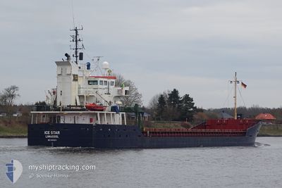
RIX MELODY
General Cargo
Current Trip
| Time Travelled | 3 days |
|---|---|
| Remaining Time | --- |
| Distance Travelled | 623.70 nm |
| Remaining Distance | --- |
| AVG Speed | 8.6 Knop |
| MAX Speed | 10 Knop |
| AVG Wind | 13.4 knots |
| MAX Wind | 21 knots |
| MIN Temp | 2°C / 35.6°F |
| MAX Temp | 5.4°C / 41.72°F |
| Djupgående | 6.5 m |
| Position mottagen | 1 h, 17 m sen |
Current Position
| Longitud | --- |
|---|---|
| Latitude | --- |
| Status | Under way using engine |
| Fart | 8.4 Knop |
| Kurs | 282.5° |
| Område | North Sea |
| Station | T-AIS |
| Position mottagen | 1 h, 17 m sen |
Info
Information
The current position of RIX MELODY is in North Sea with coordinates 58.01486° / 4.52930° as reported on 2025-03-17 20:46 by AIS to our vessel tracker app. The vessel's current speed is 8.4 Knop and is heading at the port of RUNCORN. The estimated time of arrival as calculated by MyShipTracking vessel tracking app is 2025-03-20 17:00 LT
The vessel RIX MELODY (IMO: 9142631, MMSI: 210387000) is a General Cargo that was built in 1997 ( 28 År gammal ). It's sailing under the flag of [CY] Cyprus.
In this page you can find informations about the vessels current position, last detected port calls, and current voyage information. If the vessels is not in coverage by AIS you will find the latest position.
The current position of RIX MELODY is detected by our AIS receivers and we are not responsible for the reliability of the data. The last position was recorded while the vessel was in Coverage by the Ais receivers of our vessel tracking app.
The current draught of RIX MELODY as reported by AIS is 6.5 meters
Weather
| Temperature | 5.3°C / 41.54°F |
|---|---|
| Wind Speed | 12 knots |
| Direction | 312° NW |
| Pressure | 1031.8 hPa |
| Humidity | 64.5 % |
| Cloud Coverage | 4 % |
Featured Company
Last Port Calls
| Port | Arrival | Departure | Time In Port |
|---|---|---|---|
| 2025-03-12 09:42 | 2025-03-14 22:18 | 2 d | |
| 2025-02-18 19:08 | 2025-03-10 15:10 | 19 d | |
| 2025-02-12 11:57 | 2025-02-14 02:12 | 1 d |
Last Trips
| Origin | Departure | Destination | Arrival | Distance | |
|---|---|---|---|---|---|
| 2025-03-10 15:10 | 2025-03-12 09:42 | 409.28 nm | |||
| 2025-02-14 02:12 | 2025-02-18 19:08 | 1059.63 nm | |||
| 2024-12-05 13:23 | 2025-02-12 11:57 | 793.07 nm |
Events
| Tid | Event | Detaljer | Position / Dest | Information |
|---|---|---|---|---|
| 2025-03-17 20:50 | Status ändrad | Default Under way using engine |
58.01651 / 4.51175
GB RUN
|
Fart: 8.4 kn Kurs: 282.5° |
| 2025-03-17 20:46 | Status ändrad | Under way using engine Default |
58.01486 / 4.52930
GB RUN
|
Fart: 8.4 kn Kurs: 282° |
| 2025-03-17 20:46 | UTANFÖR täckningsområde |
58.01486 / 4.52930
North Sea
GB RUN
|
Fart: 8.4 kn Kurs: 282.5° |
|
| 2025-03-17 20:39 | Status ändrad | Default Under way using engine |
58.01180 / 4.55968
GB RUN
|
Fart: 8.5 kn Kurs: 275.4° |
| 2025-03-17 09:42 | Upptäckt i hav | Norwegian part of the North Sea |
57.76884 / 7.41505
North Sea
GB RUN
|
Fart: 9.2 kn Kurs: 269.8° |
| 2025-03-17 03:49 | Byter havsområde | Norwegian part of the Skaggerak Danish part of the Skaggerak |
57.81632 / 9.08800
Skaggerak
GB RUN
|
Fart: 8.9 kn Kurs: 260.1° |
| 2025-03-16 20:55 | Byter havsområde | Danish part of the Skaggerak Danish part of the Kattegat |
57.80160 / 10.92803
Skaggerak
GB RUN
|
Fart: 8.1 kn Kurs: 307.3° |
| 2025-03-16 19:28 | Byter havsområde | Danish part of the Kattegat Swedish part of the Kattegat |
57.67367 / 11.18412
Kattegat
GB RUN
|
Fart: 7.8 kn Kurs: 318.6° |
| 2025-03-16 05:13 | Byter havsområde | Swedish part of the Kattegat Danish part of the Kattegat |
55.81548 / 12.73289
Kattegat
GB RUN
|
Fart: 8.9 kn Kurs: 18.2° |
| 2025-03-16 02:59 | Byter havsområde | Danish part of the Kattegat Swedish part of the Kattegat |
55.51231 / 12.72163
Kattegat
GB RUN
|
Fart: 8.6 kn Kurs: 2.9° |