

T/T SEAWOLF
Pleasure Craft

Current Trip
| Trip Time | 18 days |
|---|---|
| Trip Distance | 4123.83 nm |
| AVG Speed | 9.3 Knop |
| MAX Speed | 12.9 Knop |
| Djupgående | 10.8 m |
| AVG Wind | 11 knots |
| MAX Wind | 27.9 knots |
| MIN Temp | 17.1°C / 62.78°F |
| MAX Temp | 31.5°C / 88.7°F |
| Position mottagen | 5 d sen |
Current Position
| Longitud | --- |
|---|---|
| Latitude | --- |
| Status | Under way using engine |
| Fart | 10.9 Knop |
| Kurs | 204.5° |
| Område | Rio de La Plata |
| Station | T-AIS |
| Position mottagen | 5 d sen |
Information
The current position of T/T SEAWOLF is in Rio de La Plata with coordinates -35.08518° / -56.10404° as reported on 2025-02-24 11:57 by AIS to our vessel tracker app. The vessel's current speed is 10.9 Knop and is currently inside the port of SAN LORENZO.
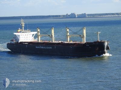
The vessel T/T SEAWOLF (IMO: 9754915, MMSI: 248056000) is a Pleasure Craft It's sailing under the flag of [MT] Malta.
In this page you can find informations about the vessels current position, last detected port calls, and current voyage information. If the vessels is not in coverage by AIS you will find the latest position.
The current position of T/T SEAWOLF is detected by our AIS receivers and we are not responsible for the reliability of the data. The last position was recorded while the vessel was in Coverage by the Ais receivers of our vessel tracking app.
The current draught of T/T SEAWOLF as reported by AIS is 10.8 meters
Weather
| Temperature | 27.1°C / 80.78°F |
|---|---|
| Wind Speed | 6 knots |
| Direction | 90° E |
| Pressure | 1010.3 hPa |
| Humidity | 74.1 % |
| Cloud Coverage | 40 % |


Featured Company
Last Port Calls
| Port | Arrival | Departure | Time In Port |
|---|---|---|---|
| 2025-02-25 22:13 | |||
| 2025-01-26 11:16 | 2025-02-07 06:00 | 11 d | |
| 2025-01-04 05:15 | 2025-01-04 13:49 | 8 h |
Most Visited Ports (Last year)
| Port | Arrivals | |
|---|---|---|
| 3 | ||
| 2 | ||
| 1 | ||
| 1 | ||
| 1 | ||
| 1 |
Last Trips
| Origin | Departure | Destination | Arrival | Distance | |
|---|---|---|---|---|---|
| 2025-02-07 08:00 | 2025-02-25 19:13 | 4123.83 nm | |||
| 2025-01-04 13:49 | 2025-01-26 13:16 | 3833.48 nm | |||
| 2024-12-20 04:28 | 2025-01-04 05:15 | 3167.10 nm |
Events
| Tid | Event | Detaljer | Position / Dest | Information |
|---|---|---|---|---|
| 2025-02-28 04:14 | STOPPAR förflyttning |
-32.58365 / -60.77902
[AR] SAN LORENZO
|
Fart: 0.2 kn Kurs: 311° |
|
| 2025-02-28 03:38 | STARTAR förflyttning |
-32.61779 / -60.75187
[AR] SAN LORENZO
|
Fart: 7.7 kn Kurs: 338° |
|
| 2025-02-25 22:22 | STOPPAR förflyttning |
-32.62949 / -60.74661
[AR] SAN LORENZO
|
Fart: 0.1 kn Kurs: 344° |
|
| 2025-02-25 22:13 | ANLÄNDER HAMN |
|
-32.62944 / -60.74721
[AR] SAN LORENZO
|
Fart: 0.8 kn Kurs: 321° |
| 2025-02-24 12:02 | Status ändrad | Default Under way using engine |
-35.09856 / -56.11343
NAWVB
|
Fart: 10.9 kn Kurs: 204.5° |
| 2025-02-24 11:57 | UTANFÖR täckningsområde |
-35.08518 / -56.10404
Rio de La Plata
|
Fart: 10.9 kn Kurs: 204.5° |
|
| 2025-02-24 10:14 | Upptäckt i hav | Uruguayan part of the Rio de La Plata |
-35.02040 / -55.84770
Rio de La Plata
|
Fart: 10.1 kn Kurs: 279.9° |
| 2025-02-24 10:14 | Status ändrad | Under way using engine Default |
-35.02040 / -55.84770
NAWVB
|
Fart: 10.1 kn Kurs: 279° |
| 2025-02-24 10:06 | I täckningsområde |
-35.02040 / -55.84770
Rio de La Plata
|
Fart: 10.1 kn Kurs: 279.9° |
|
| 2025-02-24 01:29 | UTANFÖR täckningsområde |
-34.99629 / -54.42681
South Atlantic Ocean
|
Fart: 5.6 kn Kurs: 242° |