
RESOURCE
General Cargo
Current Trip
PLSSZ
| Time Travelled | 36 days |
|---|---|
| Remaining Time | --- |
| Distance Travelled | 1728.27 nm |
| Remaining Distance | --- |
| AVG Speed | 9.3 Knop |
| MAX Speed | 14.9 Knop |
| AVG Wind | 13.5 knots |
| MAX Wind | 25.9 knots |
| MIN Temp | 8°C / 46.4°F |
| MAX Temp | 20.3°C / 68.54°F |
| Djupgående | 6.6 m |
| Position mottagen | Nu |
Current Position
| Longitud | 13.69713° |
|---|---|
| Latitude | 54.72882° |
| Status | Under way using engine |
| Fart | 2.2 Knop |
| Kurs | 353° |
| Område | Baltic Sea |
| Station | T-AIS |
| Position mottagen | Nu |
Info
Information
The current position of RESOURCE is in Baltic Sea with coordinates 54.72882° / 13.69713° as reported on 2024-06-10 08:02 by AIS to our vessel tracker app. The vessel's current speed is 2.2 Knop
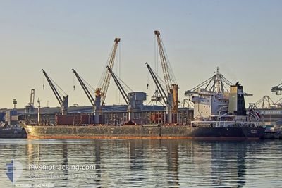
The vessel RESOURCE (IMO: 9487031, MMSI: 636021067) is a General Cargo that was built in 2010 ( 14 År gammal ). It's sailing under the flag of [LR] Liberia.
In this page you can find informations about the vessels current position, last detected port calls, and current voyage information. If the vessels is not in coverage by AIS you will find the latest position.
The current position of RESOURCE is detected by our AIS receivers and we are not responsible for the reliability of the data. The last position was recorded while the vessel was in Coverage by the Ais receivers of our vessel tracking app.
The current draught of RESOURCE as reported by AIS is 6.6 meters
Weather
| Temperature | 12.9°C / 55.22°F |
|---|---|
| Wind Speed | 21 knots |
| Direction | 247° WSW |
| Pressure | 1004.4 hPa |
| Humidity | 73.9 % |
| Cloud Coverage | 56 % |
Featured Company
Last Port Calls
| Port | Arrival | Departure | Time In Port |
|---|---|---|---|
| 2024-05-01 13:22 | 2024-05-04 13:48 | 3 d | |
| 2024-04-26 07:15 | 2024-04-28 20:10 | 2 d | |
| 2024-04-02 03:21 | 2024-04-09 03:09 | 6 d |
Most Visited Ports (Last year)
| Port | Arrivals | |
|---|---|---|
| 3 | ||
| 3 | ||
| 2 | ||
| 2 | ||
| 1 | ||
| 1 |
Events
| Tid | Event | Detaljer | Position / Dest | Information |
|---|---|---|---|---|
| 2024-06-10 04:10 | STARTAR förflyttning | 14.44 nm, North of SASSNITZ |
54.74233 / 13.74688
PLSSZ
|
Fart: 3.2 kn Kurs: 23° |
| 2024-06-10 01:32 | STOPPAR förflyttning | 10.92 nm, North of SASSNITZ |
54.69167 / 13.64870
PLSSZ
|
Fart: 0.3 kn Kurs: 240° |
| 2024-06-09 14:02 | Djupgående ändrat | 6.6 6.2 |
54.70394 / 13.59180
PLSSZ
|
Fart: 2.4 kn Kurs: 179° |
| 2024-06-09 11:31 | Byter havsområde | German part of the Baltic Sea Swedish part of the Baltic Sea |
55.00987 / 13.38625
Baltic Sea
PLSSZ
|
Fart: 10.5 kn Kurs: 131.5° |
| 2024-06-09 08:46 | Byter havsområde | Swedish part of the Baltic Sea Danish part of the Baltic Sea |
55.29390 / 12.64947
Baltic Sea
PLSSZ
|
Fart: 10.9 kn Kurs: 131.5° |
| 2024-06-09 08:37 | Byter havsområde | Danish part of the Baltic Sea Danish part of the Kattegat |
55.31923 / 12.62939
Baltic Sea
PLSSZ
|
Fart: 11 kn Kurs: 173.4° |
| 2024-06-09 08:25 | Byter havsområde | Danish part of the Kattegat Swedish part of the Kattegat |
55.35355 / 12.63459
Kattegat
PLSSZ
|
Fart: 9.7 kn Kurs: 192.5° |
| 2024-06-09 07:43 | Byter havsområde | Swedish part of the Kattegat Danish part of the Kattegat |
55.46894 / 12.68639
Kattegat
PLSSZ
|
Fart: 10.8 kn Kurs: 190.6° |
| 2024-06-09 05:01 | Byter havsområde | Danish part of the Kattegat Swedish part of the Kattegat |
55.93743 / 12.65199
Kattegat
PLSSZ
|
Fart: 11.4 kn Kurs: 193.1° |
| 2024-06-09 04:37 | Byter havsområde | Swedish part of the Kattegat Danish part of the Kattegat |
56.01879 / 12.65813
Kattegat
PLSSZ
|
Fart: 13.1 kn Kurs: 162.9° |