

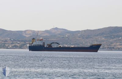
RENATA
General Cargo

Current Trip
| Time Travelled | 21 h, 51 mins |
|---|---|
| Remaining Time | 12 h, 33 mins |
| Distance Travelled | 184.29 nm |
| Remaining Distance | 110.46 nm |
| AVG Speed | 8.6 Knop |
| MAX Speed | 9.1 Knop |
| AVG Wind | 8.6 knots |
| MAX Wind | 13.3 knots |
| MIN Temp | 4.4°C / 39.92°F |
| MAX Temp | 13.4°C / 56.12°F |
| Djupgående | 6 m |
| Position mottagen | 13 m sen |
Current Position
| Longitud | --- |
|---|---|
| Latitude | --- |
| Status | Under way using engine |
| Fart | 8.4 Knop |
| Kurs | 139.8° |
| Område | Aegean Sea |
| Station | T-AIS |
| Position mottagen | 13 m sen |
Information
The current position of RENATA is in Aegean Sea with coordinates 37.05993° / 24.44932° as reported on 2025-03-21 16:14 by AIS to our vessel tracker app. The vessel's current speed is 8.4 Knop and is heading at the port of HERACLIO. The estimated time of arrival as calculated by MyShipTracking vessel tracking app is 2025-03-22 07:01 LT
The vessel RENATA (IMO: 8022872, MMSI: 240136700) is a General Cargo that was built in 1982 ( 43 År gammal ). It's sailing under the flag of [GR] Greece.
In this page you can find informations about the vessels current position, last detected port calls, and current voyage information. If the vessels is not in coverage by AIS you will find the latest position.
The current position of RENATA is detected by our AIS receivers and we are not responsible for the reliability of the data. The last position was recorded while the vessel was in Coverage by the Ais receivers of our vessel tracking app.
The current draught of RENATA as reported by AIS is 6 meters
Weather
| Temperature | 12.8°C / 55.04°F |
|---|---|
| Wind Speed | 12 knots |
| Direction | 7° N |
| Pressure | 1025.4 hPa |
| Humidity | 57.5 % |
| Cloud Coverage | --- |


Featured Company
Last Port Calls
| Port | Arrival | Departure | Time In Port |
|---|---|---|---|
| 2025-03-20 08:49 | 2025-03-20 20:37 | 11 h | |
| 2025-03-19 21:20 | 2025-03-19 22:53 | 1 h | |
| 2025-03-16 06:44 | 2025-03-19 07:03 | 3 d | |
| 2025-03-14 11:15 | 2025-03-14 19:12 | 7 h | |
| 2025-03-12 07:01 | 2025-03-12 21:47 | 14 h | |
| 2025-03-09 21:57 | 2025-03-10 16:39 | 18 h | |
| 2025-03-08 06:46 | 2025-03-08 18:51 | 12 h | |
| 2025-03-07 07:01 | 2025-03-07 13:19 | 6 h | |
| 2025-03-05 06:51 | 2025-03-06 18:11 | 1 d | |
| 2025-03-02 16:49 | 2025-03-02 16:58 | 9 m |
Most Visited Ports (Last year)
| Port | Arrivals | |
|---|---|---|
| 44 | ||
| 28 | ||
| 10 | ||
| 9 | ||
| 8 | ||
| 8 |
Last Trips
| Origin | Departure | Destination | Arrival | Distance | |
|---|---|---|---|---|---|
| 2025-03-19 22:53 | 2025-03-20 08:49 | 66.42 nm | |||
| 2025-03-19 07:03 | 2025-03-19 21:20 | 104.57 nm | |||
| 2025-03-14 19:12 | 2025-03-16 06:44 | 263.65 nm | |||
| 2025-03-12 21:47 | 2025-03-14 11:15 | 267.06 nm | |||
| 2025-03-10 16:39 | 2025-03-12 07:01 | 254.88 nm | |||
| 2025-03-08 18:51 | 2025-03-09 21:57 | 245.96 nm | |||
| 2025-03-07 13:19 | 2025-03-08 06:46 | 120.17 nm | |||
| 2025-03-06 18:11 | 2025-03-07 07:01 | 96.07 nm | |||
| 2025-03-02 16:58 | 2025-03-05 06:51 | 1.28 nm | |||
| 2025-03-01 18:41 | 2025-03-02 16:49 | 192.99 nm |
Events
| Tid | Event | Detaljer | Position / Dest | Information |
|---|---|---|---|---|
| 2025-03-21 13:18 | Status ändrad | Under way using engine Default |
37.45528 / 24.34451
GR HER
|
Fart: 8.3 kn Kurs: 198° |
| 2025-03-21 13:18 | I täckningsområde |
37.45408 / 24.34401
Aegean Sea
GR HER
|
Fart: 8.7 kn Kurs: 197.1° |
|
| 2025-03-21 12:21 | Status ändrad | Default Under way using engine |
37.58441 / 24.39654
GR HER
|
Fart: 8.7 kn Kurs: 198° |
| 2025-03-21 11:59 | UTANFÖR täckningsområde |
37.63402 / 24.41846
Aegean Sea
GR HER
|
Fart: 8.7 kn Kurs: 198° |
|
| 2025-03-21 11:35 | Status ändrad | Under way using engine Default |
37.68912 / 24.44248
GR HER
|
Fart: 8.9 kn Kurs: 200° |
| 2025-03-21 11:01 | Status ändrad | Default Under way using engine |
37.76822 / 24.48079
GR HER
|
Fart: 8.8 kn Kurs: 200.8° |
| 2025-03-21 06:45 | Destination ändrad | GR HER GR APL |
38.36547 / 24.58601
GR HER
|
Fart: 8.5 kn Kurs: 168.1° |
| 2025-03-21 06:45 | ETA ändrat | 2025/03/22 07:10 2026/01/01 07:10 |
38.36547 / 24.58601
GR HER
|
Fart: 8.5 kn Kurs: 168.1° |
| 2025-03-21 05:56 | I täckningsområde |
38.47407 / 24.54895
Aegean Sea
|
Fart: 8.7 kn Kurs: 162.6° |
|
| 2025-03-20 18:37 | AVGÅTT HAMN |
|
39.16788 / 22.85653
GR APL
|
Fart: 3.9 kn Kurs: 34° |