
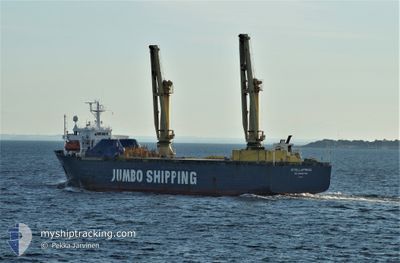
PRINCESS AYANA
Heavy Load Carrier
Current Trip
| Time Travelled | 16 h, 45 mins |
|---|---|
| Remaining Time | --- |
| Distance Travelled | 11.71 nm |
| Remaining Distance | --- |
| AVG Speed | 8.8 Knop |
| MAX Speed | 9.2 Knop |
| AVG Wind | 13.1 knots |
| MAX Wind | 13.4 knots |
| MIN Temp | 1.1°C / 33.98°F |
| MAX Temp | 1.2°C / 34.16°F |
| Djupgående | 7.6 m |
| Position mottagen | 16 h, 50 m sen |
Current Position
| Longitud | --- |
|---|---|
| Latitude | --- |
| Status | Under way using engine |
| Fart | 7.2 Knop |
| Kurs | 135° |
| Område | Black Sea |
| Station | T-AIS |
| Position mottagen | 16 h, 50 m sen |
Info
Information
The current position of PRINCESS AYANA is in Black Sea with coordinates 44.10581° / 28.69876° as reported on 2025-02-16 14:07 by AIS to our vessel tracker app. The vessel's current speed is 7.2 Knop and is heading at the port of HEREKE. The estimated time of arrival as calculated by MyShipTracking vessel tracking app is 2025-02-18 04:00 LT
The vessel PRINCESS AYANA (IMO: 8912326, MMSI: 511100502) is a Heavy Load Carrier that was built in 1991 ( 34 År gammal ). It's sailing under the flag of [PW] Palau.
In this page you can find informations about the vessels current position, last detected port calls, and current voyage information. If the vessels is not in coverage by AIS you will find the latest position.
The current position of PRINCESS AYANA is detected by our AIS receivers and we are not responsible for the reliability of the data. The last position was recorded while the vessel was in Coverage by the Ais receivers of our vessel tracking app.
The current draught of PRINCESS AYANA as reported by AIS is 7.6 meters
Weather
| Temperature | 4.7°C / 40.46°F |
|---|---|
| Wind Speed | 23 knots |
| Direction | 59° ENE |
| Pressure | 1018.4 hPa |
| Humidity | 96.4 % |
| Cloud Coverage | 100 % |
Featured Company
Last Trips
Events
| Tid | Event | Detaljer | Position / Dest | Information |
|---|---|---|---|---|
| 2025-02-16 14:13 | Status ändrad | Default Under way using engine |
44.09257 / 28.70711
HEREKE/TR
|
Fart: 7.2 kn Kurs: 135° |
| 2025-02-16 14:13 | AVGÅTT HAMN |
|
44.09257 / 28.70711
HEREKE/TR
|
Fart: 7.2 kn Kurs: 135° |
| 2025-02-16 14:07 | UTANFÖR täckningsområde |
44.10581 / 28.69876
Black Sea
HEREKE/TR
|
Fart: 7.2 kn Kurs: 132.9° |
|
| 2025-02-16 14:06 | Djupgående ändrat | 7.6 5 |
44.10697 / 28.69563
[RO] CONSTANTA
|
Fart: 7.2 kn Kurs: 105° |
| 2025-02-16 14:06 | Destination ändrad | HEREKE/TR RO/CND |
44.10697 / 28.69563
[RO] CONSTANTA
|
Fart: 7.2 kn Kurs: 105° |
| 2025-02-16 14:06 | ETA ändrat | 2025/02/18 01:00 2026/01/25 08:00 |
44.10697 / 28.69563
[RO] CONSTANTA
|
Fart: 7.2 kn Kurs: 105° |
| 2025-02-16 13:49 | Status ändrad | Under way using engine Default |
44.10883 / 28.65914
[RO] CONSTANTA
|
Fart: 2.9 kn Kurs: 14° |
| 2025-02-16 13:49 | STARTAR förflyttning |
44.10883 / 28.65914
[RO] CONSTANTA
|
Fart: 5 kn Kurs: 82° |
|
| 2025-02-16 13:45 | I täckningsområde |
44.10883 / 28.65914
Black Sea
[RO] CONSTANTA
|
Fart: 5 kn Kurs: 82.1° |