
PEREGRINE PACIFIC
Tanker
Current Trip
| Time Travelled | 2 days |
|---|---|
| Remaining Time | 2 days |
| Distance Travelled | 780.97 nm |
| Remaining Distance | 763.60 nm |
| AVG Speed | 12 Knop |
| MAX Speed | 14.5 Knop |
| AVG Wind | 11.3 knots |
| MAX Wind | 15.6 knots |
| MIN Temp | 23.2°C / 73.76°F |
| MAX Temp | 30.1°C / 86.18°F |
| Djupgående | 12 m |
| Position mottagen | 2 d sen |
Current Position
| Longitud | -89.87896° |
|---|---|
| Latitude | 27.73780° |
| Status | Under way using engine |
| Fart | 13.1 Knop |
| Kurs | 163.5° |
| Område | Gulf of Mexico |
| Station | T-AIS |
| Position mottagen | 2 d sen |
Info
Information
The current position of PEREGRINE PACIFIC is in Gulf of Mexico with coordinates 27.73780° / -89.87896° as reported on 2024-09-07 05:48 by AIS to our vessel tracker app. The vessel's current speed is 13.1 Knop and is heading at the port of CRISTOBAL. The estimated time of arrival as calculated by MyShipTracking vessel tracking app is 2024-09-11 16:25 LT
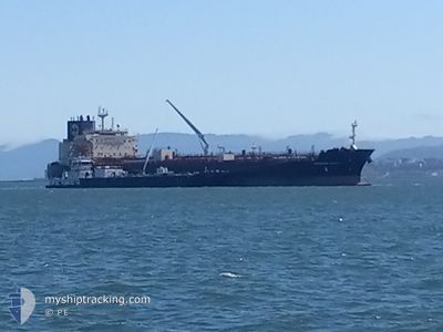
The vessel PEREGRINE PACIFIC (IMO: 9960306, MMSI: 563189700) is a Tanker It's sailing under the flag of [SG] Singapore.
In this page you can find informations about the vessels current position, last detected port calls, and current voyage information. If the vessels is not in coverage by AIS you will find the latest position.
The current position of PEREGRINE PACIFIC is detected by our AIS receivers and we are not responsible for the reliability of the data. The last position was recorded while the vessel was in Coverage by the Ais receivers of our vessel tracking app.
The current draught of PEREGRINE PACIFIC as reported by AIS is 12 meters
Weather
| Temperature | 29.7°C / 85.46°F |
|---|---|
| Wind Speed | 12 knots |
| Direction | 117° ESE |
| Pressure | 1011.3 hPa |
| Humidity | 75.9 % |
| Cloud Coverage | 95 % |
Featured Company
Last Port Calls
| Port | Arrival | Departure | Time In Port |
|---|---|---|---|
| 2024-09-02 02:37 | 2024-09-06 17:27 | 4 d | |
| 2024-08-20 23:22 | 2024-08-21 21:27 | 22 h | |
| 2024-08-03 10:52 | 2024-08-05 01:42 | 1 d | |
| 2024-07-16 09:17 | 2024-07-16 22:40 | 13 h | |
| 2024-07-13 21:43 | 2024-07-15 03:24 | 1 d |
Most Visited Ports (Last year)
| Port | Arrivals | |
|---|---|---|
| 6 | ||
| 3 | ||
| 3 | ||
| 2 | ||
| 1 | ||
| 1 |
Last Trips
| Origin | Departure | Destination | Arrival | Distance | |
|---|---|---|---|---|---|
| 2024-08-21 16:27 | 2024-09-01 21:37 | 1614.99 nm | |||
| 2024-08-04 18:42 | 2024-08-20 18:22 | 3418.92 nm | |||
| 2024-07-16 17:40 | 2024-08-03 03:52 | 3887.27 nm | |||
| 2024-07-14 22:24 | 2024-07-16 04:17 | 378.30 nm | |||
| 2024-06-25 21:22 | 2024-07-13 16:43 | 3417.35 nm |
Events
| Tid | Event | Detaljer | Position / Dest | Information |
|---|---|---|---|---|
| 2024-09-07 05:58 | Status ändrad | Default Under way using engine |
27.70258 / -89.86640
PACTB
|
Fart: 13.1 kn Kurs: 163.5° |
| 2024-09-07 05:48 | UTANFÖR täckningsområde |
27.73780 / -89.87896
Gulf of Mexico
PACTB
|
Fart: 13.1 kn Kurs: 163.5° |
|
| 2024-09-07 05:08 | Status ändrad | Under way using engine Default |
27.88482 / -89.89070
PACTB
|
Fart: 13.4 kn Kurs: 179° |
| 2024-09-07 05:07 | Status ändrad | Default Under way using engine |
27.88856 / -89.89078
PACTB
|
Fart: 13.4 kn Kurs: 179° |
| 2024-09-07 02:10 | Djupgående ändrat | 12 8.2 |
28.51232 / -89.72151
PACTB
|
Fart: 14.5 kn Kurs: 219.8° |
| 2024-09-07 02:10 | ETA ändrat | 2024/09/11 21:00 2024/09/11 19:00 |
28.51232 / -89.72151
PACTB
|
Fart: 14.5 kn Kurs: 219.8° |
| 2024-09-07 01:54 | Status ändrad | Under way using engine Default |
28.56044 / -89.67731
PACTB
|
Fart: 14.1 kn Kurs: 218° |
| 2024-09-07 01:54 | I täckningsområde |
28.55787 / -89.67965
Gulf of Mexico
PACTB
|
Fart: 14.4 kn Kurs: 219° |
|
| 2024-09-06 17:27 | AVGÅTT HAMN |
|
29.75615 / -90.02338
PACTB
|
Fart: 12.4 kn Kurs: 195° |
| 2024-09-06 16:52 | UTANFÖR täckningsområde |
29.86315 / -89.97608
Gulf of Mexico
PACTB
|
Fart: 11.3 kn Kurs: 183.5° |