
PELAGOS
Passenger
Current Trip
| Time Travelled | 1 day |
|---|---|
| Remaining Time | 12 h, 50 mins |
| Distance Travelled | 479.09 nm |
| Remaining Distance | 234.29 nm |
| AVG Speed | 16.1 Knop |
| MAX Speed | 19.3 Knop |
| AVG Wind | 10.1 knots |
| MAX Wind | 15 knots |
| MIN Temp | 15.4°C / 59.72°F |
| MAX Temp | 19.9°C / 67.82°F |
| Djupgående | 6 m |
| Position mottagen | 55 m sen |
Current Position
| Longitud | -1.02491° |
|---|---|
| Latitude | 37.23024° |
| Status | Under way using engine |
| Fart | 17.3 Knop |
| Kurs | 226.3° |
| Område | Mediterranean Sea - Western Basin |
| Station | T-AIS |
| Position mottagen | 55 m sen |
Info
Information
The current position of PELAGOS is in Mediterranean Sea - Western Basin with coordinates 37.23024° / -1.02491° as reported on 2024-05-17 19:24 by AIS to our vessel tracker app. The vessel's current speed is 17.3 Knop and is heading at the port of TANGER MED. The estimated time of arrival as calculated by MyShipTracking vessel tracking app is 2024-05-18 10:09 LT
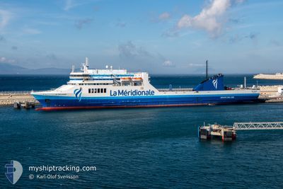
The vessel PELAGOS (MMSI: 228393700) is a Passenger It's sailing under the flag of [FR] France.
In this page you can find informations about the vessels current position, last detected port calls, and current voyage information. If the vessels is not in coverage by AIS you will find the latest position.
The current position of PELAGOS is detected by our AIS receivers and we are not responsible for the reliability of the data. The last position was recorded while the vessel was in Coverage by the Ais receivers of our vessel tracking app.
The current draught of PELAGOS as reported by AIS is 6 meters
Weather
| Temperature | 18.6°C / 65.48°F |
|---|---|
| Wind Speed | 12 knots |
| Direction | 209° SSW |
| Pressure | 1008.2 hPa |
| Humidity | 84.7 % |
| Cloud Coverage | --- |
Featured Company
Last Port Calls
| Port | Arrival | Departure | Time In Port |
|---|---|---|---|
| 2024-05-15 12:59 | 2024-05-16 19:28 | 1 d | |
| 2024-05-13 12:02 | 2024-05-13 19:46 | 7 h | |
| 2024-05-10 13:16 | 2024-05-11 14:55 | 1 d | |
| 2024-05-08 12:35 | 2024-05-08 18:54 | 6 h | |
| 2024-05-06 13:08 | 2024-05-06 23:02 | 9 h | |
| 2024-05-04 12:03 | 2024-05-04 19:29 | 7 h | |
| 2024-05-01 12:30 | 2024-05-02 19:30 | 1 d | |
| 2024-04-29 15:06 | 2024-04-29 21:33 | 6 h | |
| 2024-04-26 13:13 | 2024-04-27 23:03 | 1 d | |
| 2024-04-24 17:07 | 2024-04-24 21:50 | 4 h |
Most Visited Ports (Last year)
| Port | Arrivals | |
|---|---|---|
| 52 | ||
| 47 | ||
| 6 | ||
| 5 | ||
| 5 | ||
| 3 |
Last Trips
| Origin | Departure | Destination | Arrival | Distance | |
|---|---|---|---|---|---|
| 2024-05-13 19:46 | 2024-05-15 12:59 | 712.71 nm | |||
| 2024-05-11 14:55 | 2024-05-13 12:02 | 713.94 nm | |||
| 2024-05-08 18:54 | 2024-05-10 13:16 | 711.97 nm | |||
| 2024-05-06 23:02 | 2024-05-08 12:35 | 719.53 nm | |||
| 2024-05-04 19:29 | 2024-05-06 13:08 | 712.43 nm | |||
| 2024-05-02 19:30 | 2024-05-04 12:03 | 731.02 nm | |||
| 2024-04-29 21:33 | 2024-05-01 12:30 | 712.67 nm | |||
| 2024-04-27 23:03 | 2024-04-29 15:06 | 749.30 nm | |||
| 2024-04-24 21:50 | 2024-04-26 13:13 | 711.37 nm | |||
| 2024-04-22 23:59 | 2024-04-24 17:07 | 739.03 nm |
Events
| Tid | Event | Detaljer | Position / Dest | Information |
|---|---|---|---|---|
| 2024-05-17 19:27 | Status ändrad | Default Under way using engine |
37.21873 / -1.04029
MAPTM
|
Fart: 17.3 kn Kurs: 226.3° |
| 2024-05-17 19:24 | Status ändrad | Under way using engine Default |
37.23024 / -1.02491
MAPTM
|
Fart: 17.3 kn Kurs: 228° |
| 2024-05-17 18:46 | Status ändrad | Default Under way using engine |
37.35794 / -.85658
MAPTM
|
Fart: 17.9 kn Kurs: 227.5° |
| 2024-05-17 18:41 | Status ändrad | Under way using engine Default |
37.37465 / -.83420
MAPTM
|
Fart: 17.9 kn Kurs: 227° |
| 2024-05-17 18:30 | Status ändrad | Default Under way using engine |
37.41138 / -.78488
MAPTM
|
Fart: 17.8 kn Kurs: 227.2° |
| 2024-05-17 18:24 | Status ändrad | Under way using engine Default |
37.43424 / -.75381
MAPTM
|
Fart: 17.7 kn Kurs: 228° |
| 2024-05-17 18:06 | Status ändrad | Default Under way using engine |
37.49097 / -.67649
MAPTM
|
Fart: 17.3 kn Kurs: 227.9° |
| 2024-05-17 18:01 | Status ändrad | Under way using engine Default |
37.50901 / -.65146
MAPTM
|
Fart: 17.3 kn Kurs: 228° |
| 2024-05-17 17:58 | Status ändrad | Default Under way using engine |
37.51711 / -.64011
MAPTM
|
Fart: 17.3 kn Kurs: 228.3° |
| 2024-05-17 17:51 | Status ändrad | Under way using engine Default |
37.54159 / -.60577
MAPTM
|
Fart: 17.3 kn Kurs: 228° |