
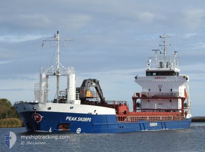
PEAK SKORPO
General Cargo
Current Trip
| Time Travelled | 1 day |
|---|---|
| Remaining Time | 12 h, 13 mins |
| Distance Travelled | 268.55 nm |
| Remaining Distance | 127.25 nm |
| AVG Speed | 9.3 Knop |
| MAX Speed | 12.7 Knop |
| AVG Wind | 15.2 knots |
| MAX Wind | 24.3 knots |
| MIN Temp | 6.5°C / 43.7°F |
| MAX Temp | 8.9°C / 48.02°F |
| Djupgående | 3.7 m |
| Position mottagen | Nu |
Current Position
| Longitud | --- |
|---|---|
| Latitude | --- |
| Status | Under way using engine |
| Fart | 10.4 Knop |
| Kurs | 157.8° |
| Område | Kattegat |
| Station | T-AIS |
| Position mottagen | Nu |
Info
Information
The current position of PEAK SKORPO is in Kattegat with coordinates 57.05488° / 10.80058° as reported on 2024-11-27 11:36 by AIS to our vessel tracker app. The vessel's current speed is 10.4 Knop and is heading at the port of KOLDING. The estimated time of arrival as calculated by MyShipTracking vessel tracking app is 2024-11-28 00:50 LT
The vessel PEAK SKORPO (IMO: 9190353, MMSI: 257114000) is a General Cargo that was built in 1999 ( 25 År gammal ). It's sailing under the flag of [NO] Norway.
In this page you can find informations about the vessels current position, last detected port calls, and current voyage information. If the vessels is not in coverage by AIS you will find the latest position.
The current position of PEAK SKORPO is detected by our AIS receivers and we are not responsible for the reliability of the data. The last position was recorded while the vessel was in Coverage by the Ais receivers of our vessel tracking app.
The current draught of PEAK SKORPO as reported by AIS is 3.7 meters
Weather
| Temperature | 7°C / 44.6°F |
|---|---|
| Wind Speed | 13 knots |
| Direction | 251° WSW |
| Pressure | 1015 hPa |
| Humidity | 86.2 % |
| Cloud Coverage | 6 % |
Featured Company
Last Port Calls
| Port | Arrival | Departure | Time In Port |
|---|---|---|---|
| 2024-11-26 01:57 | 2024-11-26 08:59 | 7 h | |
| 2024-11-24 11:18 | 2024-11-25 20:27 | 1 d | |
| 2024-11-19 10:43 | 2024-11-21 14:03 | 2 d | |
| 2024-11-15 09:54 | 2024-11-15 19:52 | 9 h | |
| 2024-11-14 12:00 | 2024-11-14 19:58 | 7 h | |
| 2024-11-13 00:44 | 2024-11-13 16:31 | 15 h | |
| 2024-11-11 21:56 | 2024-11-12 09:01 | 11 h | |
| 2024-11-08 20:47 | 2024-11-09 14:15 | 17 h | |
| 2024-11-05 08:29 | 2024-11-06 10:24 | 1 d | |
| 2024-11-03 10:51 | 2024-11-04 11:53 | 1 d |
Last Trips
| Origin | Departure | Destination | Arrival | Distance | |
|---|---|---|---|---|---|
| 2024-11-25 20:27 | 2024-11-26 01:57 | 53.07 nm | |||
| 2024-11-21 14:03 | 2024-11-24 11:18 | 640.99 nm | |||
| 2024-11-15 19:52 | 2024-11-19 10:43 | 616.82 nm | |||
| 2024-11-14 19:58 | 2024-11-15 09:54 | 134.83 nm | |||
| 2024-11-13 16:31 | 2024-11-14 12:00 | 183.54 nm | |||
| 2024-11-12 09:01 | 2024-11-13 00:44 | 173.13 nm | |||
| 2024-11-09 14:15 | 2024-11-11 21:56 | 463.60 nm | |||
| 2024-11-06 10:24 | 2024-11-08 20:47 | 537.01 nm | |||
| 2024-11-04 11:53 | 2024-11-05 08:29 | 213.74 nm | |||
| 2024-11-01 18:12 | 2024-11-03 10:51 | 216.24 nm |
Events
| Tid | Event | Detaljer | Position / Dest | Information |
|---|---|---|---|---|
| 2024-11-27 07:25 | Byter havsområde | Danish part of the Kattegat Danish part of the Skaggerak |
57.75778 / 10.77380
Kattegat
DKKOL
|
Fart: 10 kn Kurs: 184° |
| 2024-11-27 02:44 | Byter havsområde | Danish part of the Skaggerak Norwegian part of the Skaggerak |
57.86415 / 9.18784
Skaggerak
DKKOL
|
Fart: 11.1 kn Kurs: 92.9° |
| 2024-11-26 19:40 | Byter havsområde | Norwegian part of the Skaggerak Norwegian part of the North Sea |
57.94642 / 7.08908
Skaggerak
DKKOL
|
Fart: 10.2 kn Kurs: 105.5° |
| 2024-11-26 19:31 | Status ändrad | Under way using engine Default |
57.95231 / 7.04626
DKKOL
|
Fart: 10.2 kn Kurs: 110° |
| 2024-11-26 19:02 | Status ändrad | Default Under way using engine |
57.97975 / 6.89764
DKKOL
|
Fart: 10.1 kn Kurs: 104.3° |
| 2024-11-26 07:59 | AVGÅTT HAMN |
|
59.09043 / 5.89764
DKKOL
|
Fart: 4.3 kn Kurs: 262° |
| 2024-11-26 07:57 | STARTAR förflyttning |
59.08962 / 5.90115
[NO] BREIVIKEN
|
Fart: 3.6 kn Kurs: 290° |
|
| 2024-11-26 07:46 | ETA ändrat | 2024/11/28 23:00 2024/11/25 23:00 |
59.08873 / 5.90433
[NO] BREIVIKEN
|
Fart: Kurs: 262° |
| 2024-11-26 07:40 | Destination ändrad | DKKOL NOBVR |
59.08871 / 5.90429
[NO] BREIVIKEN
|
Fart: Kurs: 262° |
| 2024-11-26 07:39 | Status ändrad | Under way using engine Moored |
59.08871 / 5.90429
[NO] BREIVIKEN
|
Fart: Kurs: 262° |