
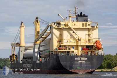
PACIFIC INTEGRITY
General Cargo
Current Trip
| Time Travelled | 1 day |
|---|---|
| Remaining Time | 1 day |
| Distance Travelled | 447.42 nm |
| Remaining Distance | 682.39 nm |
| AVG Speed | 12.4 Knop |
| MAX Speed | 16 Knop |
| AVG Wind | 17 knots |
| MAX Wind | 21.5 knots |
| MIN Temp | 25.2°C / 77.36°F |
| MAX Temp | 27.3°C / 81.14°F |
| Djupgående | 6.6 m |
| Position mottagen | 1 d sen |
Current Position
| Longitud | --- |
|---|---|
| Latitude | --- |
| Status | Under way using engine |
| Fart | 10.8 Knop |
| Kurs | 50.5° |
| Område | Singapore Strait |
| Station | T-AIS |
| Position mottagen | 1 d sen |
Info
Information
The current position of PACIFIC INTEGRITY is in Singapore Strait with coordinates 1.29880° / 104.35594° as reported on 2026-01-07 19:31 by AIS to our vessel tracker app. The vessel's current speed is 10.8 Knop and is heading at the port of BALIKPAPAN. The estimated time of arrival as calculated by MyShipTracking vessel tracking app is 2026-01-11 03:11 LT
The vessel PACIFIC INTEGRITY (IMO: 9469780, MMSI: 636021434) is a General Cargo that was built in 2011 ( 15 År gammal ). It's sailing under the flag of [LR] Liberia.
In this page you can find informations about the vessels current position, last detected port calls, and current voyage information. If the vessels is not in coverage by AIS you will find the latest position.
The current position of PACIFIC INTEGRITY is detected by our AIS receivers and we are not responsible for the reliability of the data. The last position was recorded while the vessel was in Coverage by the Ais receivers of our vessel tracking app.
The current draught of PACIFIC INTEGRITY as reported by AIS is 6.6 meters
Weather
| Temperature | 27.4°C / 81.32°F |
|---|---|
| Wind Speed | 15 knots |
| Direction | 328° NNW |
| Pressure | 1011.2 hPa |
| Humidity | 79.7 % |
| Cloud Coverage | 100 % |
Featured Company
Last Port Calls
| Port | Arrival | Departure | Time In Port |
|---|---|---|---|
| 2026-01-06 15:28 | 2026-01-07 23:25 | 1 d | |
| 2026-01-05 12:44 | 2026-01-06 11:21 | 22 h | |
| 2025-12-28 17:20 | 2025-12-31 08:00 | 2 d | |
| 2025-12-23 19:13 | 2025-12-24 16:27 | 21 h | |
| 2025-12-14 08:50 | 2025-12-14 17:53 | 9 h | |
| 2025-12-11 11:11 | 2025-12-13 07:00 | 1 d | |
| 2025-12-06 21:41 | 2025-12-08 21:36 | 1 d | |
| 2025-12-03 21:37 | 2025-12-05 09:53 | 1 d | |
| 2025-11-17 16:42 | 2025-11-19 11:32 | 1 d | |
| 2025-11-05 12:11 | 2025-11-10 23:47 | 5 d |
Last Trips
| Origin | Departure | Destination | Arrival | Distance | |
|---|---|---|---|---|---|
| 2026-01-06 11:21 | 2026-01-06 15:28 | 38.92 nm | |||
| 2025-12-31 08:00 | 2026-01-05 12:44 | 260.64 nm | |||
| 2025-12-24 16:27 | 2025-12-28 17:20 | 1188.94 nm | |||
| 2025-12-14 17:53 | 2025-12-23 19:13 | 2946.60 nm | |||
| 2025-12-13 07:00 | 2025-12-14 08:50 | 331.40 nm | |||
| 2025-12-08 21:36 | 2025-12-11 11:11 | 663.31 nm | |||
| 2025-12-05 09:53 | 2025-12-06 21:41 | 108.19 nm | |||
| 2025-11-19 11:32 | 2025-12-03 21:37 | 3729.83 nm | |||
| 2025-11-10 23:47 | 2025-11-17 16:42 | 1075.49 nm | |||
| 2025-10-23 19:28 | 2025-11-05 12:11 | 4052.62 nm |
Events
| Tid | Event | Detaljer | Position / Dest | Information |
|---|---|---|---|---|
| 2026-01-07 19:36 | Status ändrad | Default Under way using engine |
1.30926 / 104.36840
IDBPN
|
Fart: 10.8 kn Kurs: 50.5° |
| 2026-01-07 19:31 | UTANFÖR täckningsområde |
1.29881 / 104.35594
Singapore Strait
IDBPN
|
Fart: 10.8 kn Kurs: 50.5° |
|
| 2026-01-07 19:24 | Byter havsområde | Malaysian part of the Singapore Strait Indonesian part of the Singapore Strait |
1.28631 / 104.34077
Singapore Strait
IDBPN
|
Fart: 10.8 kn Kurs: 50.2° |
| 2026-01-07 19:19 | Byter havsområde | Indonesian part of the Singapore Strait Malaysian part of the Singapore Strait |
1.27683 / 104.32914
Singapore Strait
IDBPN
|
Fart: 10.7 kn Kurs: 55.6° |
| 2026-01-07 19:19 | Status ändrad | Under way using engine Default |
1.27601 / 104.32790
IDBPN
|
Fart: 10.9 kn Kurs: 74° |
| 2026-01-07 19:01 | Status ändrad | Default Under way using engine |
1.26563 / 104.27248
IDBPN
|
Fart: 11.3 kn Kurs: 83.7° |
| 2026-01-07 18:46 | Byter havsområde | Malaysian part of the Singapore Strait Indonesian part of the Singapore Strait |
1.25909 / 104.22483
Singapore Strait
IDBPN
|
Fart: 11.7 kn Kurs: 81.9° |
| 2026-01-07 16:45 | Byter havsområde | Indonesian part of the Singapore Strait Singaporean part of the Singapore Strait |
1.18548 / 103.84120
Singapore Strait
IDBPN
|
Fart: 8.8 kn Kurs: 102° |
| 2026-01-07 15:28 | STARTAR förflyttning | 3.02 nm, North East of JURONG ISLAND |
1.29538 / 103.72499
IDBPN
|
Fart: 3.1 kn Kurs: 134° |
| 2026-01-07 15:26 | Djupgående ändrat | 6.6 6.7 |
1.29674 / 103.72397
IDBPN
|
Fart: 1.8 kn Kurs: 135° |