

PACANDA
Container Ship

Current Trip
INCCU E LT V
| Time Travelled | 12 days |
|---|---|
| Remaining Time | --- |
| Distance Travelled | 2439.29 nm |
| Remaining Distance | --- |
| AVG Speed | 12.9 Knop |
| MAX Speed | 17.5 Knop |
| AVG Wind | 8.5 knots |
| MAX Wind | 19.8 knots |
| MIN Temp | 24°C / 75.2°F |
| MAX Temp | 39.2°C / 102.56°F |
| Djupgående | 7.2 m |
| Position mottagen | 12 d sen |
Current Position
| Longitud | --- |
|---|---|
| Latitude | --- |
| Status | Under way using engine |
| Fart | 15.5 Knop |
| Kurs | 315° |
| Område | Malacca Strait |
| Station | T-AIS |
| Position mottagen | 12 d sen |
Information
The current position of PACANDA is in Malacca Strait with coordinates 1.25147° / 103.40298° as reported on 2025-03-09 09:54 by AIS to our vessel tracker app. The vessel's current speed is 15.5 Knop
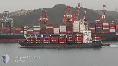
The vessel PACANDA (IMO: 9343675, MMSI: 305060000) is a Container Ship that was built in 2007 ( 18 År gammal ). It's sailing under the flag of [AG] Antigua Barbuda.
In this page you can find informations about the vessels current position, last detected port calls, and current voyage information. If the vessels is not in coverage by AIS you will find the latest position.
The current position of PACANDA is detected by our AIS receivers and we are not responsible for the reliability of the data. The last position was recorded while the vessel was in Coverage by the Ais receivers of our vessel tracking app.
The current draught of PACANDA as reported by AIS is 7.2 meters
Weather
| Temperature | 26.2°C / 79.16°F |
|---|---|
| Wind Speed | 4 knots |
| Direction | 282° WNW |
| Pressure | 1016.5 hPa |
| Humidity | 72.6 % |
| Cloud Coverage | 74 % |


Featured Company
Last Port Calls
| Port | Arrival | Departure | Time In Port |
|---|---|---|---|
| 2025-03-08 22:05 | 2025-03-09 15:07 | 17 h | |
| 2025-02-19 12:49 | 2025-02-20 08:05 | 19 h | |
| 2025-02-11 15:21 | 2025-02-12 23:17 | 1 d | |
| 2025-02-09 23:17 | 2025-02-10 19:34 | 20 h | |
| 2025-02-03 14:49 | 2025-02-04 15:29 | 1 d | |
| 2025-01-20 21:58 | 2025-01-21 20:56 | 22 h | |
| 2025-01-09 07:24 | 2025-01-10 08:37 | 1 d | |
| 2025-01-03 01:49 | 2025-01-04 00:21 | 22 h |
Last Trips
| Origin | Departure | Destination | Arrival | Distance | |
|---|---|---|---|---|---|
| 2025-02-20 08:05 | 2025-03-08 22:05 | 3480.51 nm | |||
| 2025-02-12 23:17 | 2025-02-19 12:49 | 219.29 nm | |||
| 2025-02-10 19:34 | 2025-02-11 15:21 | 193.19 nm | |||
| 2025-02-04 15:29 | 2025-02-09 23:17 | 1583.98 nm | |||
| 2025-01-21 20:56 | 2025-02-03 14:49 | 2144.13 nm | |||
| 2025-01-10 08:37 | 2025-01-20 21:58 | 1946.45 nm | |||
| 2025-01-04 00:21 | 2025-01-09 07:24 | 1580.01 nm | |||
| 2024-12-31 00:33 | 2025-01-03 01:49 | 871.41 nm |
Events
| Tid | Event | Detaljer | Position / Dest | Information |
|---|---|---|---|---|
| 2025-03-17 03:56 | STARTAR förflyttning |
22.56290 / 88.25238
INCCU E LT V
|
Fart: 11.8 kn Kurs: 285° |
|
| 2025-03-14 09:40 | STOPPAR förflyttning |
22.54693 / 88.29865
INCCU E LT V
|
Fart: 0.1 kn Kurs: 317° |
|
| 2025-03-13 22:25 | STARTAR förflyttning |
20.94123 / 88.22072
INCCU E LT V
|
Fart: 3.5 kn Kurs: 291° |
|
| 2025-03-13 12:34 | STOPPAR förflyttning |
20.94517 / 88.22102
INCCU E LT V
|
Fart: 0.2 kn Kurs: 175° |