

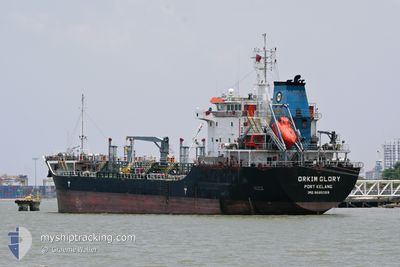
ORKIM GLORY
Oil Products Tanker

Current Trip
PEBGC SIGN
| Time Travelled | 15 days |
|---|---|
| Remaining Time | --- |
| Distance Travelled | 125.75 nm |
| Remaining Distance | --- |
| AVG Speed | 9.5 Knop |
| MAX Speed | 10.6 Knop |
| AVG Wind | 6.6 knots |
| MAX Wind | 21 knots |
| MIN Temp | 24.5°C / 76.1°F |
| MAX Temp | 28.5°C / 83.3°F |
| Djupgående | 5.2 m |
| Position mottagen | 2 d sen |
Current Position
| Longitud | --- |
|---|---|
| Latitude | --- |
| Status | At anchor |
| Fart | |
| Kurs | 117° |
| Område | South China Sea |
| Station | T-AIS |
| Position mottagen | 2 d sen |
Information
The current position of ORKIM GLORY is in South China Sea with coordinates 5.20460° / 115.25964° as reported on 2025-03-27 07:17 by AIS to our vessel tracker app. The vessel's current speed is 0 Knop
The vessel ORKIM GLORY (IMO: 9685059, MMSI: 533130976) is a Oil Products Tanker that was built in 2013 ( 12 År gammal ). It's sailing under the flag of [MY] Malaysia.
In this page you can find informations about the vessels current position, last detected port calls, and current voyage information. If the vessels is not in coverage by AIS you will find the latest position.
The current position of ORKIM GLORY is detected by our AIS receivers and we are not responsible for the reliability of the data. The last position was recorded while the vessel was in Coverage by the Ais receivers of our vessel tracking app.
The current draught of ORKIM GLORY as reported by AIS is 5.2 meters
Weather
| Temperature | 27.9°C / 82.22°F |
|---|---|
| Wind Speed | 5 knots |
| Direction | 53° NE |
| Pressure | 1009.8 hPa |
| Humidity | 79.9 % |
| Cloud Coverage | 100 % |


Featured Company
Last Port Calls
| Port | Arrival | Departure | Time In Port |
|---|---|---|---|
| 2025-03-13 10:24 | 2025-03-14 08:28 | 22 h | |
| 2025-03-02 12:45 | 2025-03-03 17:42 | 1 d | |
| 2025-02-22 17:24 | 2025-02-23 08:33 | 15 h | |
| 2025-02-12 02:32 | 2025-02-13 02:38 | 1 d | |
| 2025-02-09 10:49 | 2025-02-10 11:09 | 1 d | |
| 2025-02-07 06:01 | 2025-02-08 01:58 | 19 h | |
| 2025-01-25 04:44 | 2025-01-26 04:50 | 1 d | |
| 2025-01-21 08:37 | 2025-01-22 23:45 | 1 d | |
| 2025-01-18 18:48 | 2025-01-19 16:51 | 22 h | |
| 2025-01-05 18:43 | 2025-01-07 03:21 | 1 d |
Most Visited Ports (Last year)
| Port | Arrivals | |
|---|---|---|
| 20 | ||
| 14 | ||
| 8 | ||
| 6 | ||
| 6 | ||
| 5 |
Last Trips
| Origin | Departure | Destination | Arrival | Distance | |
|---|---|---|---|---|---|
| 2025-03-03 17:42 | 2025-03-13 10:24 | 947.54 nm | |||
| 2025-02-23 08:33 | 2025-03-02 12:45 | 786.37 nm | |||
| 2025-02-13 02:38 | 2025-02-22 17:24 | 945.24 nm | |||
| 2025-02-10 11:09 | 2025-02-12 02:32 | 206.35 nm | |||
| 2025-02-08 01:58 | 2025-02-09 10:49 | 193.52 nm | |||
| 2025-01-26 04:50 | 2025-02-07 06:01 | 1667.62 nm | |||
| 2025-01-22 23:45 | 2025-01-25 04:44 | 399.43 nm | |||
| 2025-01-19 16:51 | 2025-01-21 08:37 | 394.43 nm | |||
| 2025-01-07 03:21 | 2025-01-18 18:48 | 1662.05 nm | |||
| 2024-12-27 23:37 | 2025-01-05 18:43 | 182.47 nm |
Events
| Tid | Event | Detaljer | Position / Dest | Information |
|---|---|---|---|---|
| 2025-03-27 19:54 | STARTAR förflyttning | 3.99 nm, South of LABUAN |
5.20412 / 115.26138
PEBGC SIGN
|
Fart: 4.6 kn Kurs: 199° |
| 2025-03-27 17:34 | STOPPAR förflyttning | 3.92 nm, South of LABUAN |
5.20475 / 115.25925
PEBGC SIGN
|
Fart: 0.1 kn Kurs: 62° |
| 2025-03-27 17:10 | STARTAR förflyttning | 4.15 nm, South of LABUAN |
5.20152 / 115.26226
PEBGC SIGN
|
Fart: 5.9 kn Kurs: 156° |
| 2025-03-27 07:23 | Status ändrad | Default At anchor |
5.20462 / 115.25977
PEBGC SIGN
|
Fart: Kurs: 117° |
| 2025-03-27 07:17 | UTANFÖR täckningsområde |
5.20460 / 115.25964
South China Sea
|
Fart: Kurs: 333.8° |
|
| 2025-03-27 07:02 | Status ändrad | At anchor Default |
5.20467 / 115.25976
PEBGC SIGN
|
Fart: Kurs: 127° |
| 2025-03-27 07:02 | I täckningsområde |
5.20467 / 115.25976
South China Sea
|
Fart: Kurs: 333.8° |
|
| 2025-03-27 03:41 | Status ändrad | Default At anchor |
5.20523 / 115.26019
PEBGC SIGN
|
Fart: Kurs: 187° |
| 2025-03-27 03:35 | Status ändrad | At anchor Default |
5.20519 / 115.26024
PEBGC SIGN
|
Fart: Kurs: 185° |
| 2025-03-27 03:35 | UTANFÖR täckningsområde |
5.20519 / 115.26024
South China Sea
|
Fart: Kurs: 333.8° |