

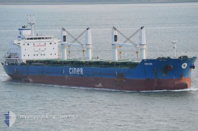
ORHAN
Bulk Carrier

Current Trip
| Time Travelled | 2 days |
|---|---|
| Remaining Time | --- |
| Distance Travelled | 735.36 nm |
| Remaining Distance | --- |
| AVG Speed | 10.1 Knop |
| MAX Speed | 11.3 Knop |
| AVG Wind | 12 knots |
| MAX Wind | 22.3 knots |
| MIN Temp | -4.7°C / 23.54°F |
| MAX Temp | 1.4°C / 34.52°F |
| Djupgående | 10.3 m |
| Position mottagen | Nu |
Current Position
| Longitud | --- |
|---|---|
| Latitude | --- |
| Status | Under way using engine |
| Fart | 9.7 Knop |
| Kurs | 342.2° |
| Område | Kattegat |
| Station | T-AIS |
| Position mottagen | Nu |
Information
The current position of ORHAN is in Kattegat with coordinates 56.76215° / 11.90192° as reported on 2025-02-18 13:05 by AIS to our vessel tracker app. The vessel's current speed is 9.7 Knop and is heading at the port of NEMRUT. The estimated time of arrival as calculated by MyShipTracking vessel tracking app is 2025-03-04 10:00 LT
The vessel ORHAN (IMO: 9625451, MMSI: 229215000) is a Bulk Carrier that was built in 2013 ( 12 År gammal ). It's sailing under the flag of [MT] Malta.
In this page you can find informations about the vessels current position, last detected port calls, and current voyage information. If the vessels is not in coverage by AIS you will find the latest position.
The current position of ORHAN is detected by our AIS receivers and we are not responsible for the reliability of the data. The last position was recorded while the vessel was in Coverage by the Ais receivers of our vessel tracking app.
The current draught of ORHAN as reported by AIS is 10.3 meters
Weather
| Temperature | 1.4°C / 34.52°F |
|---|---|
| Wind Speed | 11 knots |
| Direction | 298° WNW |
| Pressure | 1029 hPa |
| Humidity | 80.1 % |
| Cloud Coverage | 5 % |


Featured Company
Most Visited Ports (Last year)
| Port | Arrivals | |
|---|---|---|
| 3 | ||
| 1 | ||
| 1 | ||
| 1 | ||
| 1 | ||
| 1 |
Last Trips
Events
| Tid | Event | Detaljer | Position / Dest | Information |
|---|---|---|---|---|
| 2025-02-18 04:24 | ETA ändrat | 2025/03/04 10:00 2025/03/04 10:05 |
55.46587 / 10.92754
TR NEM
|
Fart: 10.3 kn Kurs: 327.5° |
| 2025-02-18 00:19 | ETA ändrat | 2025/03/04 10:05 2025/03/04 10:00 |
54.82731 / 10.83558
TR NEM
|
Fart: 11 kn Kurs: 2.5° |
| 2025-02-17 23:46 | Byter havsområde | Danish part of the Kattegat Danish part of the Baltic Sea |
54.73554 / 10.78135
Kattegat
TR NEM
|
Fart: 9.7 kn Kurs: 17.7° |
| 2025-02-17 22:46 | Upptäckt i hav | Danish part of the Baltic Sea |
54.63807 / 10.90037
Baltic Sea
TR NEM
|
Fart: 9 kn Kurs: 299.6° |
| 2025-02-17 21:10 | Byter havsområde | German part of the Baltic Sea Danish part of the Baltic Sea |
54.55356 / 11.34897
Baltic Sea
TR NEM
|
Fart: 10.6 kn Kurs: 295.3° |
| 2025-02-17 18:19 | Byter havsområde | Danish part of the Baltic Sea German part of the Baltic Sea |
54.44206 / 12.14441
Baltic Sea
TR NEM
|
Fart: 9.9 kn Kurs: 264.6° |
| 2025-02-17 17:58 | Byter havsområde | German part of the Baltic Sea Danish part of the Baltic Sea |
54.48286 / 12.20377
Baltic Sea
TR NEM
|
Fart: 10.9 kn Kurs: 195.3° |
| 2025-02-17 16:49 | Byter havsområde | Danish part of the Baltic Sea German part of the Baltic Sea |
54.64449 / 12.39010
Baltic Sea
TR NEM
|
Fart: 10.6 kn Kurs: 237.6° |
| 2025-02-17 16:18 | Byter havsområde | German part of the Baltic Sea Danish part of the Baltic Sea |
54.70381 / 12.50896
Baltic Sea
TR NEM
|
Fart: 10.4 kn Kurs: 227.7° |
| 2025-02-17 14:52 | Upptäckt i hav | Danish part of the Baltic Sea |
54.81358 / 12.87916
Baltic Sea
TR NEM
|
Fart: 10.1 kn Kurs: 244.1° |