
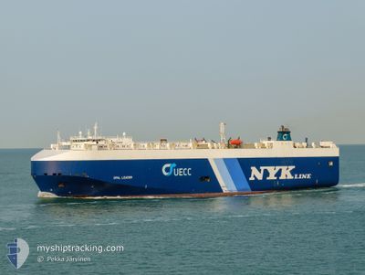
OPAL LEADER
Vehicles Carrier
Current Trip
| Time Travelled | 4 days |
|---|---|
| Remaining Time | --- |
| Distance Travelled | 1319.84 nm |
| Remaining Distance | 2440.34 nm |
| AVG Speed | 13.5 Knop |
| MAX Speed | 17.3 Knop |
| AVG Wind | 13.4 knots |
| MAX Wind | 18.9 knots |
| MIN Temp | 24.8°C / 76.64°F |
| MAX Temp | 28.1°C / 82.58°F |
| Djupgående | 8.3 m |
| Position mottagen | 3 d sen |
Current Position
| Longitud | -74.89172° |
|---|---|
| Latitude | 11.45726° |
| Status | Under way using engine |
| Fart | 14.3 Knop |
| Kurs | 68.3° |
| Område | Caribbean Sea |
| Station | T-AIS |
| Position mottagen | 3 d sen |
Info
Information
The current position of OPAL LEADER is in Caribbean Sea with coordinates 11.45726° / -74.89172° as reported on 2024-04-27 01:49 by AIS to our vessel tracker app. The vessel's current speed is 14.3 Knop and is heading at the port of VERACRUZ.
The vessel OPAL LEADER (IMO: 9318498, MMSI: 309285000) is a Vehicles Carrier that was built in 2007 ( 17 År gammal ). It's sailing under the flag of [BS] Bahamas.
In this page you can find informations about the vessels current position, last detected port calls, and current voyage information. If the vessels is not in coverage by AIS you will find the latest position.
The current position of OPAL LEADER is detected by our AIS receivers and we are not responsible for the reliability of the data. The last position was recorded while the vessel was in Coverage by the Ais receivers of our vessel tracking app.
The current draught of OPAL LEADER as reported by AIS is 8.3 meters
Weather
| Temperature | 27.8°C / 82.04°F |
|---|---|
| Wind Speed | 12 knots |
| Direction | 68° ENE |
| Pressure | 1011.9 hPa |
| Humidity | 68.7 % |
| Cloud Coverage | 35 % |
Featured Company
Last Port Calls
| Port | Arrival | Departure | Time In Port |
|---|---|---|---|
| 2024-04-25 11:38 | 2024-04-26 02:18 | 14 h | |
| 2024-04-18 17:28 | 2024-04-20 16:19 | 1 d | |
| 2024-04-15 09:33 | 2024-04-16 06:50 | 21 h | |
| 2024-04-10 10:47 | 2024-04-10 20:59 | 10 h | |
| 2024-03-26 14:38 | 2024-03-27 21:21 | 1 d | |
| 2024-03-25 15:52 | 2024-03-25 21:53 | 6 h | |
| 2024-03-19 16:45 | 2024-03-21 18:08 | 2 d | |
| 2024-03-11 09:07 | 2024-03-12 02:31 | 17 h | |
| 2024-02-25 23:03 | 2024-02-26 10:42 | 11 h | |
| 2024-02-24 12:36 | 2024-02-25 06:48 | 18 h |
Most Visited Ports (Last year)
| Port | Arrivals | |
|---|---|---|
| 7 | ||
| 7 | ||
| 6 | ||
| 6 | ||
| 6 | ||
| 6 |
Last Trips
| Origin | Departure | Destination | Arrival | Distance | |
|---|---|---|---|---|---|
| 2024-04-20 11:19 | 2024-04-25 06:38 | 1476.66 nm | |||
| 2024-04-16 01:50 | 2024-04-18 12:28 | 618.80 nm | |||
| 2024-04-10 15:59 | 2024-04-15 04:33 | 1521.42 nm | |||
| 2024-03-27 18:21 | 2024-04-10 05:47 | 4520.92 nm | |||
| 2024-03-25 18:53 | 2024-03-26 11:38 | 180.53 nm | |||
| 2024-03-21 15:08 | 2024-03-25 12:52 | 991.47 nm | |||
| 2024-03-11 23:31 | 2024-03-19 13:45 | 1479.60 nm | |||
| 2024-02-26 04:42 | 2024-03-11 06:07 | 4180.19 nm | |||
| 2024-02-25 01:48 | 2024-02-25 17:03 | 195.40 nm | |||
| 2024-02-19 21:44 | 2024-02-24 07:36 | 1448.95 nm |
Events
| Tid | Event | Detaljer | Position / Dest | Information |
|---|---|---|---|---|
| 2024-04-27 01:51 | Status ändrad | Default Under way using engine |
11.46088 / -74.88236
MX VER
|
Fart: 14.3 kn Kurs: 68.3° |
| 2024-04-27 01:49 | UTANFÖR täckningsområde |
11.45726 / -74.89172
Caribbean Sea
|
Fart: 14.3 kn Kurs: 68.3° |
|
| 2024-04-27 01:36 | Status ändrad | Under way using engine Default |
11.43807 / -74.94009
MX VER
|
Fart: 14.4 kn Kurs: 67° |
| 2024-04-27 01:22 | Status ändrad | Default Under way using engine |
11.42280 / -74.99471
MX VER
|
Fart: 14.8 kn Kurs: 83.7° |
| 2024-04-27 00:55 | Status ändrad | Under way using engine Default |
11.40780 / -75.10614
MX VER
|
Fart: 14.9 kn Kurs: 82° |
| 2024-04-27 00:53 | Status ändrad | Default Under way using engine |
11.40662 / -75.11451
MX VER
|
Fart: 15 kn Kurs: 82.2° |
| 2024-04-27 00:47 | Status ändrad | Under way using engine Default |
11.40271 / -75.14171
MX VER
|
Fart: 15 kn Kurs: 82° |
| 2024-04-27 00:35 | Status ändrad | Default Under way using engine |
11.39560 / -75.19113
MX VER
|
Fart: 15.3 kn Kurs: 81.7° |
| 2024-04-27 00:32 | Byter havsområde | Colombian part of the Caribbean Sea Mexican part of the Gulf of Mexico |
11.39349 / -75.20518
Caribbean Sea
|
Fart: 15.4 kn Kurs: 80.8° |
| 2024-04-27 00:30 | Status ändrad | Under way using engine Default |
11.39256 / -75.21081
MX VER
|
Fart: 15.2 kn Kurs: 65° |