
FRANZISKA
General Cargo
Current Trip
| Time Travelled | 2 days |
|---|---|
| Remaining Time | --- |
| Distance Travelled | 504.01 nm |
| Remaining Distance | --- |
| AVG Speed | 12.1 Knop |
| MAX Speed | 15 Knop |
| AVG Wind | 12.1 knots |
| MAX Wind | 20.2 knots |
| MIN Temp | 24.3°C / 75.74°F |
| MAX Temp | 27.8°C / 82.04°F |
| Djupgående | 5.8 m |
| Position mottagen | 2 m sen |
Current Position
| Longitud | -97.76303° |
|---|---|
| Latitude | 22.45377° |
| Status | At anchor |
| Fart | |
| Kurs | 79° |
| Område | Gulf of Mexico |
| Station | T-AIS |
| Position mottagen | 2 m sen |
Info
Information
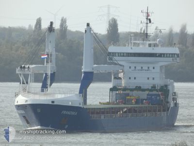
The current position of FRANZISKA is in Gulf of Mexico with coordinates 22.45377° / -97.76303° as reported on 2024-05-13 06:01 by AIS to our vessel tracker app. The vessel's current speed is 0 Knop
The vessel FRANZISKA (IMO: 9535618, MMSI: 305700000) is a General Cargo that was built in 2011 ( 13 År gammal ). It's sailing under the flag of [AG] Antigua Barbuda.
In this page you can find informations about the vessels current position, last detected port calls, and current voyage information. If the vessels is not in coverage by AIS you will find the latest position.
The current position of FRANZISKA is detected by our AIS receivers and we are not responsible for the reliability of the data. The last position was recorded while the vessel was in Coverage by the Ais receivers of our vessel tracking app.
The current draught of FRANZISKA as reported by AIS is 5.8 meters
Weather
| Temperature | 26.9°C / 80.42°F |
|---|---|
| Wind Speed | 7 knots |
| Direction | 64° ENE |
| Pressure | 1004.9 hPa |
| Humidity | 93.2 % |
| Cloud Coverage | 7 % |
Featured Company
Last Port Calls
| Port | Arrival | Departure | Time In Port |
|---|---|---|---|
| 2024-05-06 15:51 | 2024-05-11 00:01 | 4 d | |
| 2024-04-12 19:06 | 2024-04-16 23:04 | 4 d | |
| 2024-04-12 18:13 | 2024-04-12 18:43 | 29 m | |
| 2024-04-11 13:05 | 2024-04-11 20:56 | 7 h | |
| 2024-04-06 12:01 | 2024-04-10 14:52 | 4 d | |
| 2024-03-21 22:12 | 2024-03-24 04:30 | 2 d | |
| 2024-03-14 13:03 | 2024-03-15 21:24 | 1 d | |
| 2024-03-09 15:20 | 2024-03-11 22:29 | 2 d | |
| 2024-03-08 09:46 | |||
| 2024-03-04 03:10 |
Last Trips
| Origin | Departure | Destination | Arrival | Distance | |
|---|---|---|---|---|---|
| 2024-04-16 23:04 | 2024-05-06 15:51 | 5224.36 nm | |||
| 2024-04-12 18:43 | 2024-04-12 19:06 | 1.35 nm | |||
| 2024-04-11 20:56 | 2024-04-12 18:13 | 272.50 nm | |||
| 2024-04-10 14:52 | 2024-04-11 13:05 | 222.39 nm | |||
| 2024-03-24 04:30 | 2024-04-06 12:01 | 3364.07 nm | |||
| 2024-03-15 21:24 | 2024-03-21 22:12 | 1239.57 nm | |||
| 2024-03-11 22:29 | 2024-03-14 13:03 | 690.90 nm | |||
| 2024-03-08 09:46 | 2024-03-09 15:20 | 371.88 nm |
Events
| Tid | Event | Detaljer | Position / Dest | Information |
|---|---|---|---|---|
| 2024-05-12 22:25 | Status ändrad | At anchor Under way using engine |
22.45431 / -97.76271
MXATM
|
Fart: 0.6 kn Kurs: 84° |
| 2024-05-12 22:19 | STOPPAR förflyttning | 6.97 nm, East of ALTAMIRA |
22.45425 / -97.76134
MXATM
|
Fart: 0.3 kn Kurs: 97° |
| 2024-05-12 20:48 | ETA ändrat | 2024/05/12 22:00 2024/05/12 20:00 |
22.68431 / -97.57334
MXATM
|
Fart: 11.8 kn Kurs: 217.3° |
| 2024-05-12 20:41 | Status ändrad | Under way using engine Default |
22.70085 / -97.55863
MXATM
|
Fart: 11.7 kn Kurs: 221° |
| 2024-05-12 20:37 | I täckningsområde |
22.69360 / -97.56518
Gulf of Mexico
MXATM
|
Fart: 11.8 kn Kurs: 219.9° |
|
| 2024-05-12 09:34 | Status ändrad | Default Under way using engine |
24.48952 / -96.00397
MXATM
|
Fart: 12.3 kn Kurs: 216.9° |
| 2024-05-12 09:34 | UTANFÖR täckningsområde |
24.49038 / -96.00324
Gulf of Mexico
MXATM
|
Fart: 12.3 kn Kurs: 216.9° |
|
| 2024-05-12 09:34 | Byter havsområde | Mexican part of the Gulf of Mexico United States part of the Gulf of Mexico |
24.49038 / -96.00324
Gulf of Mexico
MXATM
|
Fart: 12.3 kn Kurs: 216.9° |
| 2024-05-12 09:34 | Status ändrad | Under way using engine Default |
24.49083 / -96.00284
MXATM
|
Fart: 12.3 kn Kurs: 220° |
| 2024-05-12 09:27 | I täckningsområde |
24.49038 / -96.00324
Gulf of Mexico
MXATM
|
Fart: 12.3 kn Kurs: 216.9° |