

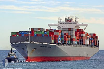
ONE HELSINKI
Container Ship

Current Trip
| Time Travelled | 1 day |
|---|---|
| Remaining Time | 6 days |
| Distance Travelled | 277.12 nm |
| Remaining Distance | 2400.65 nm |
| AVG Speed | 12.6 Knop |
| MAX Speed | 16.1 Knop |
| AVG Wind | 4.6 knots |
| MAX Wind | 8 knots |
| MIN Temp | 26.8°C / 80.24°F |
| MAX Temp | 28.4°C / 83.12°F |
| Djupgående | 13.7 m |
| Position mottagen | 1 d sen |
Current Position
| Longitud | --- |
|---|---|
| Latitude | --- |
| Status | Under way using engine |
| Fart | 15 Knop |
| Kurs | 84° |
| Område | Singapore Strait |
| Station | T-AIS |
| Position mottagen | 1 d sen |
Information
The current position of ONE HELSINKI is in Singapore Strait with coordinates 1.26298° / 104.17085° as reported on 2025-03-29 09:05 by AIS to our vessel tracker app. The vessel's current speed is 15 Knop and is heading at the port of KOBE. The estimated time of arrival as calculated by MyShipTracking vessel tracking app is 2025-04-05 21:25 LT
The vessel ONE HELSINKI (IMO: 9588081, MMSI: 373119000) is a Container Ship that was built in 2012 ( 13 År gammal ). It's sailing under the flag of [PA] Panama.
In this page you can find informations about the vessels current position, last detected port calls, and current voyage information. If the vessels is not in coverage by AIS you will find the latest position.
The current position of ONE HELSINKI is detected by our AIS receivers and we are not responsible for the reliability of the data. The last position was recorded while the vessel was in Coverage by the Ais receivers of our vessel tracking app.
The current draught of ONE HELSINKI as reported by AIS is 13.7 meters
Weather
| Temperature | 27.5°C / 81.5°F |
|---|---|
| Wind Speed | 9 knots |
| Direction | 52° NE |
| Pressure | 1007.9 hPa |
| Humidity | 79.9 % |
| Cloud Coverage | 100 % |


Featured Company
Last Port Calls
| Port | Arrival | Departure | Time In Port |
|---|---|---|---|
| 2025-03-27 21:05 | 2025-03-29 06:55 | 1 d | |
| 2025-02-23 15:53 | 2025-02-25 21:21 | 2 d | |
| 2025-02-18 16:47 | 2025-02-20 14:18 | 1 d | |
| 2025-02-11 17:42 | 2025-02-14 19:34 | 3 d |
Last Trips
| Origin | Departure | Destination | Arrival | Distance | |
|---|---|---|---|---|---|
| 2025-02-25 22:21 | 2025-03-28 05:05 | 11664.70 nm | |||
| 2025-02-20 15:18 | 2025-02-23 16:53 | 522.97 nm | |||
| 2025-02-14 20:34 | 2025-02-18 17:47 | 363.66 nm | |||
| 2024-12-28 04:02 | 2025-02-11 18:42 | 10465.62 nm |
Events
| Tid | Event | Detaljer | Position / Dest | Information |
|---|---|---|---|---|
| 2025-03-29 09:10 | Status ändrad | Default Under way using engine |
1.26582 / 104.19386
JP UKB
|
Fart: 15 kn Kurs: 84° |
| 2025-03-29 09:05 | Upptäckt i hav | Malaysian part of the Singapore Strait |
1.26298 / 104.17085
Singapore Strait
JP UKB
|
Fart: 15 kn Kurs: 84° |
| 2025-03-29 09:05 | UTANFÖR täckningsområde |
1.26298 / 104.17085
Singapore Strait
JP UKB
|
Fart: 15 kn Kurs: 84° |
|
| 2025-03-29 09:04 | Status ändrad | Under way using engine Default |
1.26270 / 104.16797
JP UKB
|
Fart: 14.9 kn Kurs: 82° |
| 2025-03-29 08:58 | Status ändrad | Default Under way using engine |
1.26003 / 104.14323
JP UKB
|
Fart: 14.9 kn Kurs: 83° |
| 2025-03-29 07:37 | Byter havsområde | Indonesian part of the Singapore Strait Singaporean part of the Singapore Strait |
1.18285 / 103.83368
Singapore Strait
JP UKB
|
Fart: 10.6 kn Kurs: 116° |
| 2025-03-29 06:55 | AVGÅTT HAMN |
|
1.26322 / 103.76808
JP UKB
|
Fart: 5.1 kn Kurs: 170° |
| 2025-03-29 06:49 | STARTAR förflyttning |
1.26965 / 103.76453
[SG] SINGAPORE
|
Fart: 3.1 kn Kurs: 152° |
|
| 2025-03-29 06:30 | Status ändrad | Under way using engine Moored |
1.27287 / 103.76237
[SG] SINGAPORE
|
Fart: Kurs: 121° |
| 2025-03-29 05:41 | Djupgående ändrat | 13.7 13.6 |
1.27295 / 103.76250
[SG] SINGAPORE
|
Fart: Kurs: 121° |