

ONE ENERGY
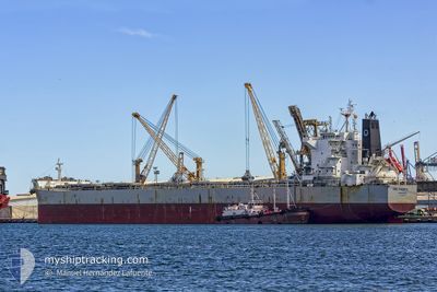
Bulk Carrier
Current Trip
| Trip Time | 1 day |
|---|---|
| Trip Distance | 12.66 nm |
| AVG Speed | 5.5 Knop |
| MAX Speed | 8.5 Knop |
| Djupgående | 14.6 m |
| AVG Wind | 15.8 knots |
| MAX Wind | 18 knots |
| MIN Temp | 23.9°C / 75.02°F |
| MAX Temp | 27.7°C / 81.86°F |
| Position mottagen | 12 d sen |
Current Position
| Longitud | --- |
|---|---|
| Latitude | --- |
| Status | Under way using engine |
| Fart | 12.1 Knop |
| Kurs | 82.6° |
| Område | Singapore Strait |
| Station | T-AIS |
| Position mottagen | 12 d sen |
Information
The current position of ONE ENERGY is in Singapore Strait with coordinates 1.26450° / 104.15957° as reported on 2025-03-15 07:15 by AIS to our vessel tracker app. The vessel's current speed is 12.1 Knop and is currently inside the port of MAILIAO.
The vessel ONE ENERGY (IMO: 9592123, MMSI: 209191000) is a Bulk Carrier that was built in 2011 ( 14 År gammal ). It's sailing under the flag of [CY] Cyprus.
In this page you can find informations about the vessels current position, last detected port calls, and current voyage information. If the vessels is not in coverage by AIS you will find the latest position.
The current position of ONE ENERGY is detected by our AIS receivers and we are not responsible for the reliability of the data. The last position was recorded while the vessel was in Coverage by the Ais receivers of our vessel tracking app.
The current draught of ONE ENERGY as reported by AIS is 14.6 meters
Weather
| Temperature | 23.9°C / 75.02°F |
|---|---|
| Wind Speed | 5 knots |
| Direction | 212° SSW |
| Pressure | 1009 hPa |
| Humidity | 83.1 % |
| Cloud Coverage | 100 % |
Featured Company
Most Visited Ports (Last year)
| Port | Arrivals | |
|---|---|---|
| 2 | ||
| 1 | ||
| 1 | ||
| 1 | ||
| 1 | ||
| 1 |
Events
| Tid | Event | Detaljer | Position / Dest | Information |
|---|---|---|---|---|
| 2025-03-27 09:18 | STOPPAR förflyttning |
23.79398 / 120.18182
[TW] MAILIAO
|
Fart: Kurs: 26° |
|
| 2025-03-27 08:43 | ANLÄNDER HAMN |
|
23.78291 / 120.15815
[TW] MAILIAO
|
Fart: 7.5 kn Kurs: 59° |
| 2025-03-27 08:10 | STARTAR förflyttning | 4.63 nm, West of MAILIAO |
23.76536 / 120.08772
MAILIAO
|
Fart: 4 kn Kurs: 106° |
| 2025-03-26 02:04 | STOPPAR förflyttning | 5.07 nm, West of MAILIAO |
23.77760 / 120.07739
MAILIAO
|
Fart: 0.3 kn Kurs: 2° |
| 2025-03-26 00:45 | AVGÅTT HAMN |
|
23.77570 / 120.14776
MAILIAO
|
Fart: 8.1 kn Kurs: 236° |
| 2025-03-26 00:38 | STARTAR förflyttning |
23.78554 / 120.16320
[TW] MAILIAO
|
Fart: 8.4 kn Kurs: 236° |
|
| 2025-03-23 03:11 | STOPPAR förflyttning |
23.79427 / 120.18184
[TW] MAILIAO
|
Fart: 0.2 kn Kurs: 27° |
|
| 2025-03-23 02:37 | ANLÄNDER HAMN |
|
23.78855 / 120.16836
[TW] MAILIAO
|
Fart: 5.9 kn Kurs: 55° |
| 2025-03-23 00:58 | STARTAR förflyttning | 6.11 nm, West of MAILIAO |
23.77611 / 120.05870
MAILIAO
|
Fart: 3.5 kn Kurs: 160° |
| 2025-03-22 13:02 | STOPPAR förflyttning | 6.37 nm, West of MAILIAO |
23.77945 / 120.05375
MAILIAO
|
Fart: 0.3 kn Kurs: 23° |