

OGUZ SOFUOGLU
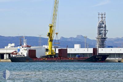
General Cargo

Current Trip
| Time Travelled | 4 days |
|---|---|
| Remaining Time | 12 h, 11 mins |
| Distance Travelled | 1135.44 nm |
| Remaining Distance | 138.59 nm |
| AVG Speed | 10.2 Knop |
| MAX Speed | 11.5 Knop |
| AVG Wind | 10.2 knots |
| MAX Wind | 32 knots |
| MIN Temp | 11.6°C / 52.88°F |
| MAX Temp | 16.9°C / 62.42°F |
| Djupgående | 6 m |
| Position mottagen | 2 d sen |
Current Position
| Longitud | --- |
|---|---|
| Latitude | --- |
| Status | Under way using engine |
| Fart | 10.5 Knop |
| Kurs | 355° |
| Område | North Atlantic Ocean |
| Station | T-AIS |
| Position mottagen | 2 d sen |
Information
The current position of OGUZ SOFUOGLU is in North Atlantic Ocean with coordinates 40.29048° / -9.76800° as reported on 2025-02-17 18:10 by AIS to our vessel tracker app. The vessel's current speed is 10.5 Knop and is heading at the port of DROGHEDA. The estimated time of arrival as calculated by MyShipTracking vessel tracking app is 2025-02-21 01:19 LT
The vessel OGUZ SOFUOGLU (IMO: 9424259, MMSI: 355861000) is a General Cargo that was built in 2008 ( 17 År gammal ). It's sailing under the flag of [PA] Panama.
In this page you can find informations about the vessels current position, last detected port calls, and current voyage information. If the vessels is not in coverage by AIS you will find the latest position.
The current position of OGUZ SOFUOGLU is detected by our AIS receivers and we are not responsible for the reliability of the data. The last position was recorded while the vessel was in Coverage by the Ais receivers of our vessel tracking app.
The current draught of OGUZ SOFUOGLU as reported by AIS is 6 meters
Weather
| Temperature | 11.6°C / 52.88°F |
|---|---|
| Wind Speed | 30 knots |
| Direction | 221° SW |
| Pressure | 1005.6 hPa |
| Humidity | 85 % |
| Cloud Coverage | 84 % |


Featured Company
Last Port Calls
| Port | Arrival | Departure | Time In Port |
|---|---|---|---|
| 2025-02-15 19:45 | 2025-02-16 00:26 | 4 h | |
| 2025-02-13 20:55 | 2025-02-14 17:34 | 20 h | |
| 2025-02-06 08:03 | 2025-02-09 17:35 | 3 d | |
| 2025-01-30 11:45 | 2025-02-04 21:49 | 5 d | |
| 2025-01-27 07:22 | 2025-01-29 13:19 | 2 d | |
| 2025-01-20 19:58 | 2025-01-24 00:37 | 3 d | |
| 2025-01-02 10:12 | 2025-01-04 00:39 | 1 d | |
| 2024-12-18 22:55 | 2024-12-20 14:39 | 1 d | |
| 2024-12-14 15:38 | |||
| 2024-12-04 20:12 | 2024-12-09 15:24 | 4 d |
Last Trips
| Origin | Departure | Destination | Arrival | Distance | |
|---|---|---|---|---|---|
| 2025-02-14 17:34 | 2025-02-15 19:45 | 259.06 nm | |||
| 2025-02-09 17:35 | 2025-02-13 20:55 | 843.96 nm | |||
| 2025-02-04 21:49 | 2025-02-06 08:03 | 338.90 nm | |||
| 2025-01-29 13:19 | 2025-01-30 11:45 | 24.97 nm | |||
| 2025-01-24 00:37 | 2025-01-27 07:22 | 641.69 nm | |||
| 2025-01-04 00:39 | 2025-01-20 19:58 | 362.72 nm | |||
| 2024-12-20 14:39 | 2025-01-02 10:12 | 1639.42 nm | |||
| 2024-12-14 15:38 | 2024-12-18 22:55 | 899.79 nm | |||
| 2024-12-02 12:40 | 2024-12-04 20:12 | 624.74 nm |
Events
| Tid | Event | Detaljer | Position / Dest | Information |
|---|---|---|---|---|
| 2025-02-17 18:23 | Status ändrad | Default Under way using engine |
40.33087 / -9.77110
IEDRO
|
Fart: 10.5 kn Kurs: 355° |
| 2025-02-17 18:10 | UTANFÖR täckningsområde |
40.29048 / -9.76800
North Atlantic Ocean
IEDRO
|
Fart: 10.5 kn Kurs: 355° |
|
| 2025-02-17 17:49 | Status ändrad | Under way using engine Default |
40.23048 / -9.76348
IEDRO
|
Fart: 10.5 kn Kurs: 357° |
| 2025-02-17 17:48 | Status ändrad | Default Under way using engine |
40.22600 / -9.76338
IEDRO
|
Fart: 10.6 kn Kurs: 358° |
| 2025-02-17 17:41 | Status ändrad | Under way using engine Default |
40.20788 / -9.76282
IEDRO
|
Fart: 10.6 kn Kurs: 2° |
| 2025-02-17 17:23 | Status ändrad | Default Under way using engine |
40.15442 / -9.76425
IEDRO
|
Fart: 10.7 kn Kurs: 1° |
| 2025-02-17 17:17 | Status ändrad | Under way using engine Default |
40.13397 / -9.76517
IEDRO
|
Fart: 10.7 kn Kurs: 1° |
| 2025-02-17 17:15 | Status ändrad | Default Under way using engine |
40.12862 / -9.76540
IEDRO
|
Fart: 10.6 kn Kurs: 0° |
| 2025-02-17 16:58 | Status ändrad | Under way using engine Default |
40.07827 / -9.76850
IEDRO
|
Fart: 10.7 kn Kurs: 2° |
| 2025-02-17 16:55 | Status ändrad | Default Under way using engine |
40.06997 / -9.76925
IEDRO
|
Fart: 10.9 kn Kurs: 3° |