
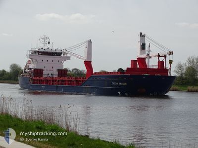
OCEAN TRADER
General Cargo
Current Trip
| Time Travelled | 5 days |
|---|---|
| Remaining Time | --- |
| Distance Travelled | 1271.74 nm |
| Remaining Distance | --- |
| AVG Speed | 9.1 Knop |
| MAX Speed | 14 Knop |
| AVG Wind | 11.5 knots |
| MAX Wind | 36.7 knots |
| MIN Temp | -2.1°C / 28.22°F |
| MAX Temp | 10.1°C / 50.18°F |
| Djupgående | 8.1 m |
| Position mottagen | 13 m sen |
Current Position
| Longitud | --- |
|---|---|
| Latitude | --- |
| Status | Under way using engine |
| Fart | 12.6 Knop |
| Kurs | 253.7° |
| Område | English Channel |
| Station | T-AIS |
| Position mottagen | 13 m sen |
Info
Information
The current position of OCEAN TRADER is in English Channel with coordinates 50.14147° / -2.10961° as reported on 2025-01-15 13:10 by AIS to our vessel tracker app. The vessel's current speed is 12.6 Knop and is heading at the port of BEJAIA. The estimated time of arrival as calculated by MyShipTracking vessel tracking app is 2025-01-22 05:00 LT
The vessel OCEAN TRADER (IMO: 9349461, MMSI: 255805916) is a General Cargo that was built in 2011 ( 14 År gammal ). It's sailing under the flag of [PT] Portugal.
In this page you can find informations about the vessels current position, last detected port calls, and current voyage information. If the vessels is not in coverage by AIS you will find the latest position.
The current position of OCEAN TRADER is detected by our AIS receivers and we are not responsible for the reliability of the data. The last position was recorded while the vessel was in Coverage by the Ais receivers of our vessel tracking app.
The current draught of OCEAN TRADER as reported by AIS is 8.1 meters
Weather
| Temperature | 10.1°C / 50.18°F |
|---|---|
| Wind Speed | 3 knots |
| Direction | 274° W |
| Pressure | 1034.4 hPa |
| Humidity | 87.2 % |
| Cloud Coverage | 85 % |
Featured Company
Last Port Calls
| Port | Arrival | Departure | Time In Port |
|---|---|---|---|
| 2025-01-07 20:57 | 2025-01-10 03:37 | 2 d | |
| 2025-01-01 03:35 | 2025-01-03 03:48 | 2 d | |
| 2024-12-17 06:29 | 2024-12-19 06:45 | 2 d | |
| 2024-12-11 07:01 | 2024-12-14 05:13 | 2 d | |
| 2024-12-06 17:56 | 2024-12-07 19:41 | 1 d | |
| 2024-11-25 03:15 | 2024-11-25 18:29 | 15 h | |
| 2024-11-19 06:28 | 2024-11-22 08:24 | 3 d | |
| 2024-11-15 07:45 | 2024-11-15 18:16 | 10 h | |
| 2024-11-12 05:16 | 2024-11-13 16:04 | 1 d | |
| 2024-11-04 11:45 | 2024-11-05 15:04 | 1 d |
Last Trips
| Origin | Departure | Destination | Arrival | Distance | |
|---|---|---|---|---|---|
| 2025-01-03 04:48 | 2025-01-07 22:57 | 1015.49 nm | |||
| 2024-12-19 07:45 | 2025-01-01 04:35 | 2990.40 nm | |||
| 2024-12-14 06:13 | 2024-12-17 07:29 | 18.17 nm | |||
| 2024-12-07 20:41 | 2024-12-11 08:01 | 543.92 nm | |||
| 2024-11-25 19:29 | 2024-12-06 18:56 | 2240.22 nm | |||
| 2024-11-22 09:24 | 2024-11-25 04:15 | 646.27 nm | |||
| 2024-11-15 20:16 | 2024-11-19 07:28 | 134.99 nm | |||
| 2024-11-13 17:04 | 2024-11-15 09:45 | 472.65 nm | |||
| 2024-11-05 15:04 | 2024-11-12 06:16 | 1711.00 nm | |||
| 2024-11-02 05:35 | 2024-11-04 11:45 | 635.44 nm |
Events
| Tid | Event | Detaljer | Position / Dest | Information |
|---|---|---|---|---|
| 2025-01-15 13:19 | Status ändrad | Default Under way using engine |
50.13298 / -2.15549
DZBJA
|
Fart: 12.6 kn Kurs: 253.7° |
| 2025-01-15 13:10 | Upptäckt i hav | Guernsey part of the English Channel |
50.14147 / -2.10961
English Channel
DZBJA
|
Fart: 12.6 kn Kurs: 253.7° |
| 2025-01-15 13:10 | Status ändrad | Under way using engine Default |
50.14147 / -2.10961
DZBJA
|
Fart: 12.6 kn Kurs: 254° |
| 2025-01-15 12:43 | Status ändrad | Default Under way using engine |
50.16785 / -1.96992
DZBJA
|
Fart: 11.8 kn Kurs: 253.1° |
| 2025-01-15 12:36 | Status ändrad | Under way using engine Default |
50.17486 / -1.93411
DZBJA
|
Fart: 11.7 kn Kurs: 253° |
| 2025-01-15 12:19 | Status ändrad | Default Under way using engine |
50.18967 / -1.85449
DZBJA
|
Fart: 11.1 kn Kurs: 254.1° |
| 2025-01-15 12:11 | Status ändrad | Under way using engine Default |
50.19645 / -1.81696
DZBJA
|
Fart: 10.6 kn Kurs: 254° |
| 2025-01-15 11:55 | Status ändrad | Default Under way using engine |
50.20965 / -1.74693
DZBJA
|
Fart: 10.3 kn Kurs: 253.2° |
| 2025-01-15 11:40 | Status ändrad | Under way using engine Default |
50.22198 / -1.68363
DZBJA
|
Fart: 9.9 kn Kurs: 255° |
| 2025-01-15 11:23 | Status ändrad | Default Under way using engine |
50.23440 / -1.61365
DZBJA
|
Fart: 9.2 kn Kurs: 254.2° |