

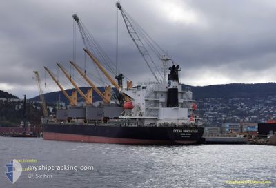
OCEAN INNOVATION
Cargo
Current Trip
| Time Travelled | 2 h, 11 mins |
|---|---|
| Remaining Time | 2 days |
| Distance Travelled | 26.01 nm |
| Remaining Distance | 969.19 nm |
| AVG Speed | 13.7 Knop |
| MAX Speed | 14.6 Knop |
| AVG Wind | 3.3 knots |
| MAX Wind | 4.8 knots |
| MIN Temp | 22.5°C / 72.5°F |
| MAX Temp | 26.4°C / 79.52°F |
| Djupgående | 6.3 m |
| Position mottagen | 9 d sen |
Current Position
| Longitud | --- |
|---|---|
| Latitude | --- |
| Status | Under way using engine |
| Fart | 14.6 Knop |
| Kurs | 193.5° |
| Område | South Atlantic Ocean |
| Station | T-AIS |
| Position mottagen | 9 d sen |
Information
The current position of OCEAN INNOVATION is in South Atlantic Ocean with coordinates -28.57004° / -48.09658° as reported on 2025-03-07 03:46 by AIS to our vessel tracker app. The vessel's current speed is 14.6 Knop and is heading at the port of PARANAGUA. The estimated time of arrival as calculated by MyShipTracking vessel tracking app is 2025-03-19 16:39 LT
The vessel OCEAN INNOVATION (IMO: 9659892, MMSI: 477195900) is a Cargo It's sailing under the flag of [HK] Hong Kong.
In this page you can find informations about the vessels current position, last detected port calls, and current voyage information. If the vessels is not in coverage by AIS you will find the latest position.
The current position of OCEAN INNOVATION is detected by our AIS receivers and we are not responsible for the reliability of the data. The last position was recorded while the vessel was in Coverage by the Ais receivers of our vessel tracking app.
The current draught of OCEAN INNOVATION as reported by AIS is 6.3 meters
Weather
| Temperature | 21.9°C / 71.42°F |
|---|---|
| Wind Speed | 5 knots |
| Direction | 112° ESE |
| Pressure | 1018.1 hPa |
| Humidity | 58 % |
| Cloud Coverage | 72 % |
Featured Company
Last Port Calls
| Port | Arrival | Departure | Time In Port |
|---|---|---|---|
| 2025-03-13 07:47 | 2025-03-16 16:52 | 3 d | |
| 2025-03-02 18:40 | 2025-03-06 09:17 | 3 d | |
| 2025-02-03 15:43 | 2025-02-04 15:12 | 23 h | |
| 2025-01-26 08:23 | 2025-02-01 08:41 | 6 d | |
| 2025-01-16 04:54 | 2025-01-24 22:54 | 8 d | |
| 2025-01-03 16:53 | 2025-01-16 03:29 | 12 d |
Most Visited Ports (Last year)
| Port | Arrivals | |
|---|---|---|
| 2 | ||
| 2 | ||
| 2 | ||
| 2 | ||
| 2 | ||
| 1 |
Last Trips
| Origin | Departure | Destination | Arrival | Distance | |
|---|---|---|---|---|---|
| 2025-03-06 09:17 | 2025-03-13 07:47 | 1057.29 nm | |||
| 2025-02-04 15:12 | 2025-03-02 18:40 | 4007.69 nm | |||
| 2025-02-01 08:41 | 2025-02-03 15:43 | 481.96 nm | |||
| 2025-01-24 22:54 | 2025-01-26 08:23 | 369.02 nm | |||
| 2025-01-16 03:29 | 2025-01-16 04:54 | 3.52 nm | |||
| 2024-12-22 20:07 | 2025-01-03 16:53 | 3235.51 nm |
Events
| Tid | Event | Detaljer | Position / Dest | Information |
|---|---|---|---|---|
| 2025-03-16 19:52 | AVGÅTT HAMN |
|
-33.68885 / -59.63047
BRPNG
|
Fart: 3.5 kn Kurs: 119° |
| 2025-03-16 19:49 | STARTAR förflyttning |
-33.68693 / -59.63456
[AR] SAN PEDRO (AR)
|
Fart: 3.5 kn Kurs: 119° |
|
| 2025-03-13 11:19 | STOPPAR förflyttning |
-33.68629 / -59.63942
[AR] SAN PEDRO (AR)
|
Fart: 0.2 kn Kurs: 39° |
|
| 2025-03-13 10:47 | ANLÄNDER HAMN |
|
-33.68607 / -59.63765
[AR] SAN PEDRO (AR)
|
Fart: 1.3 kn Kurs: 303° |
| 2025-03-13 10:29 | STARTAR förflyttning | 1.8 nm, South East of SAN PEDRO (AR) |
-33.69250 / -59.62449
BRPNG
|
Fart: 3.8 kn Kurs: 305° |
| 2025-03-11 03:31 | STOPPAR förflyttning | 2.17 nm, South East of SAN PEDRO (AR) |
-33.69176 / -59.61432
BRPNG
|
Fart: 0.3 kn Kurs: 303° |
| 2025-03-10 01:28 | STARTAR förflyttning | 18.72 nm, South of PIRIAPOLIS |
-35.18159 / -55.35509
BRPNG
|
Fart: 6.2 kn Kurs: 310° |
| 2025-03-09 00:23 | STOPPAR förflyttning | 18.89 nm, South of PIRIAPOLIS |
-35.18494 / -55.35253
BRPNG
|
Fart: 0.2 kn Kurs: 221° |
| 2025-03-07 03:52 | Status ändrad | Default Under way using engine |
-28.59438 / -48.10327
BRPNG
|
Fart: 14.6 kn Kurs: 193.5° |
| 2025-03-07 03:46 | UTANFÖR täckningsområde |
-28.57004 / -48.09658
South Atlantic Ocean
|
Fart: 14.6 kn Kurs: 193.5° |