
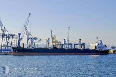
OCCITAN PAUILLAC
Bulk Carrier
Current Trip
| Time Travelled | 9 days |
|---|---|
| Remaining Time | 2 h, 25 mins |
| Distance Travelled | 450.94 nm |
| Remaining Distance | 17.04 nm |
| AVG Speed | 5.3 Knop |
| MAX Speed | 5.3 Knop |
| AVG Wind | 10.9 knots |
| MAX Wind | 23.9 knots |
| MIN Temp | 12.8°C / 55.04°F |
| MAX Temp | 16.3°C / 61.34°F |
| Djupgående | 6.5 m |
| Position mottagen | 5 m sen |
Current Position
| Longitud | 28.92188° |
|---|---|
| Latitude | 41.41302° |
| Status | Under way using engine |
| Fart | 1.5 Knop |
| Kurs | 282° |
| Område | Black Sea |
| Station | T-AIS |
| Position mottagen | 5 m sen |
Info
Information
The current position of OCCITAN PAUILLAC is in Black Sea with coordinates 41.41302° / 28.92188° as reported on 2024-05-09 10:16 by AIS to our vessel tracker app. The vessel's current speed is 1.5 Knop and is heading at the port of ISTANBUL. The estimated time of arrival as calculated by MyShipTracking vessel tracking app is 2024-05-09 12:46 LT
The vessel OCCITAN PAUILLAC (IMO: 9483451, MMSI: 215362000) is a Bulk Carrier that was built in 2008 ( 16 År gammal ). It's sailing under the flag of [MT] Malta.
In this page you can find informations about the vessels current position, last detected port calls, and current voyage information. If the vessels is not in coverage by AIS you will find the latest position.
The current position of OCCITAN PAUILLAC is detected by our AIS receivers and we are not responsible for the reliability of the data. The last position was recorded while the vessel was in Coverage by the Ais receivers of our vessel tracking app.
The current draught of OCCITAN PAUILLAC as reported by AIS is 6.5 meters
Weather
| Temperature | 15°C / 59°F |
|---|---|
| Wind Speed | 12 knots |
| Direction | 15° NNE |
| Pressure | 1015.6 hPa |
| Humidity | 86.9 % |
| Cloud Coverage | 100 % |
Featured Company
Last Port Calls
| Port | Arrival | Departure | Time In Port |
|---|---|---|---|
| 2024-04-26 15:52 | 2024-04-29 21:16 | 3 d | |
| 2024-03-26 03:16 | 2024-03-30 18:43 | 4 d | |
| 2024-03-08 05:28 | 2024-03-11 18:04 | 3 d | |
| 2024-03-02 21:38 |
Most Visited Ports (Last year)
| Port | Arrivals | |
|---|---|---|
| 2 | ||
| 2 | ||
| 1 | ||
| 1 | ||
| 1 | ||
| 1 |
Last Trips
| Origin | Departure | Destination | Arrival | Distance | |
|---|---|---|---|---|---|
| 2024-03-30 20:43 | 2024-04-26 18:52 | 6547.77 nm | |||
| 2024-03-11 19:04 | 2024-03-26 05:16 | 1817.80 nm | |||
| 2024-03-02 21:38 | 2024-03-08 06:28 | 940.12 nm |
Events
| Tid | Event | Detaljer | Position / Dest | Information |
|---|---|---|---|---|
| 2024-05-09 10:18 | Status ändrad | Default Under way using engine |
41.41226 / 28.92108
TR IST
|
Fart: 1.5 kn Kurs: 282° |
| 2024-05-09 10:12 | Status ändrad | Under way using engine Default |
41.41446 / 28.92338
TR IST
|
Fart: 1.5 kn Kurs: 288° |
| 2024-05-09 10:05 | Status ändrad | Default Under way using engine |
41.41686 / 28.92578
TR IST
|
Fart: 1.4 kn Kurs: 289° |
| 2024-05-09 09:40 | Status ändrad | Under way using engine Default |
41.42653 / 28.93371
TR IST
|
Fart: 1.5 kn Kurs: 265° |
| 2024-05-09 09:31 | Status ändrad | Default Under way using engine |
41.43032 / 28.93509
TR IST
|
Fart: 0.9 kn Kurs: 290° |
| 2024-05-09 09:26 | Status ändrad | Under way using engine Default |
41.43194 / 28.93534
TR IST
|
Fart: 0.9 kn Kurs: 351° |
| 2024-05-09 09:17 | Status ändrad | Default Under way using engine |
41.43431 / 28.93460
TR IST
|
Fart: 0.3 kn Kurs: 13° |
| 2024-05-09 09:05 | Status ändrad | Under way using engine Default |
41.43561 / 28.93343
TR IST
|
Fart: 2.1 kn Kurs: 320° |
| 2024-05-09 09:05 | STOPPAR förflyttning | 14.7 nm, North West of RUMELI FENERI |
41.43561 / 28.93343
TR IST
|
Fart: 0.3 kn Kurs: 15° |
| 2024-05-09 08:57 | Status ändrad | Default Under way using engine |
41.43398 / 28.93568
TR IST
|
Fart: 1.2 kn Kurs: 287° |