

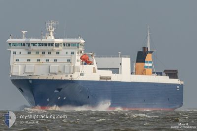
NORSKY
Ro-Ro Cargo

Current Trip
| Trip Time | 1 day |
|---|---|
| Trip Distance | 262.54 nm |
| AVG Speed | 14.5 Knop |
| MAX Speed | 18.5 Knop |
| Djupgående | 5.6 m |
| AVG Wind | 6.8 knots |
| MAX Wind | 11.7 knots |
| MIN Temp | 7.5°C / 45.5°F |
| MAX Temp | 11.3°C / 52.34°F |
| Position mottagen | 2 m sen |
Current Position
| Longitud | --- |
|---|---|
| Latitude | --- |
| Status | Moored |
| Fart | |
| Kurs | 178° |
| Område | North Sea |
| Station | T-AIS |
| Position mottagen | 2 m sen |
Information
The current position of NORSKY is in North Sea with coordinates 51.94575° / 4.13077° as reported on 2025-03-26 19:32 by AIS to our vessel tracker app. The vessel's current speed is 0 Knop and is currently inside the port of ROTTERDAM.
The vessel NORSKY (IMO: 9186182, MMSI: 230652000) is a Ro-Ro Cargo that was built in 1999 ( 26 År gammal ). It's sailing under the flag of [FI] Finland.
In this page you can find informations about the vessels current position, last detected port calls, and current voyage information. If the vessels is not in coverage by AIS you will find the latest position.
The current position of NORSKY is detected by our AIS receivers and we are not responsible for the reliability of the data. The last position was recorded while the vessel was in Coverage by the Ais receivers of our vessel tracking app.
The current draught of NORSKY as reported by AIS is 5.6 meters
Weather
| Temperature | 8.4°C / 47.12°F |
|---|---|
| Wind Speed | 5 knots |
| Direction | 18° NNE |
| Pressure | 1024.7 hPa |
| Humidity | 75.3 % |
| Cloud Coverage | 10 % |


Featured Company
Last Port Calls
| Port | Arrival | Departure | Time In Port |
|---|---|---|---|
| 2025-03-26 18:11 | |||
| 2025-03-25 06:23 | 2025-03-25 11:16 | 4 h | |
| 2025-03-23 07:29 | 2025-03-23 21:06 | 13 h | |
| 2025-03-21 20:55 | 2025-03-22 01:28 | 4 h | |
| 2025-03-20 20:05 | 2025-03-21 00:48 | 4 h | |
| 2025-03-19 18:27 | 2025-03-19 23:22 | 4 h | |
| 2025-03-18 06:56 | 2025-03-18 11:22 | 4 h | |
| 2025-03-16 07:25 | 2025-03-16 20:48 | 13 h | |
| 2025-03-14 20:53 | 2025-03-15 02:34 | 5 h | |
| 2025-03-13 20:03 | 2025-03-14 00:50 | 4 h |
Last Trips
| Origin | Departure | Destination | Arrival | Distance | |
|---|---|---|---|---|---|
| 2025-03-25 11:16 | 2025-03-26 18:11 | 262.54 nm | |||
| 2025-03-23 21:06 | 2025-03-25 06:23 | 264.73 nm | |||
| 2025-03-22 01:28 | 2025-03-23 07:29 | 263.70 nm | |||
| 2025-03-21 00:48 | 2025-03-21 20:55 | 265.32 nm | |||
| 2025-03-19 23:22 | 2025-03-20 20:05 | 301.39 nm | |||
| 2025-03-18 11:22 | 2025-03-19 18:27 | 264.49 nm | |||
| 2025-03-16 20:48 | 2025-03-18 06:56 | 265.69 nm | |||
| 2025-03-15 02:34 | 2025-03-16 07:25 | 263.77 nm | |||
| 2025-03-14 00:50 | 2025-03-14 20:53 | 264.54 nm | |||
| 2025-03-12 23:27 | 2025-03-13 20:03 | 300.33 nm |
Events
| Tid | Event | Detaljer | Position / Dest | Information |
|---|---|---|---|---|
| 2025-03-26 17:47 | Destination ändrad | TILBURY EUROPOORT |
51.94572 / 4.13080
[NL] ROTTERDAM
|
Fart: Kurs: 178° |
| 2025-03-26 17:47 | ETA ändrat | 2025/03/27 06:30 2025/03/26 17:30 |
51.94572 / 4.13080
[NL] ROTTERDAM
|
Fart: Kurs: 178° |
| 2025-03-26 17:46 | Status ändrad | Moored Under way using engine |
51.94575 / 4.13077
[NL] ROTTERDAM
|
Fart: Kurs: 179° |
| 2025-03-26 17:28 | STOPPAR förflyttning |
51.94568 / 4.13048
[NL] ROTTERDAM
|
Fart: 0.3 kn Kurs: 165° |
|
| 2025-03-26 17:11 | ANLÄNDER HAMN |
|
51.96635 / 4.11973
[NL] ROTTERDAM
|
Fart: 8.6 kn Kurs: 122° |
| 2025-03-26 13:28 | Byter havsområde | Dutch part of the North Sea Belgian part of the North Sea |
51.81340 / 2.64175
North Sea
EUROPOORT
|
Fart: 15.9 kn Kurs: 78.5° |
| 2025-03-26 13:10 | Byter havsområde | Belgian part of the North Sea United Kingdom part of the North Sea |
51.82098 / 2.51451
North Sea
EUROPOORT
|
Fart: 17.3 kn Kurs: 103.6° |
| 2025-03-26 07:55 | STARTAR förflyttning | 0.57 nm, North East of GRAVESEND |
51.45075 / .38980
EUROPOORT
|
Fart: 5.9 kn Kurs: 116.8° |
| 2025-03-26 07:54 | Status ändrad | Under way using engine Moored |
51.45126 / .38814
EUROPOORT
|
Fart: 3.7 kn Kurs: 96° |
| 2025-03-26 07:50 | Djupgående ändrat | 5.6 5.7 |
51.45172 / .38688
EUROPOORT
|
Fart: Kurs: 86° |